Mitchel Troy

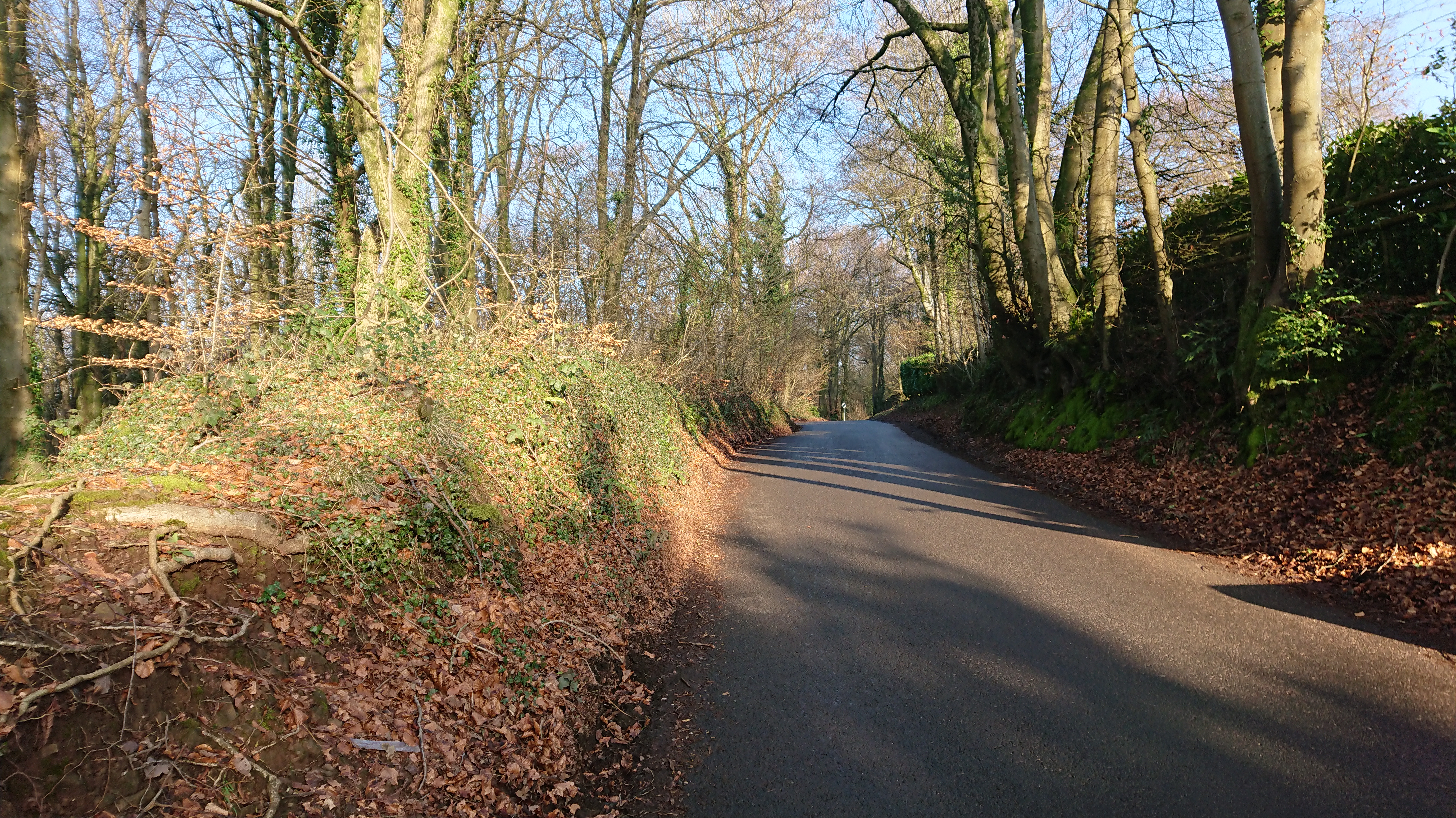
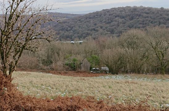
Amy and I set off to Mitchel Troy, just south of Monmouth, to look for this

https://twitter.com/johnevigar/status/1716331933066572125

which the wonderful John Vigar posted on Twitter back in October.

It’s a medieval church, probably part of the great Norman rebuilding of churches in south-east Wales, but heavily restored by John Prichard in 1873-6. Recently the parish has raised some serious funding to provide a kitchen, toilet facilities and more comfortable seating. (Replacing the Victorian pews probably caused howls of outrage but chairs are (a) infinitely more comfortable and (b) more flexible.)

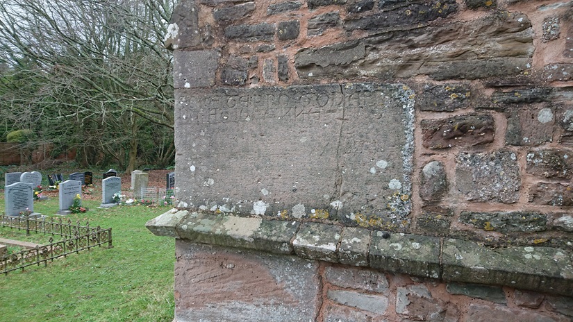
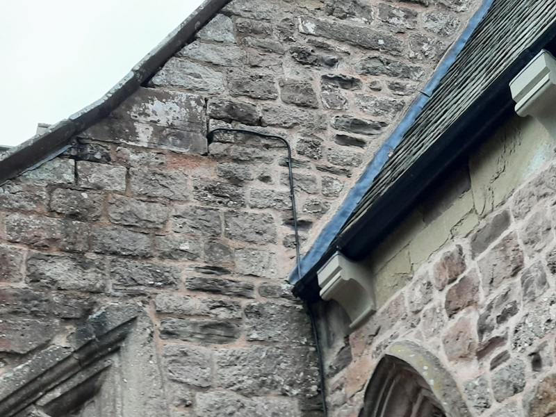
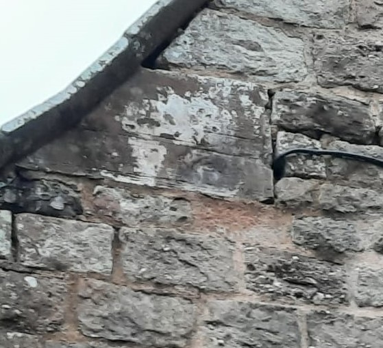
The base of the west tower could be late C12/early C13. Built into the SW buttress, about 5’ up, is this

ORATE PRO GODEFRI
DO ET JOHANNE

Did they contribute to the building of the tower, or could it possible be a tombstone? It’s rather short, and a hefty lump of stone. The west end has been used for a benchmark.


Inside we found this

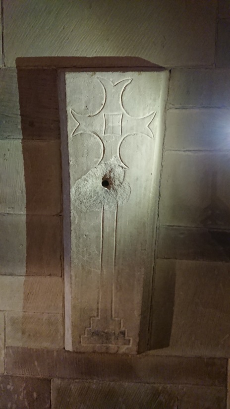
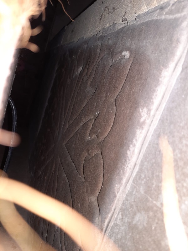
A miniature cross slab, probably C13 – possibly commemorating a child, but perhaps more likely to have been a heart burial. . It was discovered during the reconstruction, turned over and reused as the base of a piscina (see the drilled drainage hole). That must have been later medieval reuse.

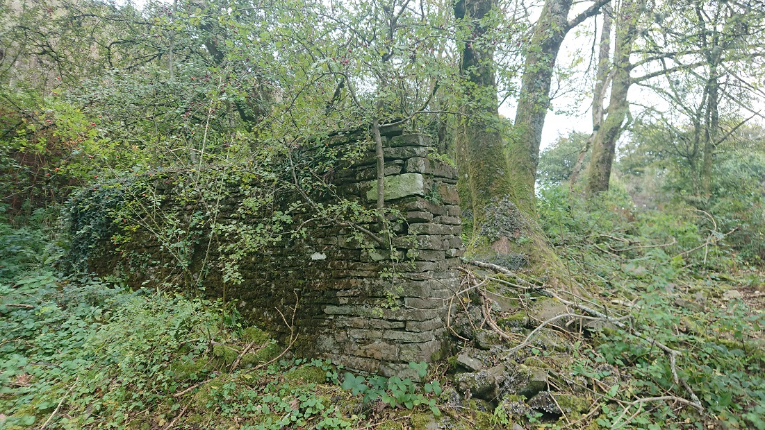
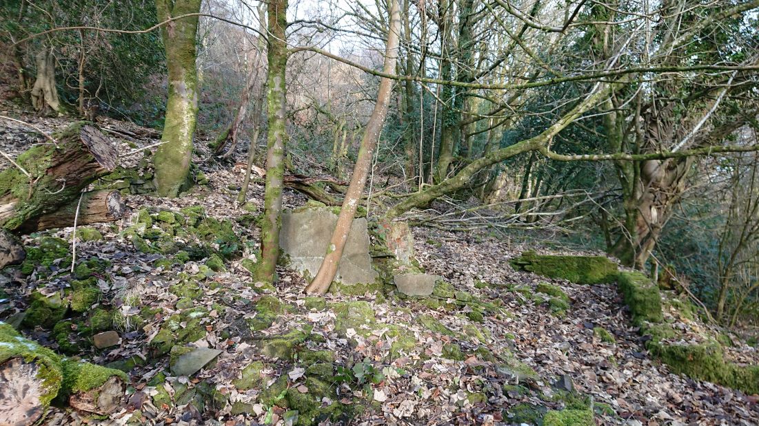
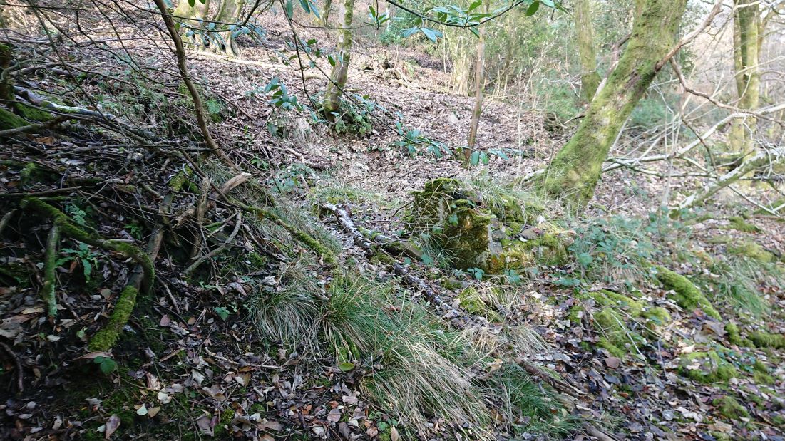
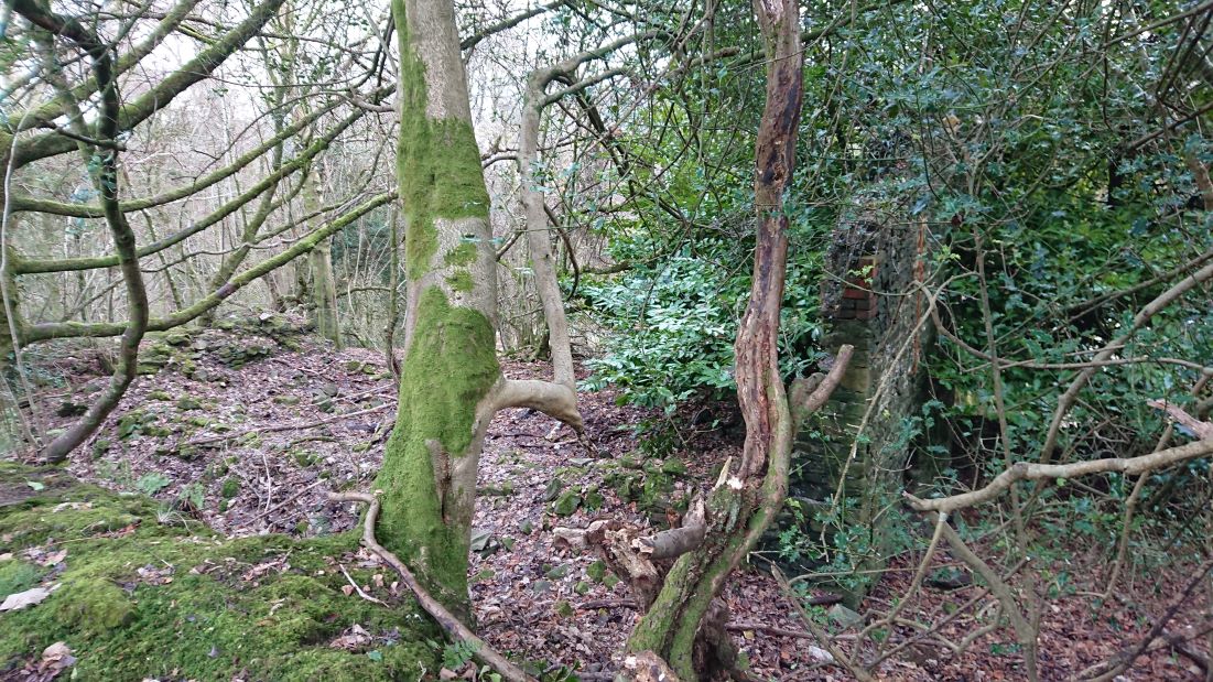
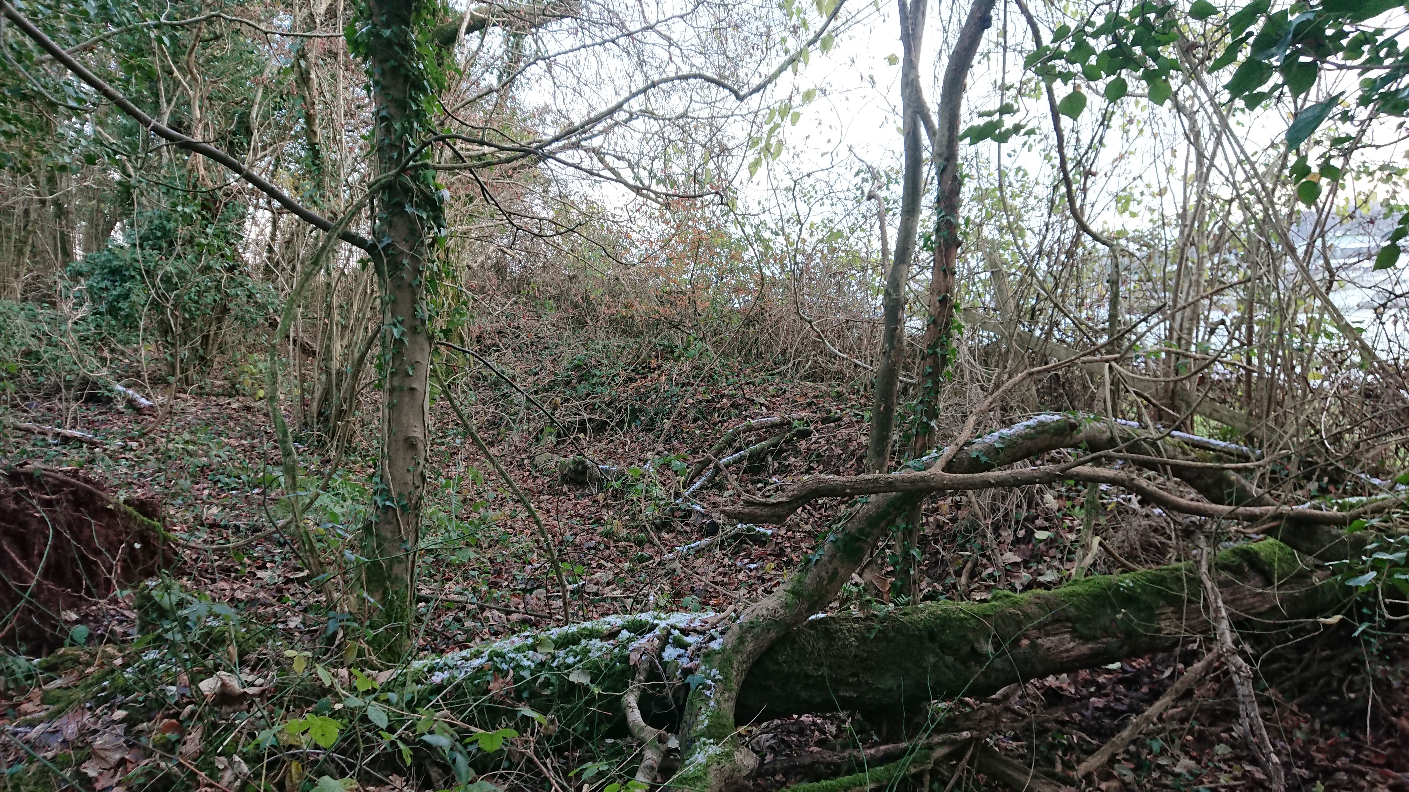
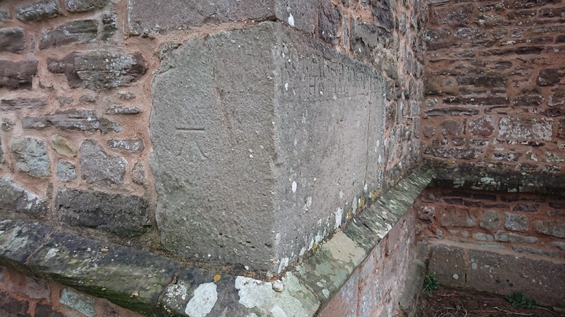
But where was John Vigar’s stone? Eventually Amy spotted it,

The perils of church-crawling at Christmas. It’s a good excuse to go back. And I probably ought to measure all the slabs.

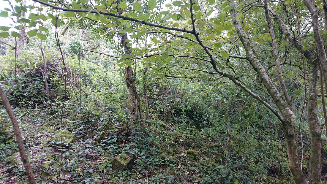
I can’t see me measuring this one, though  – in the SE angle, is this a fragment of the shaft of a medieval cross slab?


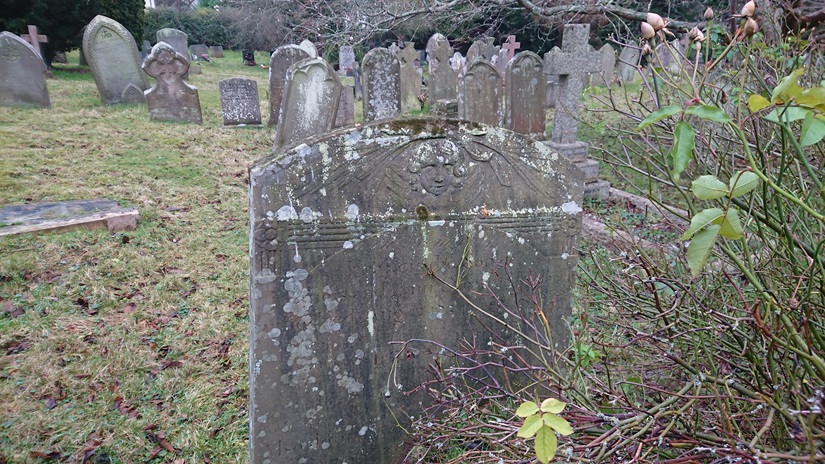
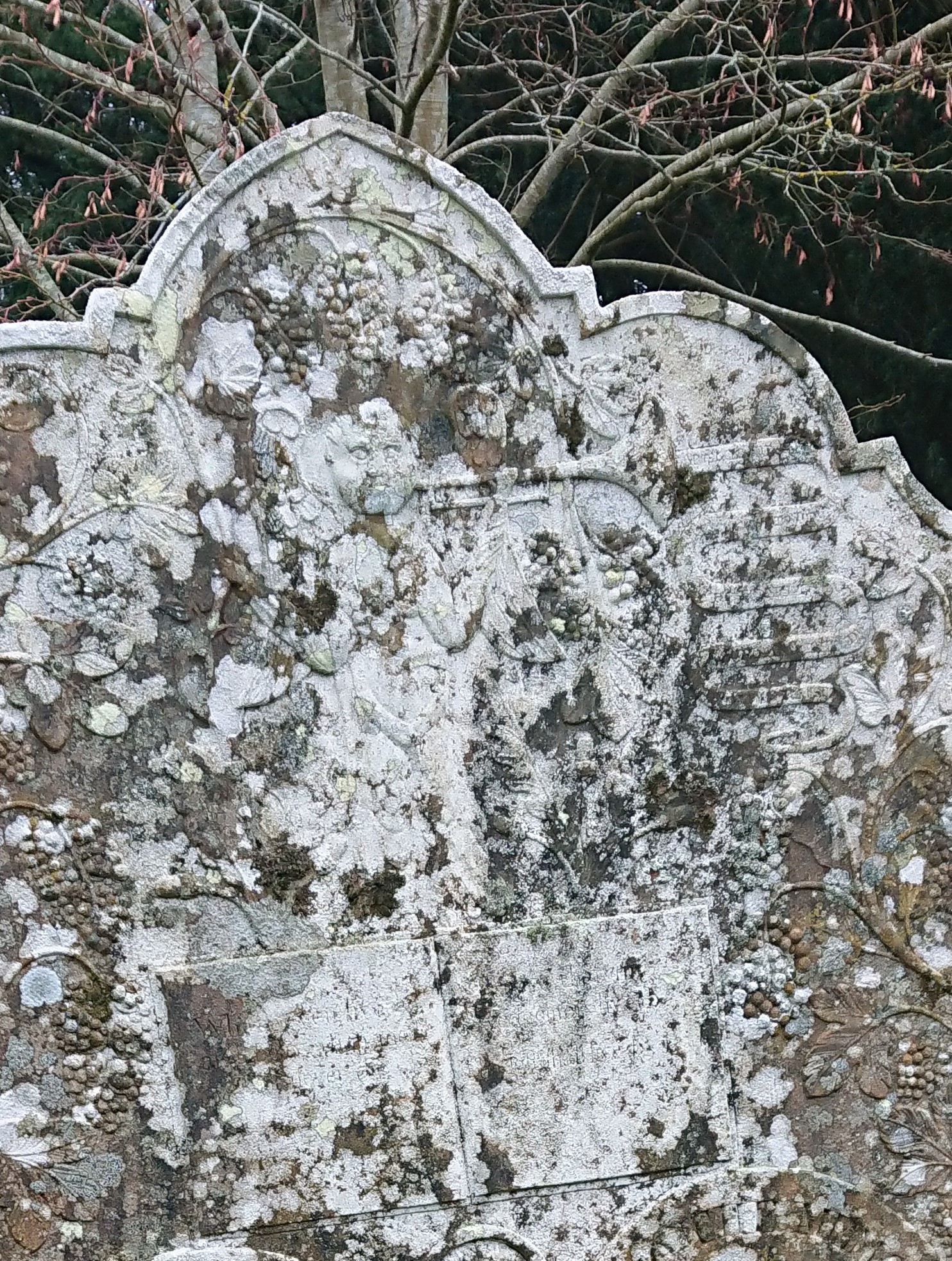
There’s a lot to enjoy in the churchyard. Several headstones with chubby cherubs

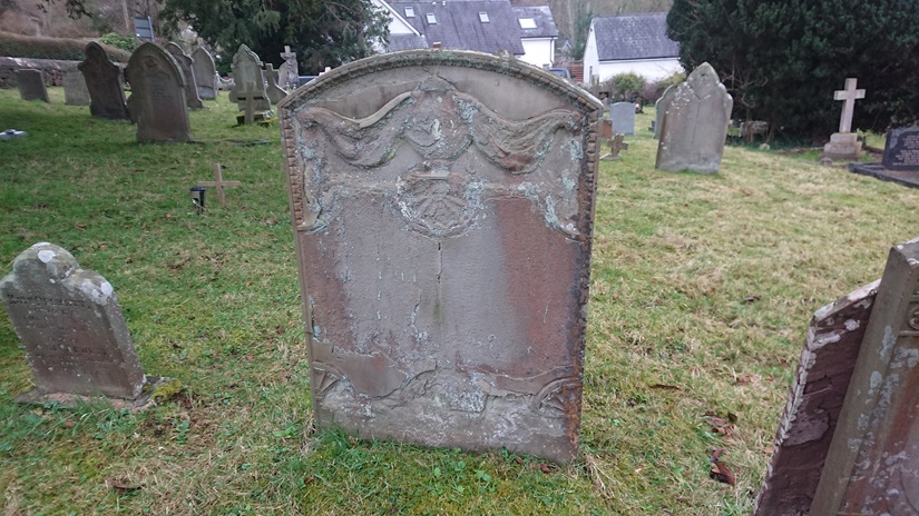
But one local firm of stonemasons seems to have specialised in elaborately-draped urns – a range of styles

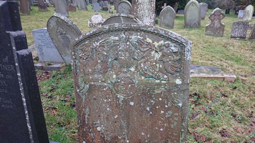
And this one with both urns and cherubs.

This one has the angel of the Last Judgement

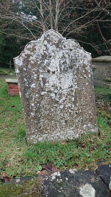
With a scroll beginning ‘Arise ye dead and come to judgement’

– there’s a lot more text on the stone but frustratingly just below the margin of legibility. Another reason for a second visit on a dry day.


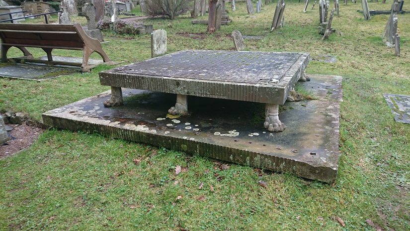
We also found something like the Luggage from Terry Pratchett

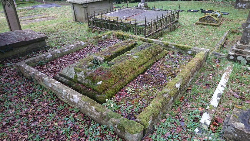
And this, an unusual way of putting a cross on a grave.

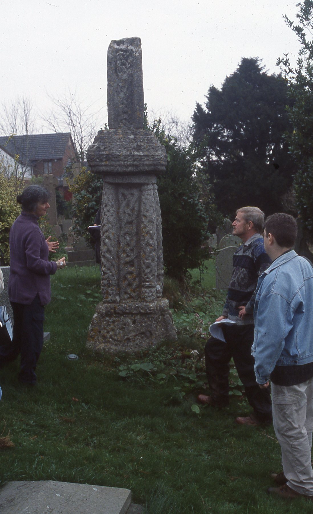
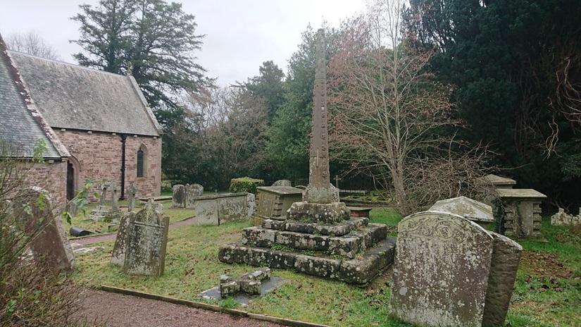
The churchyard has its medieval churchyard cross with the shaft still in place, decorated with shields and ballflower.

A good day – and already looking forward to a revisit.

Grandparenting 2023

posted in: Family | 2

Seth and Ethan are both growing – which means they are more able to play together. Here they are at St Fagan’s last summer

And here sharing the joy of puddles

and jigsaw puzzles (at which they are both pretty good)

Seth is now in the reception class at the local Welsh primary school.

He is apparently very good at Numbers but needs to work on Reading.

He also likes making bread.

We took them on the boat around Cardiff Bay for his birthday.

High point was watching the road go up so boats could go through the Barrage and into the marina.

We look after Ethan two days a week (his other grannie now has him for a day) but he starts Meithrin (a Welsh nursery) on 12 December. He already enjoys the parent and toddler group there.

He enjoys being helpful


feeding the birds

helping Steve with the Sudoku

and here are the lads together, planning their next exploit


More lost farmsteads: Craig yr Allt

Now that Gwen the cockapoo puppy is a little older (and a little more ready to come back when called), we are doing longer walks. Today, we went up Craig yr Allt, and I was reminded that I never did look for details of this


at about OS Grid Ref: ST 12516 84638. From the path just a heap of tumbled stone,


but up in the brambles there is a bit more of a wall.


And a little further up the slope, at about ST 12575 84628


a little more stonework.

They took some finding on the wonderful https://places.library.wales but they are there – it’s just tricky overlaying the 2nd edition OS and the tithe plan on the modern satellite image. Also the tithe plan shows the 2 buildings much closer together that they actually are.

In 1839, the date of the tithe plan for the huge parish of Eglwysilan, they were part of a farm called Tir Craig yr Allt. They may originally have been part of another smaller farm which had been absorbed into Tir Craig yr Allt. The lower of the two buildings isn’t named but is in a small field called Cae dan y ty, the field below the house. The upper building is in a field called Cae ysgubor, Barn field. T he main farmhouse of Tir Craig yr Allt (described as ‘Homestead’ on the tithe plan) was at about ST 13787 84873. This added to the confusion: between the tithe plan and the 1st edition OS map (surveyed 1875), the farmhouse had been rebuilt a little further down the valley of the Nant Brynau. This farm, now just called Craig yr Allt, is still there: it is a large farm and riding stables. Alas, the site of the ‘Homestead’ isn’t accessible: it’s in the woods between the drive to Craig yr Allt and the Nant Brynau, so we can’t check if anything remains of the old farmhouse.

In 1840, Tir Craig yr Allt was the property of Robert Henry Clive, part of what would become the Plymouth estate, and the tenant was Mary Williams. It was a substantial farm of nearly 130 acres, though just over 50 a. of that was rough mountain grazing.

A little further up the lane (I need to go back and check the grid reference) was this


(Gwen for scale) – presumably an old adit. Coal levels and quarries are marked along the lane on the 2nd edition OS, and both lead and iron were found in the area.

Fforest Fach

This is yet another of those ‘medieval forest boundaries I have walked past dozens of times without recognising them’ posts (see also https://www.heritagetortoise.co.uk/2022/11/forest-boundaries/, https://www.heritagetortoise.co.uk/2022/11/coed-rhiwr-ceiliog/, https://www.heritagetortoise.co.uk/2022/12/fforest-ganol/ ). Fforest Fach runs between the ridge of Rhiwbina Hill and the little valley of the Nant Cwmnofydd. The boundaries are the road up Rhiwbina Hill, the lane from the road down to the stream, and the lane back up towards Bwlch-y-cwm Cottage. But which came first, the lanes or the forest with its boundary banks?

The boundary of Fforest Ganol runs up to the road over Rhiwbina Hill at ST 14371 83141. There is a bank running north along the road which could be the eastern boundary of Fforest Ganol: the road at this point is slightly hollowed into the hillside but the bank is clear of ground level on the western side.

The boundary of Fforest Fach should run east from this point but it has been lost under the gardens of Forest Lodge and St Hilarion (on the site of Coedwig-du on the 2nd edition 6” OS map). It should run down to the lane along the Nant Cwmnofydd but there doesn’t seem to be a change in the banking along that lane at any point. Here it is near Seaview at about ST 14574 83125

and here further down at about ST 14606 83233

There is no obvious bank going north, but matching the modern OS map with the tithe plan it does look as though the boundary followed the line of the modern fence (just visible through the undergrowth at about ST 14604 83215)

then went along the lane until the turning to the footbridge and ford, where the line of the boundary follows the stream.

No evidence of a bank where the boundary turns NW away from the stream – but a very clear bank to the east of the lane leading back up towards Bwlch-y-cwm.


(How many times have I walked this lane, with a succession of dogs …)

Near the top of the slope, another track joins from the left. From the tithe plan and 2nd edition OS it looks as though the boundary bank goes right here for a little

then turns left at about ST 14580 83820 to go up the steep slope.

No evidence of a bank here, or at the top – the slope is probably too steep – but could this tree at the top be a stub?

There is a very slight boundary bank following the lane back to Bwlch-y-cwm, suggesting that the original cottage there just outside the boundary could even have been medieval.

I keep thinking that’s as far as I’m going to get with Rackham’s work but doubtless there will be more.

The Afterlife of Stone Monuments

Some years ago now, Steve (my husband) did the MA in Celto-Roman Studies offered by the late lamented University of Wales, Newport. He got particularly interested in the stone monuments of early medieval Wales and wrote a short article on the ways that the stone of these early monuments was reused. I never managed to persuade him to publish it, but it turned up a few days ago when we were sorting out old hard drives and back-up folders. So here it is.

THE AFTERLIFE OF STONE MONUMENTS 2

Update on the Griffith Jones Llanddowror Heritage Tour

I have been sent this update on the project. The tour is being developed by the Carmarthenshire Antiquarian Society to raise awareness of the roles of Carmarthenshire people in the legacy left by Griffith Jones, especially Peter Williams, as this is the tercentenary year of his birth.

The Carmarthenshire Enlightenment Project: TOUR (and local Trails)


General tour: The proposed tour will use HistoryPoints QR plaques for on-site information and linkages between sites. It tells the story of the significant multiple legacies left by Rev Griffith Jones, Llanddowror. They include:

  • development of Welsh literacy across all of Wales through Circulating Charity Schools supported and continued by Madam Bevan, with her continuing legacy and his publications;
  • his prolific writing plus promotion of Welsh Bibles, which indirectly supported Carmarthen’s printing industry;
  • his fame as a preacher and embrace of all-comers that inspired so many others to follow his example, such as Peter Williams; William Williams, Pantycelyn, Thomas Charles, David Charles – all from Carmarthenshire;
  • the unintentional support of the eventual formation of the (Calvinistic) Methodist Church;
  • and, through all of those, the resurgence of the Welsh language in the C18 and C19.

Trails: At some of the locations (Llanddowror, Laugharne, St Clears and Carmarthen) there would also be linkage to a local trail, which will also have HistoryPoints QR plaques to guide the walker, and for qseveral also link to the Wales Coast Path.

Currently there are seven locations planned, as highlighted on the map, with the possible addition of Derllys.

But it could also be possible to extend further at any point in the future e.g. to include the County Museum at Abergwili and Llandovery sites (William Williams Chapel, and Pantycelyn) if they so wish.

Promotion: Each QR can be linked to further supporting information e.g. on C.A.S. website e.g. to Antiquary articles on GJ, etc. The tour will be promoted on the following websites: Carmarthenshire Antiquarian Society; HistoryPoints; Discover Carmarthenshire; the National Churches Trust as well as the local council websites and possibly Celtic Routes. An official launch is planned for the 23/24th September 2023 as part of CADW’s Open Doors with events at the locations, and an exhibition is planned for November in Carmarthen town centre. A touring exhibition and booklet are also planned, which will help promote awareness.

In addition in, autumn 2024 the County Museum will hold their own exhibition on the same theme.


The proposed route, the sites, an outline of the relevant content and trail links are all shown in the table:

SITES, in route sequence CONTENT PROGRESS

(February, 2023)

TRAIL FOCUS OF TRAIL LINK TO WALES COAST PATH LINK
Llanddowror Griffith Jones’ overall legacy QRs funding applied for Yes (funding ditto) plus pos. Youtube video. Training CC School teachers No
Eglwys Gymin Church history Peter Williams and John Evans QR in place No No
Pendine Peter Williams Memorial Chapel Peter Williams’ early life and achievements Display panel + QR in place No Yes – directly on the WCP
Laugharne St Martins church Church history and Griffith Jones preaching fame QR in place Yes – plus pos. Youtube video. Link to Madam Bevan’s house site with blue plaques and display panel, in place plus school + port QRs Yes – via the trail
Y Gât, St Clears – &/or Pentre Farm, adjacent Circulating Charity Schools; Thos & Dd Charles Funding applied for from Town Council ? Yes Story of the Circulating Charity Schools Yes – if trail(s) can be approved
?Derllys John Vaughan and Madam Bevan charity Display Panel in place – QR needed, if agreed No No
Heol Dŵr Chapel, Water Street Peter Williams’ development of chapel, printing of bible 1770 + rise of Methodism Funding applied for Yes – funding applied for Port, Academy, Grammar School. St Peters, Printing trade, Peter Williams Yes – via the trail
Llandyfaelog St Maelog church and Village Peter Williams’ grave, former home Two QRs agreed inc funding No No


Maes Araul and the Little House

Looking again at my photos of the ruined cottages in Coed Rhiw’r Ceiliog, I wondered whether they were originally platform houses, built on land dug into the hllside. That would have suggested an early date – but were they really? We got back there in a rare gap in the rain and splashed across the ‘improved grassland’ and the many streams in the woods.

This, the larger of the cottages

does look to have been dug into the bottom of the slope, but the house is roughly square. Rebuild on an earlier site? Possibly …

But the smaller of the cottages, which I thought at first was at right angles to the slope and this was the south gable wall

turned out to be a similarly square structure and the bit to the south was this

the traditional little house at the bottom of the garden. (In Welsh we actually call it the tŷ bach)

Back to the tithe plan – and again more confusion. The tithe map overlay at https://places.library.wales/browse/51.543/-3.279/17?page=1&alt=&alt=&leaflet-base-layers_70=on has an awkwardly-placed blot over where the second cottage ought to be, but there really doesn’t seem to be anything there. The larger cottage is described as ‘2 Cottages and Gardens’ but the two buildings are close together.

Curiouser and curiouser.


And another strange thing. My sharp-eyed French cousin spotted this

on one of the old broad-leaved trees below the first cottage. The number on the tag is 1681. We didn’t see any tags on other trees. Has someone been doing a bit of surveying of the old broad-leaved trees in the wood, or is this just something that someone found and randomly stuck on the tree?

Garth Cottages

I went up the Garth before the snow melted and walked back along the Pentyrch road. This

is marked on the 2nd edition OS as Mwndy, but on the tithe plan it’s Gockatt Isha, a house and just short of 8 acres of arable, pasture, meadow and garden, belonging to the Bute estate and tenanted by David John.

Steps up from the road

To be honest, the ruins look more substantial than you’d expect from a smallholding, and the area just to the north-east

is quite a substantial enclosure. The OS marks a separate building here.

Caerwen

just south of the road was a much bigger farm, over 125 a., but now a ruin.

And this

a little further along the road, must have been the Collier’s Arms. The Lan research group have done a lot of work on the deserted buildings along the road from Gwaelod-y-garth.


Fforest Ganol

Back to Oliver Rackham’s Ancient Woods of South-east Wales. This rather undistinguished hedge-bank up in the woods on the other side of the little valley from Castell Coch

turns out to be part of the forest boundary bank of Fforest Ganol. This is at about OS Grid Ref: ST 14187 83090. Th field boundary turns south here, but the forest boundary bank continues westward under the trees.

The bank is clearer and more substantial to the east

It virtually disappears once you reach the cleared field

but with the eye of faith you can still see it.

Further down towards the stream, these are the hornbeam stools that Rackham spotted

Hornbeams are unusual west of the Chilterns – Rackham says they were briefly popular as planters’ trees in the C19 but that the size of these stools suggests they are older.


Seth and Ethan

posted in: Family | 0

When Seth first saw Ethan, a morning just before last Christmas, he put his hands on his hips and said ‘Well, I never!’

Ethan adores Seth, perhaps too much – whatever Seth is playing with Ethan wants to play too, and Seth does get very frustrated.

Seth is now in school – with the uniform and everything.


He goes to the Meithrin (Welsh nursery) a couple of streets away in the morning, then they walk in a crocodile to the meithrin at the local Welsh school for the afternoon session. The school is brilliant – they do really imaginative activities with the children and at first sight it looks as though they are ‘just’ playing but there is clearly a structured learning programme behind it.


Like most small boys, Seth is fascinated by trains, diggers, anything BIG that makes a Big Noise. He didn’t mind at all that the playground at the end of their lane was closed – he was quite happy watching the diggers rebuilding it.

He has been in heaven this summer as they are building a new bridge over the railway line at the bottom of our village. Dumper trucks, steamrollers … We took him on the train to Cardiff Bay for his birthday.

We thought we would have a nice afternoon in the Bay, but once we had lunch all he wanted to do was to get back on the train and go up to Cardiff Queen Street station to watch the trains coming in and out! So that’s what we did.

Meanwhile, Rachel is back at work and I look after Ethan three days a week. He relishes having uninterrupted access to the Duplo

here he is actually IN the Duplo box

but of course the toys are just there to try to distract him from what he really wants to do – using Mamgu’s desk as a climbing frame

exploring the sock drawer

and the kitchen cupboard

climbing the stairs

and – the real prize –

the washing machine!

Here’s the family earlier in the year

And here are the 2 lads deep in conversation over lunch.

what are they planning?