Grandparenting 2021

posted in: Family | 0

Seth has had a busy year in spite of lockdowns and restrictions. He likes being out in all weathers – snow

rain …

exploring the stream – in all weathers

watching the trains with his best friend Nell the spaniel

with Arwen on the slide

and doing a jigsaw with Grandad

We couldn’t have a birthday party but we went to the Museum at St Fagans and the custodian very sweetly let Seth sit on the prince’s throne at Llys Rhosyr. The young prince ponders the burdens of state …

Here are Rachel and Sean with Seth –

and here is little Ethan Wolfendale, who weighed in at 7lb 14 oz on 9 December

mind you, he did pull a dreadful face when he found he had to share a birthday with Boris Johnson’s latest

this is what is known in ouir family as an Aunty Olwen face, after a rather formidable great-aunt of mine.

But we consoled him by reminding him that he also shares a birthday with John Milton, Judi Dench, Jean-Claude Juncker and Rachel’s great hero Rear-Admiral Grace Hopper the computer pioneer.

So all’s well.

Llanthony – a thin place

I was supposed to be going to Capel-y-ffin, just north of Llanthony, back last January to make a radio programme about Thin Places – then the lockdown struck. We decided to have another go on Tuesday. In folklore (and in some pre-Christian traditions), thin places are literal doors to the Other World. Stories of shepherds who walk into a stone circle or a cave, find themselves in the land of the fairies, dance with them all night, fall asleep, and when they wake up they find that a hundred years have passed and everyone they knew is dead …

In the Christian tradition, it’s a bit different – they are places where you are particularly aware of the presence of God and the nearness of the Other. But are they inherently like that, or are they created by the prayers of the faithful – what T. S. Eliot called places ‘where prayer has been valid’? Llanthony is a bit of both. The legend is that the medieval priory was founded by a young knight of the local de Lacy family. Out hunting, he became separated from his companions and got to a little ruined hermitage. He was told it was where St David had gone in retreat. He became a hermit there, and attracted so many followers that his hermitage developed nto a community of Augustinian canons.

So did the place speak to him, or did he realise it was holy when he found about St David? And was St David ever really there? And are thin places always quiet, remote retreats? For me, the ultimate thin place is Penrhys – which is a busy and sometimes troubled housing estate on the site of a medieval shrine to the Virgin Mary. The estate church is a centre of prayer and social activism, somewhere the Gospel is really being lived – but it isn’t everyone’s idea of a spiritual refuge.

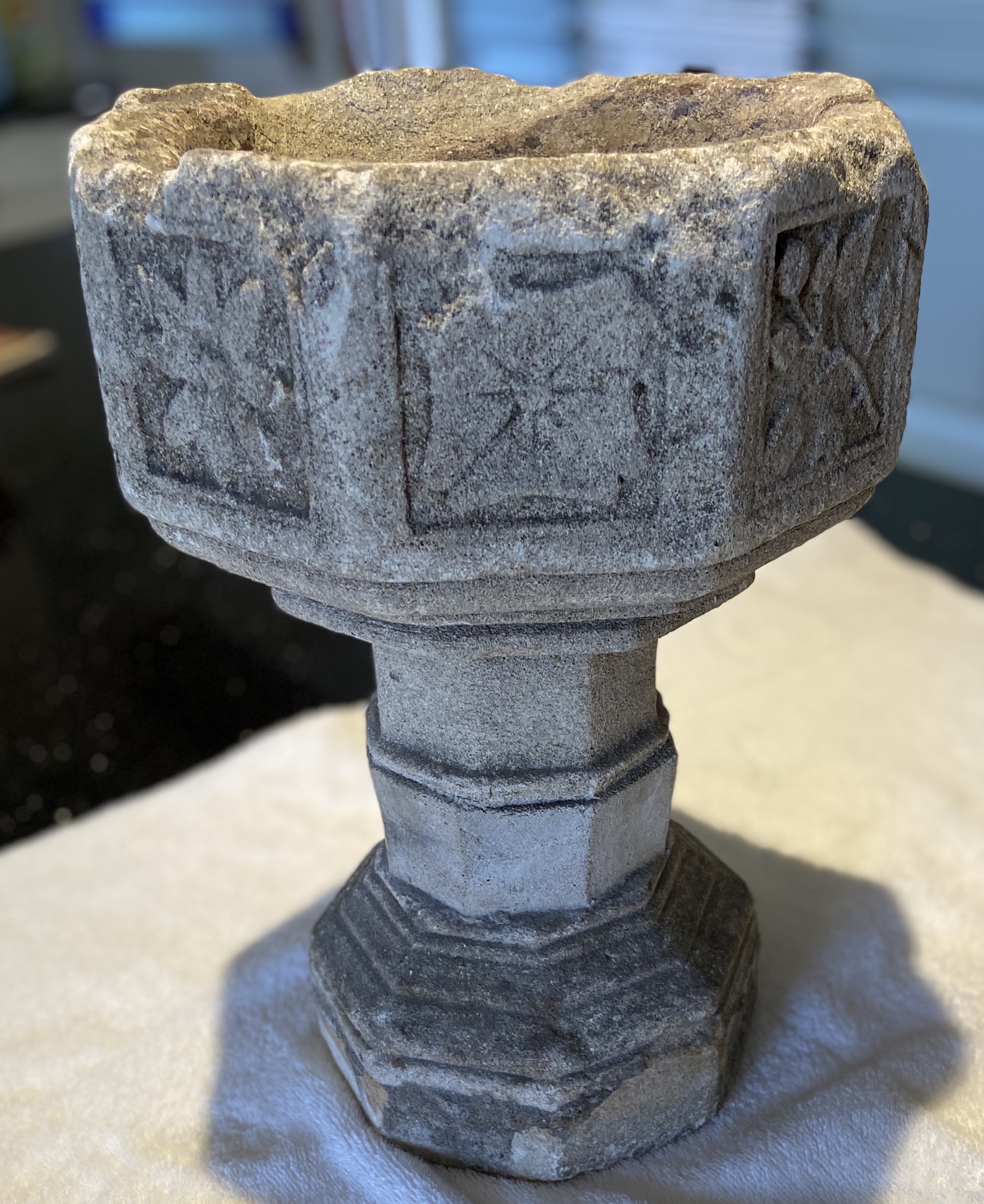
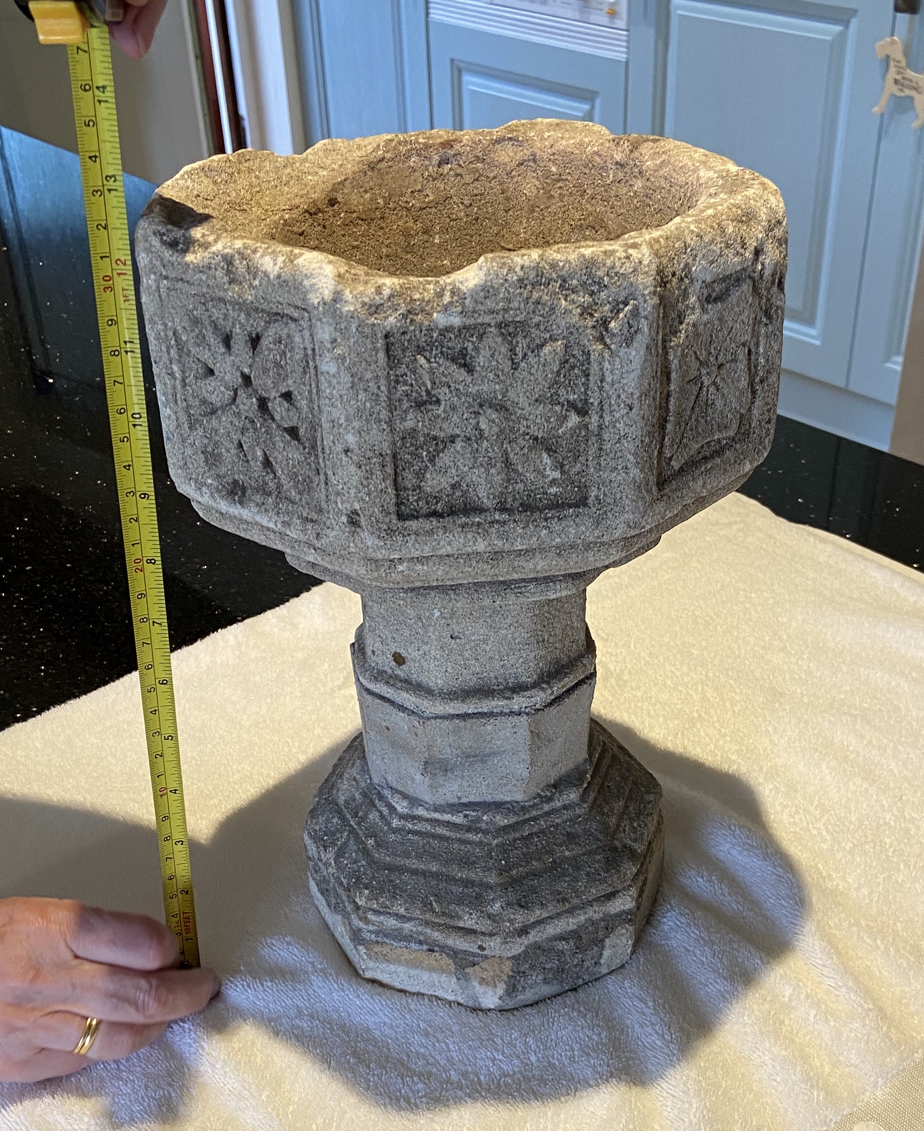
We stopped off on the way to Capel-y-Ffin at Llanthony Abbey. As well as the abbey ruins, the parish church was made out of the abbey infirmary. It has some splendid painted wall memorials – none by the famous Brute family of stonemasons but plenty to admire. Bob Silvester’s article in the current Church Monuments  is a really good study of these local stonemasons My photos aren’t brilliant because I only had my phone and it was very dark, but they give you an idea.

The Trumper monument

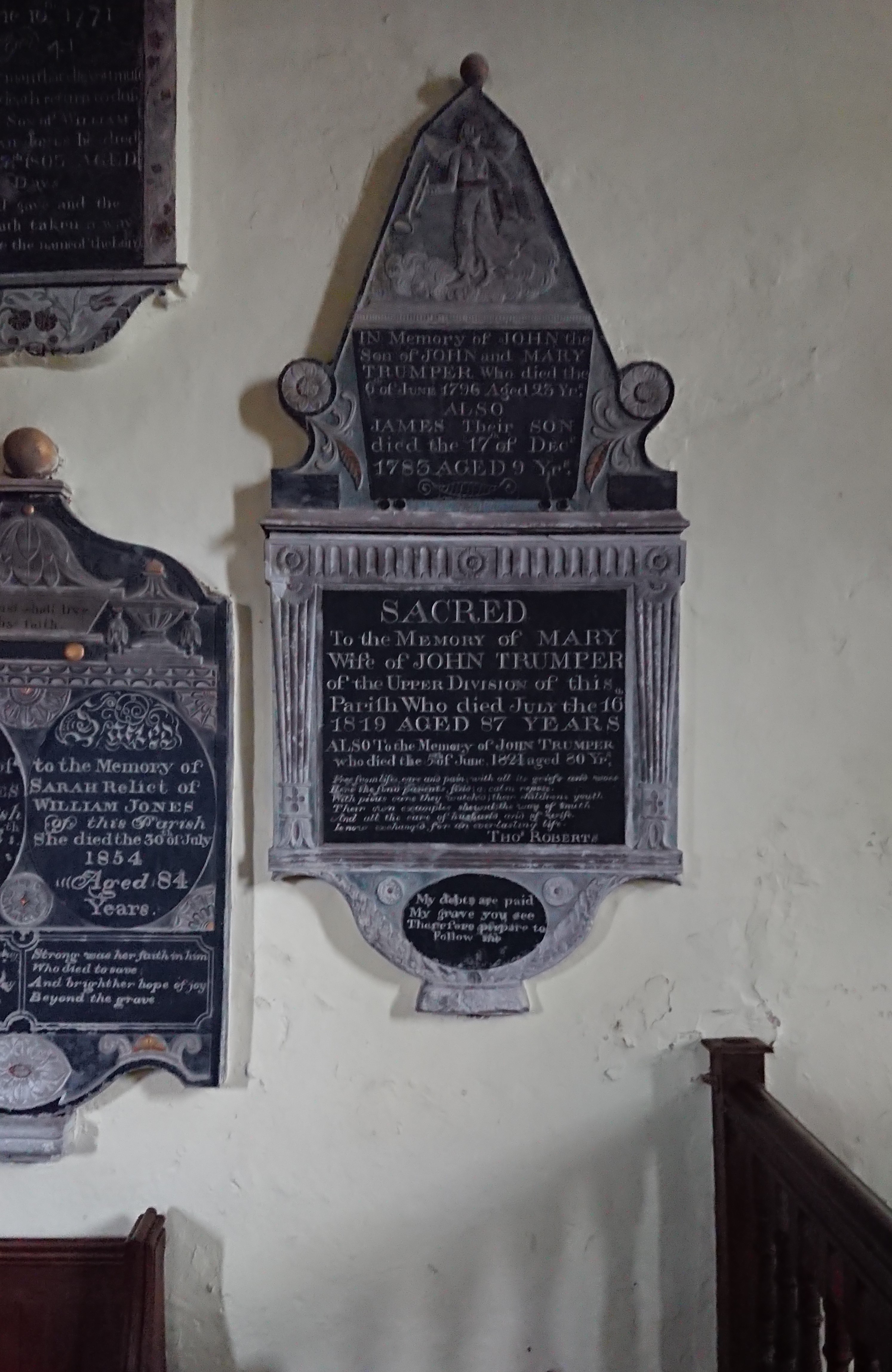
commemorates several generations of the family. There’s a particularly good angel at the top, with the trumpet of the Last Judgement (a pun, maybe?) standing on some very fluffy clouds.

Next to this, the monument to William and Sarah Jones

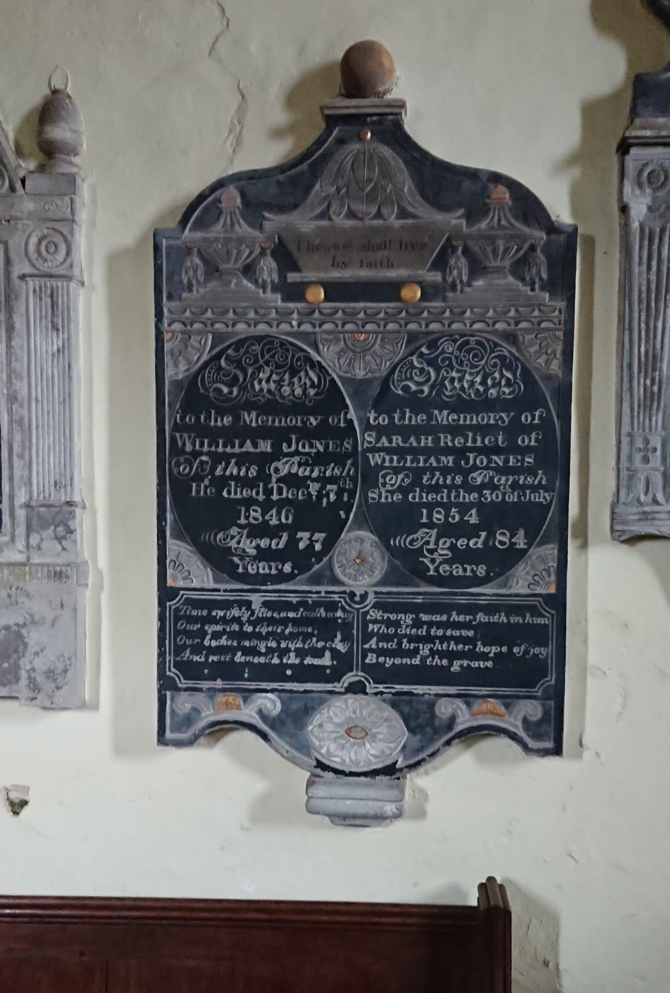
has two urns at the top and a sort of bathtub with the text ‘The just shall live by faith’.

There’s an intriguing difference in the lines under their names. His reads

Time swiftly flies, and calls away
Our spirits to their home;
Our bodies mingle with the clay
And rest beneath the stone.

Resignation, and the earthly fate of the body.

Hers by contrast reads

Strong was her faith in him
who died to save
And bright her hope of joy
beyond the grave.

more of a sense of religious belief. I’ve seen the same difference between men’s and women’s inscriptions elsewhere but I’m not sure if it’s a real gendered difference.

I couldn’t get a good picture of the one above

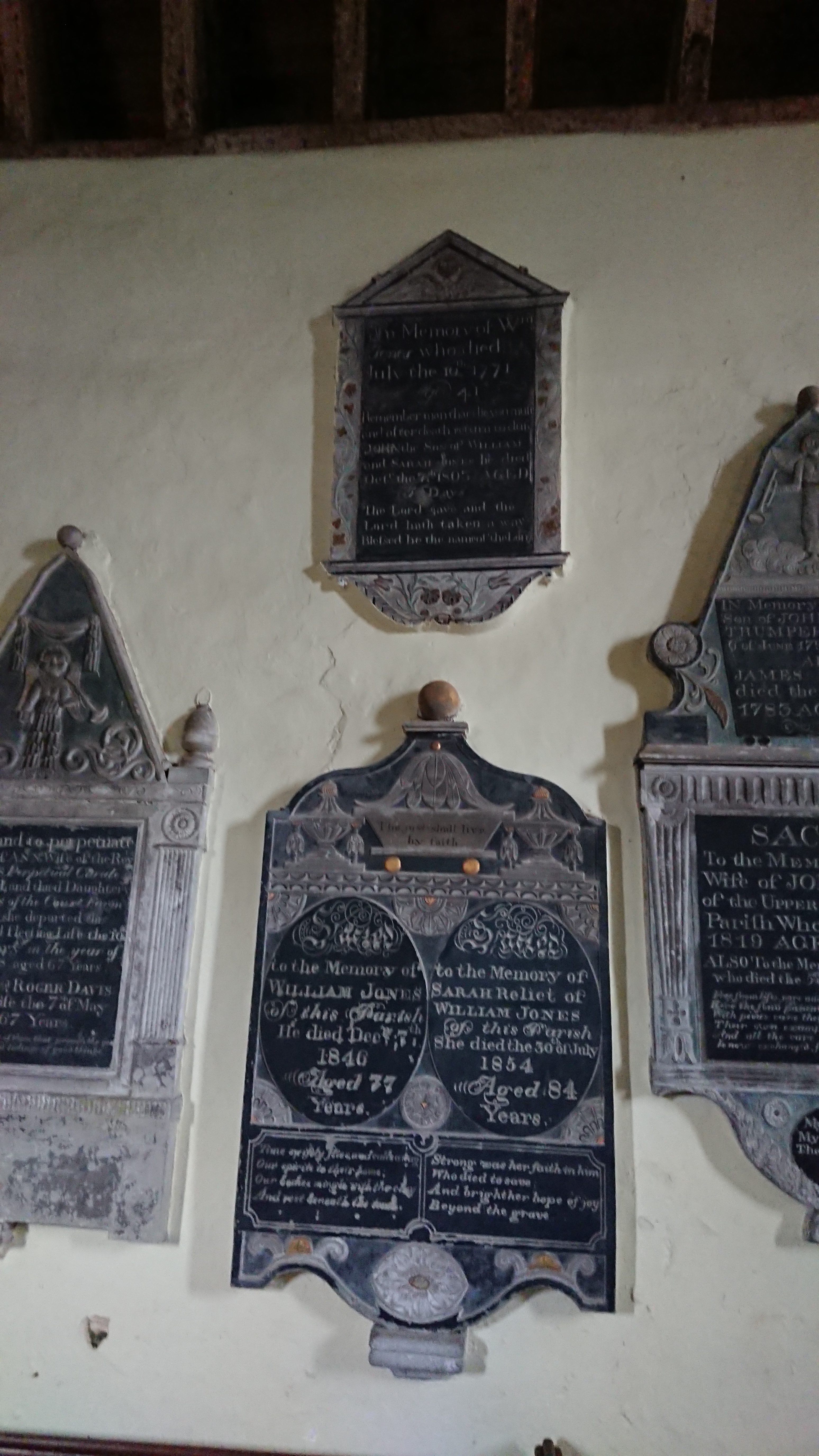
but it commemorates an earlier William Jones with the lines ‘Remember man that die thou must, and after death return to dust’ and ‘The Lord gave and the Lord hath taken away. Blessed be the name of the Lord.’

Next to this is a monument to Mary Davis and her husband Roger Davis, perpetual curate of the parish

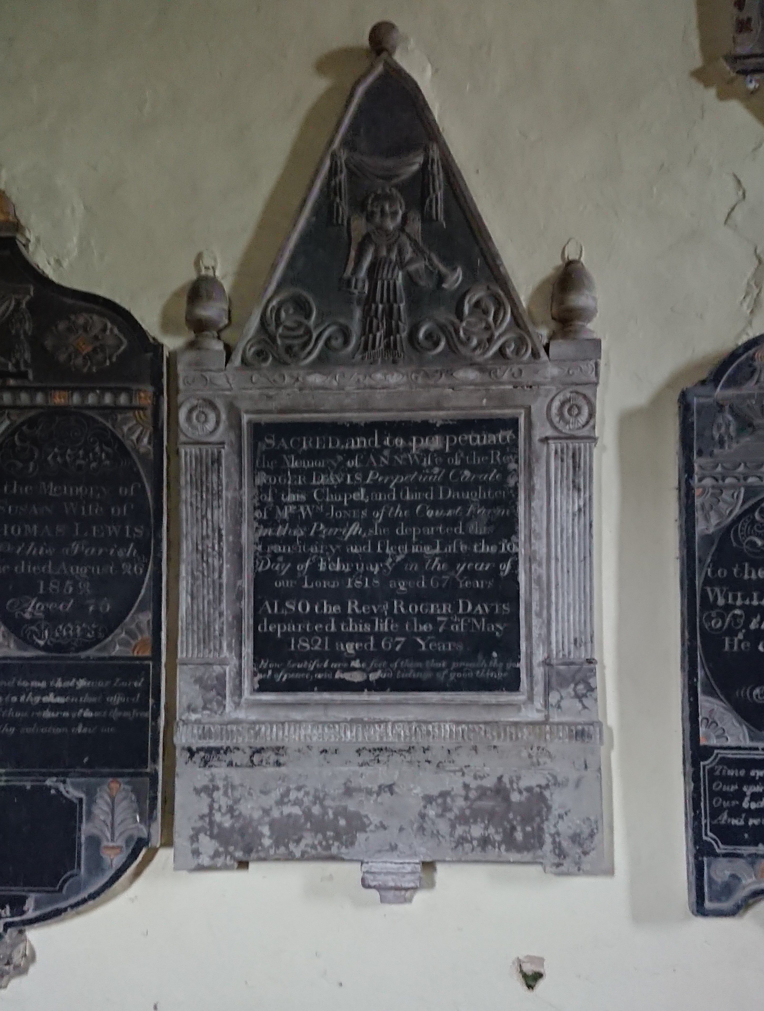
with a trumpet-wielding cherub at the top and the lines ‘How beautiful are the feet of them that preach the gospel of peace, and bring glad tidings of good things!’ – very appropriate for a cleric.

The Lewis monument

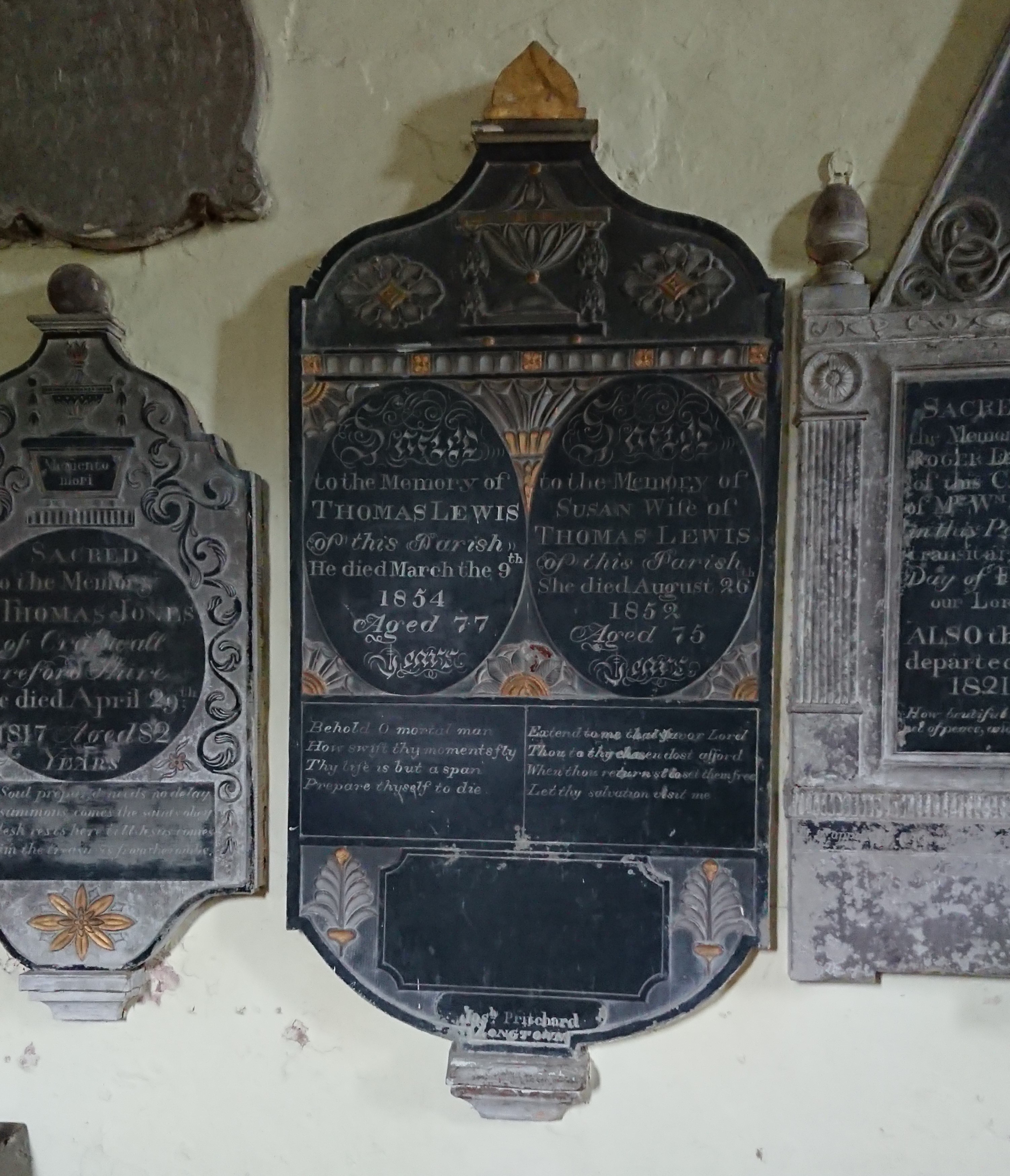
is particularly colourful, and has something of a gendered difference in the poems. His is

Behold o mortal man
How swift thy moments fly
Thy life is but a span
Prepare thyself to die.


Hers is

Extend to me thy favour, Lord,
Thou to thy chosen dost afford.
When thoui returnst to set them free
Let thy salvation visit me.

Sorting out the Joneses was tricky, but this one came from the neighbouring parish of Craswall, across the Hatterall ridge and in the next county and diocese.

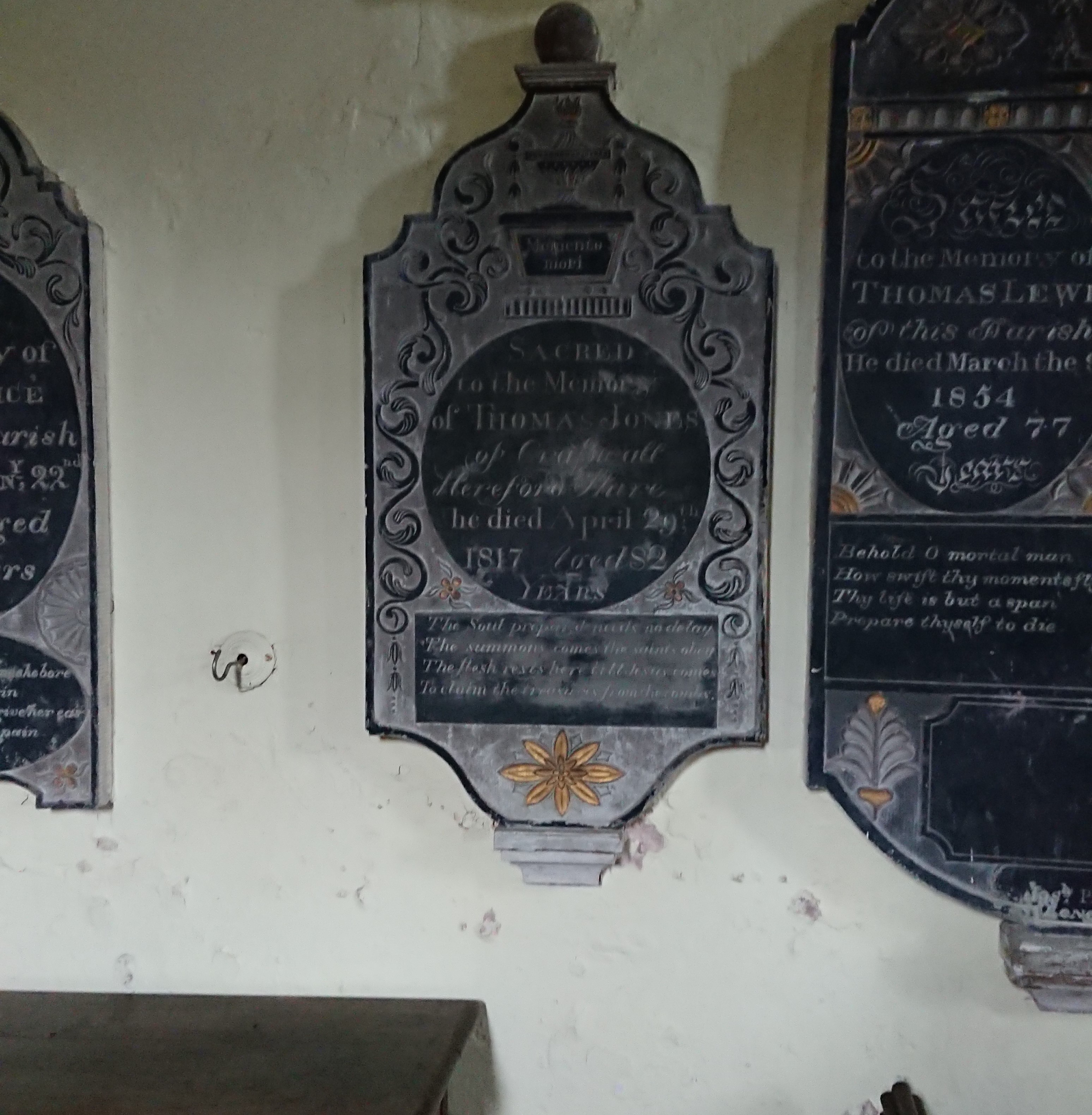
An urn sitting on a bath tub (technically they are called ‘wine coolers’) this time, with the words ‘Memento mori’. Underneath is the verse

The soul prepared made no delay,
The summons comes, the saints obey;
The flesh rests here till Jesus comes
To claim the treasures from the tombs.

Really difficult to photograph, this one, on the east side of the chancel arch

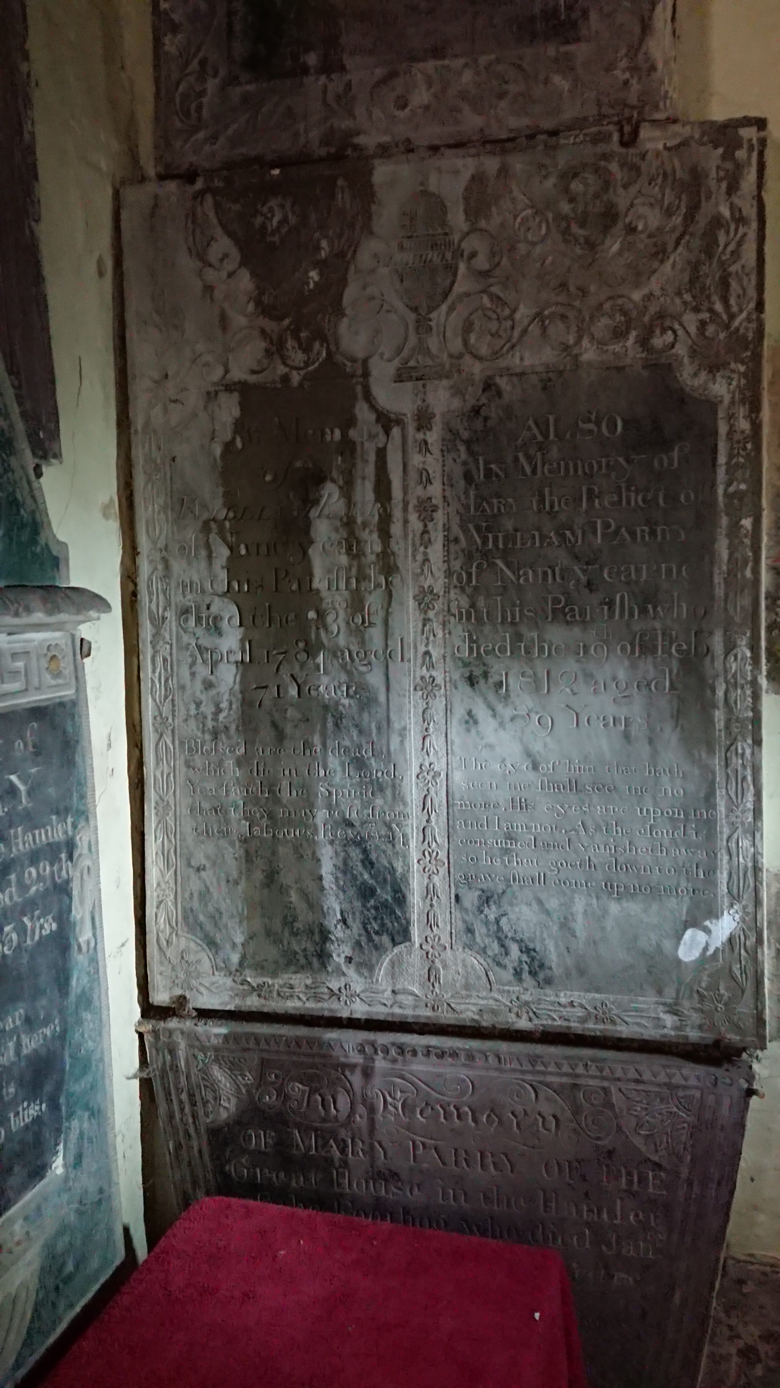
Mary and William Parry of Nantycarne, a farm tucked into the hillside just north of the abbey. Both have Bible quotes. His is from the Book of Revelation: ‘Blessed are the dead which die in the Lord. Yea, saith the spirit, that they may rest from their labours.’ Hers is really unusual, lines from chapter 7 of the Book of Job. ‘The eye of him that hath seen me shall see me no more. His eyes are upon me and I am not. As the cloud is consumed and vanisheth away, so he that goeth down to the grave shall come up no more.’

What can have led Mary (or her family) to those strangely disturbing lines? Extracts from the Book of Job feature heavily in the medieval Office of the Dead, the night prayers said after a death and before the funeral. But that would have been in Latin, and those particular verses only appear in a couple of unusual variants of the liturgy.

The other interesting thing is that the wording isn’t exactly that of the Authorised Version, which is  ‘…thine eyes are upon me and I am not’. It does sound as though the wording was given from memory, suggesting it was a text known well but not quite well enough.

But the real excitement was this

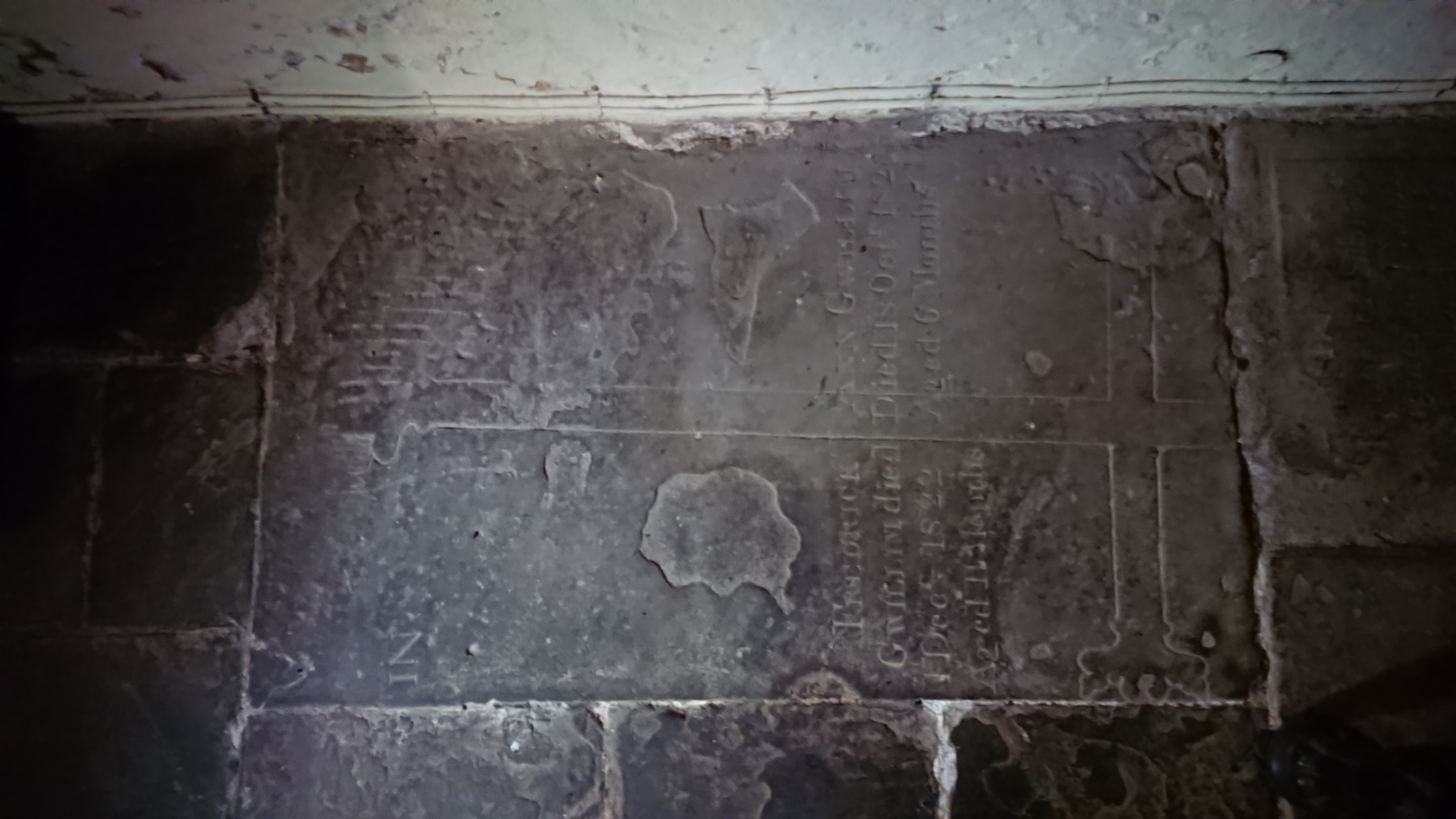
half hidden in the south-west corner. How many times have I been to the church and failed to spot it – how many groups of students have I taken there – I’ve been there with the Stone Forum, with the Church Monuments Society –

and there it was, hiding in plain sight, a medieval cross slab, trimmed on a slight slant, repurposed at least once with a later inscription.

The detail of the head

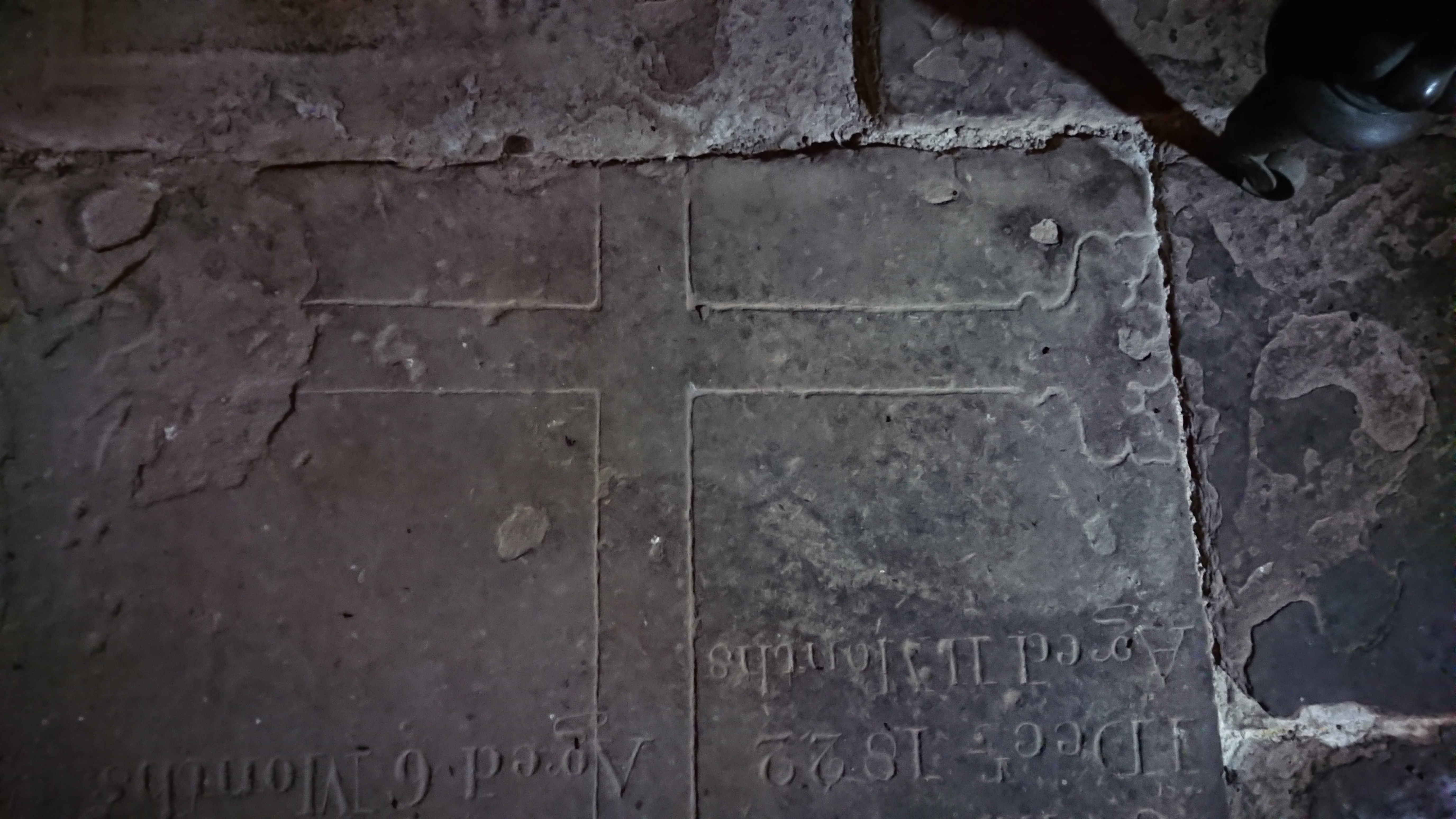
suggests a late date, probably fifteenth century. The base

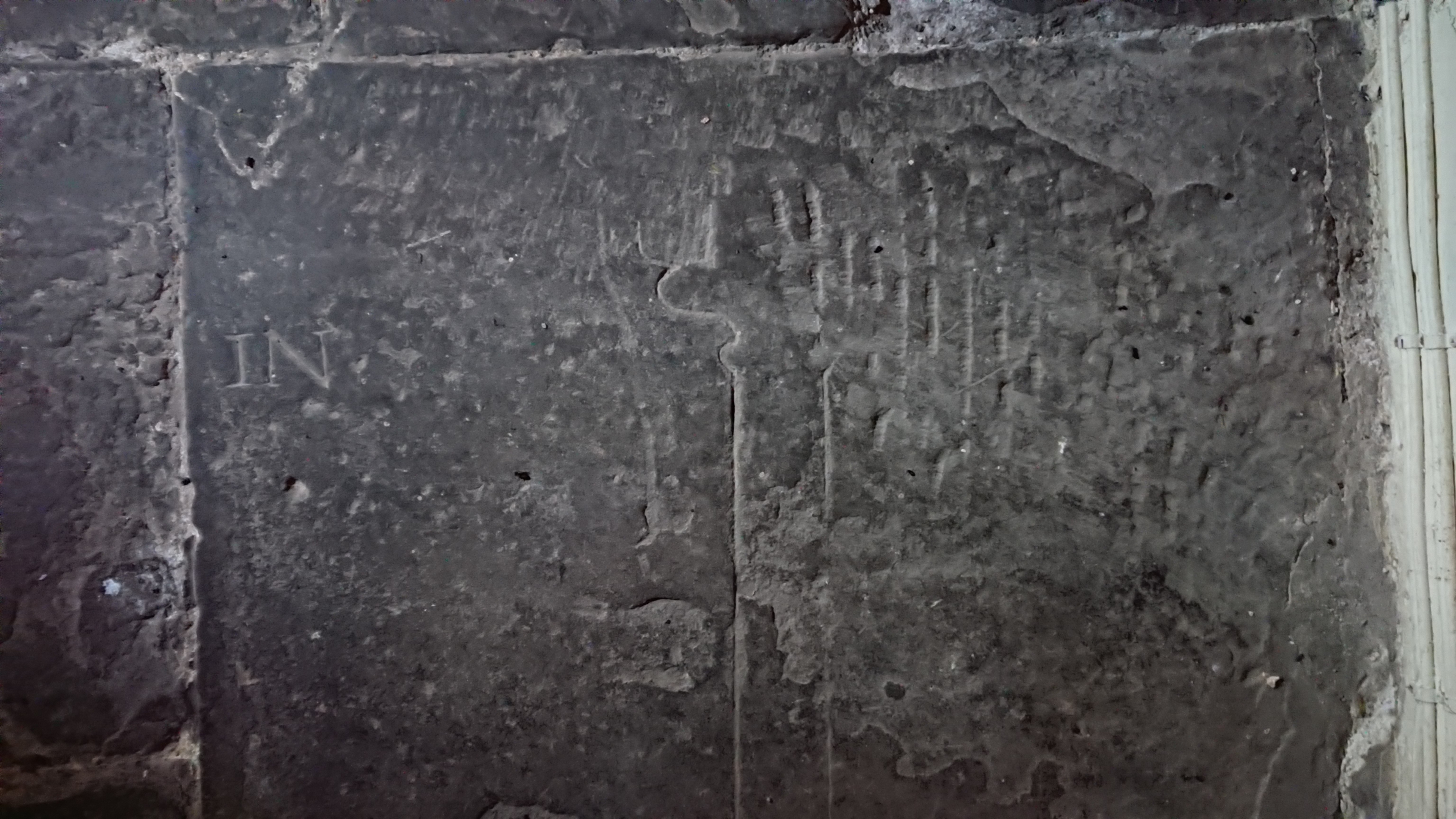
has a fleur-de-lys decoration rather than a stepped base which makes me think it’s 15th rather than early 16th. And the inscription –

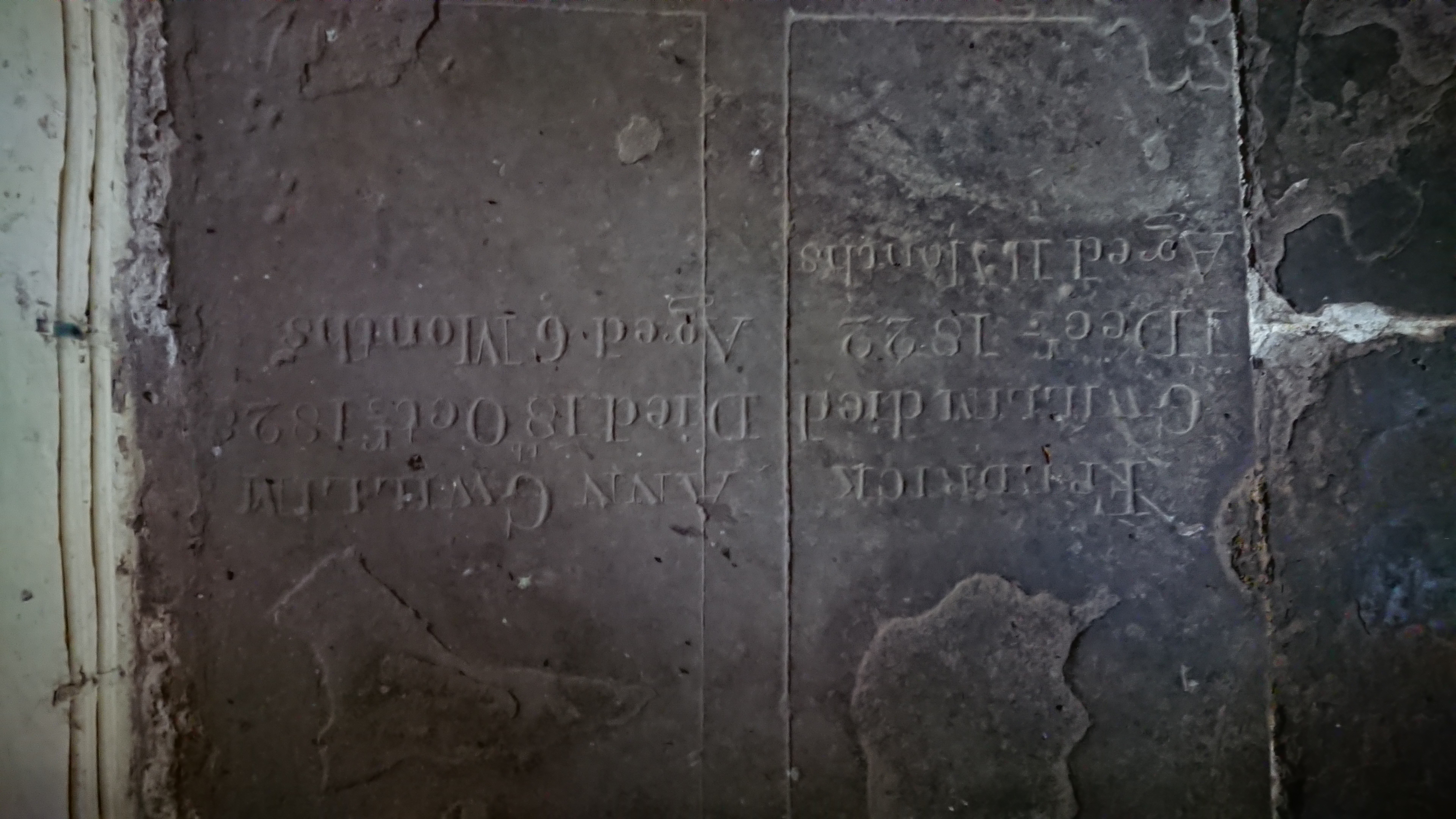
two family tragedies. Frederick Gwillim, Died 1 Decr 1822 aged 11 months, and Ann Gwillim, Died 18 October 1828 aged 6 months. How did they bear it.

Probably the stone came from the abbey – possibly the grave of a leading member of the community, possibly a lay person who had been generous to them. Who knows.

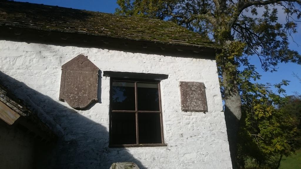
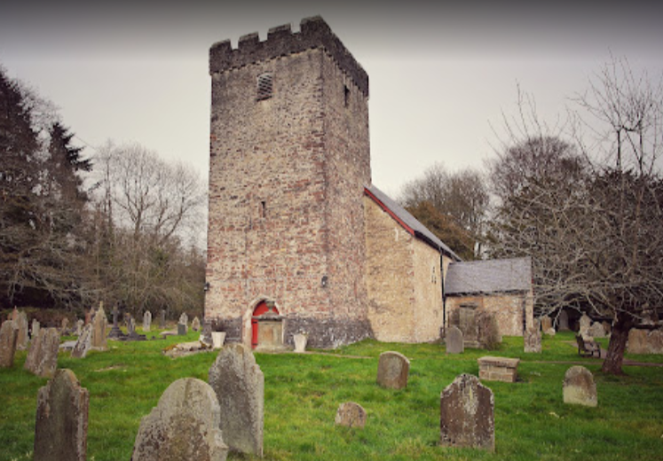
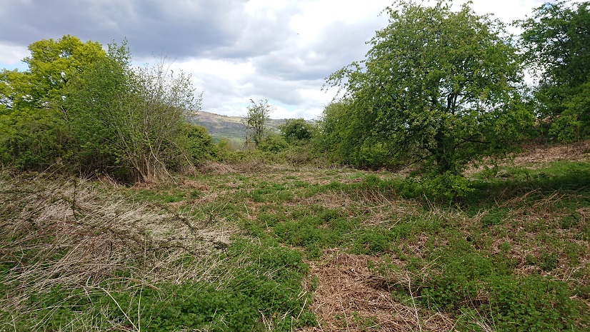
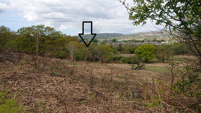
Llanthony was a bit disconcerting, being full of young army recruits, all spick and span in their new camouflage gear and 20 kilo overnight packs, off on an exercise in the mountains. The road to Capel y Ffin was nearly blocked by a landslide but Steve managed to get through. And the recording went well. They didn’t really want a lot of detail, and it was good to see the little church again.

Reeves and dunghills

This is real hardcore lost farmsteads – this

is all that is left of a farm called Maerdy. It appears on the tithe plan as Mardy Du, and in 1840 it was being farmed along with a larger farm, Gwern y Domen. It belonged to the Plymouth estate and the tenant was an Edmund Morgan (I think he has cropped up elsewhere – was he sub-letting?). It’s on the 1900 OS map as Maerdy cottages, so it seems to have gone down in the world, and it’s possible that the outbuilding marked on the tithe plan has become a cottage. There is still something marked on the 1:25.000 OS map at ST 17007 87450 but it’s hard to locate on the ground. The track down from Gwern-y-domen Farm to the railway line doesn’t follow the line of the right of way, the woods have expanded since the aerial photo was taken … but this is my best guess.


We tried to find the well, which is a little further up the slope. The stream clearly flows from it


but the brambles defeated even Nell.


This is all a pity, as Maerdy would have been one of the most important farms in the area in the middle ages. Under Welsh law, the maer was the royal official in each commote, responsible for cultivating the king’s land and supervising the serfs (somewhat like a reeve in England). He also presided over the local court. As the Norman marcher lords took over from local Welsh rulers, they took over the organizational structure of the commotes, so the office of maer continued into the later medieval period.

But there was another maer in each commote, the maer y biswail (literally the dung-reeve) who was responsible for the lord’s cattle and could have day-to-day responsibility for farming as well. In The Welsh King and his Court, Glanville Jones pointed out that most places called maerdy were actually the homes of dung-reeves. So our farm may have been the home of a practical farm supervisor rather than a court official.

In a comment on my blog post on Parc y Fan at https://www.heritagetortoise.co.uk/2020/09/parc-y-fan/, John Owen suggested that the name might indicate the home farm for the centre of a multiple estate, possibly based on a building near the site of the Van Mansion. The various surveys of the De Clare estates mention Rudry, Hendrenny and Castell Coch as separate units, possibly manors? This he thinks may be the frozen remains of a multiple estate. Multiple estates were large land holdings organized so that they included all the necessary resources – good arable land, meadow, pasture, woodland, marsh land, rough mountain etc.

Or is there some connection with Gwern y Domen? The actual tomen is a castle mound a little to the north-east of Maerdy, with its bailey cut across by the disused railway line. Could this have been the local stronghold with Maerdy as the administrative headquarters? The problem is that we have little or no documentation and the archaeology has been messed up by industrial development and later housing.

But we do still have records of farms like Maerdy, Parc y Fan, Treboeth and the Warren to enable us to start reconstructing the old farming landscape.

Picturesque tourism and industry: some links

posted in: Uncategorized | 0

These are links to the online texts that I’m using in my lecture to the Oxford House Industrial Archaeological Society

Richard Warner, A Walk Through Wales  https://books.google.co.uk/books?id=AdcQh0l41XoC&printsec=frontcover#v=onepage&q&f=false (p. 232)

The anonymous ‘Northern Tour, or, Poetical epistles’ is at https://books.google.co.uk/books?id=s_Q7AQAAMAAJ&printsec=frontcover#v=onepage&q&f=false (p. 446)

Wigstead, Remarks on a Tour to North and South Wales https://books.google.co.uk/books/about/Remarks_on_a_Tour_to_North_and_South_Wal.html?id=E6RbAAAAQAAJ&redir_esc=y (p. 57)

Edward Donovan, Descriptive Excursions through South Wales … https://books.google.co.uk/books?id=nUU9AAAAYAAJ&printsec=frontcover#v=onepage&q&f=false (starts at p. 49)

  1. W. Manby, An Historic and Picturesque Guide from Clifton … https://books.google.co.uk/books?id=x-AuAAAAMAAJ&printsec=frontcover#v=onepage&q&f=false (starts at p. 183)

The Rev. S. Shaw, A Tour to the West of England, in 1788 … is in John Pinkerton’s A General Collection of the Best and Most Interesting Voyages and Travels …  https://books.google.co.uk/books?id=JkwnAAAAMAAJ&printsec=frontcover#v=onepage&q&f=false (quote on p. 224)

Seth

posted in: Family | 2

Grandparenting in a time of Covid

Seth’s first full year has been a very strange one. From restaurant meals

and church play group

to lockdown – videochats

working from home

and a WhatsApp birthday.

But there was still fun – paddling pool in the garden

socially distanced visit in our garden

the wonderful world of books

and when we got back together as a household bubble, I introduced him to the joys of graveyards

what was he listening to?

plus the joys of leaves

and puddles.

And here he is in his Christmas jumper.

Parc y Fan

Well, this is another that I must have walked past several times without realising what it was. These foundations under the brambles and bracken

must be all that’s left of Parc y Fan (OK, Park y Van in Wenglish), a substantial farm part of the Plymouth estate. The ruins are at ST 17282 86667, just to the east of the Van house and near the bottom of the footpath down from the Gwernydomen lane to the Nant Gwaunybara.

John Owen remembers ‘substantial remains’ here (see his comments under Treboeth on this blog) but there is little left now.

It was a sizeable farm – 83½ acres according to the tithe apportionment, between the Van and the Nant Gwaunybara. The same tenant also held the area to the east called Van Park, 115 acres of pasture and woodland. By the time of the first edition 6” OS map (surveyed 1875), all the land on the east side of the brook was wooded but this still left a substantial farm of over 80 acres. The buildings are still marked on the modern 1:25,000 map but there is really very little on the ground.


Then there’s this,

a little to the east and just above the Nant Gwaunybara – but this is clearly a field wall,

above the steep bank of the stream, and this

is probably the field angle marked on the early OS. The layout of the buildings at Parc y Fan changes from map to map, and it isn’t clear which was the farmhouse and which the outbuildings. Also there’s a well somewhere above the farmhouse. We need another look when the vegetation has died down.

The name of the farm  might lead us to speculate that this was where the park keeper for the Van park lived. The Lewis family emparked a huge area east of the house, probably in the sixteenth century (Rice Merrick described a park there in 1578).  The present house of the Van was built in the 1580s. The family then moved to St Fagans and leased the Van to tenants. The park went out of use, and by the time of the tithe plan it was mostly farm land, part of the Van, Gwern y Domen, Maerdy (Mardy Du on the tithe plan) and Park y Van. The park straddled the parish boundary. West of the Nant Gwernydomen was in the Van hamlet of Bedwas (a Monmouthshire parish but with hamlets in Glamorgan – the parish boundaries in this area a very idiosyncratic). East of the stream was in the parish of Rudry. (You get some idea of the problems of surveying these farms by the fact that the road from Caerphilly to Rudry, which is the southern boundary of the farm, doesn’t line up between the two maps.) John Owen has looked at the C18 estate maps in the Plymouth collection in the Glamorgan Archives. They show the park extending south of the present Caerphilly-Rudry road, including the Warren and Ty’n-y-parc (see https://www.heritagetortoise.co.uk/2020/08/the-warren/ and https://www.heritagetortoise.co.uk/2020/05/more-deserted-farmsteads/). So did the road run through the park – or does the road post-date the park? We need to get back to the estate surveys when the record office is open.

Maerdy might be the next one to explore – it was being farmed with Gwernydomen on the tithe apportionment. It’s  marked as Maerdy Cottages on the old OS maps but there doesn’t seem to be a house there now. Alas, Caerphilly is currently in lockdown because the number of Covid-19 cases there is on the increase, so Nell and I will have to take to walking somewhere else. Time for a look at the Llandaff-Penrhys pilgrimage route, maybe?

The Warren

As I expected, there was very little to see on the site of the Warren farm. It’s on the tithe plan but as part of Treboeth, the farm to the east (https://www.heritagetortoise.co.uk/2020/08/tre-boeth-the-warm-town/). Here’s a sketch plan based on the tithe plan on places.library.wales (field numbers refer to the tithe apportionment – click through to that from the map on the web site)

and the detail of the actual farmstead

By the time of the first 6” Ordnance Survey it had vanished under the forest.

Or had it?

Part of the difficulty is that the track marked on the modern OS running past it isn’t really there on the ground. You really need the eye of faith to identify this as a track!

But persevere and just to the north of the track you spot this


the south-west angle of the farmyard (no. 1 on the plan).

And you can just see the line of the wall going north (2 on the plan)

and the return (3 on the plan).

The eastern wall of the farmyard is quite clear (4 on the plan)

the north-east corner (5 on the plan)

and the return (6 on the plan).

The farmhouse is just heaps of tumbled stone (the shaded area on the plan).


Having walked all round it several times, I’m pretty convinced that this is the site of the farm. The problem is that it is at about ST 16229 85809, 40-50 m east of where the farm is marked on the tithe plan. The 1841 plan puts the farm virtually on the bank of a little stream running north out of the woods. The remains I have found are some way to the east.

However – looking at the 6” OS map (this is a sketch based on it)

The pin marker shows the eastern end of the farmstead according to the tithe plan overlay (I’m working between the tithe plan and 2nd edition OS on places.library.wales and the 2nd edition OS and modern OS on https://historicplacenames.rcahmw.gov.uk/ – there doesn’t seem to be a single site that does the lot, and none of them uses the 1:25,000 OS Leisure map, which is the really useful one). But on the OS map there is a small square building a little to the east (outlined in red on the sketch plan).  Is this the real location of the Warren – and is the little square building all that was left of it, used as some sort of shelter, perhaps, for workmen in the plantation?

The name Warren is interesting. Warrens were preserves for rabbits, at a time when rabbits were useful but very fragile little creatures and the perquisites of lords and gentry. They came from southern Europe and took a long time to adapt to the colder and wetter climate of England and Wales. Special raised burrows called pillow mounds were built for them, and they were cared for by warreners. Our farm could have started as the warrener’s home.

There is no documentary evidence for a warren on Caerphilly Mountain. However, the big field to the west of the Warren farm (519 on the tithe plan) is actually called the Warren, and the field in which the farmstead sits is called Warren Fawr. The fields north-west of Warren farm are part of Ty’n-y-cae and are all called Cae pen y warren on the tithe apportionment. This really does look indicative.

What we can’t tell, in the absence of any documentation, is how old the warren was and who it belonged to. If it was medieval, it belonged to Caerphilly Castle. However, warrens were still being constructed in the sixteenth and seventeenth centuries, so it could have belonged to the Lewis family of the Van, the big house across the valley, before they moved to St Fagans.

John Owen’s comments on the post on Treboeth are very illuminating. Treboeth was there in the later middle ages, and wood from there went to repair a bridge in Caerphilly Castle in 1428. If the Warren really was a warrener’s house, these two little ruins, hidden under the trees, are some of our earliest evidence for the farming landscape east of Caerphilly.

Tre-boeth – the ‘warm town’?

This is another little farmstead that I must have walked past at least a dozen times without realising it was there. It’s at the north-east side of the Wern-ddu Claypits, just above the site of the old brickworks, at about ST 16684 85984.

To be fair to myself, what you can see from the lane

isn’t the farm house but a little outbuilding – henhouse? pigsty?

(nice bit of creamy mortar)

Once you know it’s there, you can just make out the farmhouse from the lane


and this fenced-off bit

must be the well

(still marked on the modern OS map).

On the old OS maps it’s Tre-boeth, the warm township, but on the tithe plan it’s Treboth. The name might suggest early industrial activity. There’s plenty of evidence for early coal mining, and before that there would have been charcoal burning for the early iron industry. The farmhouse looks small, and there is only the one outbuilding, but on the tithe apportionment it’s a substantial farm of 133 acres, part of the Clive estate and tenanted by a Thomas Evans. Most of the land is to the north and west: to the south was wooded in 1841. By the first 6”OS map (1875) the whole of the former farm was wooded. Plantation for pit props? The farm is still marked but must by that date have been a smallholding for a worker in the clay pits or the brickworks, or possibly in the woods. It’s still there on the 1915 revision but by the 1938-47 revision it has disappeared.

Part of the size of the farm on the tithe apportionment seems to be that it has swallowed up another farm. On the tithe apportionment it’s described as ‘Treboth and Warren’. ‘Warren’ is actually another farmstead to the west, in what is now the depths of Wern-ddu woods, marked on the tithe plan but not on any of the OS maps. There may be nothing now on the ground but I feel I should have a look.

Watch this space. (It may just be a space.)

Not the Head of the Pass

The woods between Rudry and Parc Cefn-onn are about the limit for my weekly long walk – about 12-13 miles with quite a bit of Up! But there is still plenty to have a look at.

This little ruined farmstead at ST 19223 85750

took a surprising amount of finding. Part of the problem was the name. On the old OS maps it’s Pen-y-bwlch, Head of the Pass – but it’s actually well down in the valley. The current OS marks a track to it – a double-pecked-line track, looking on the map like a forest road, with a bridleway along it and crossing the footpath and the little stream to head over the fields to Ty’n-y-graig.

But there is no road through the woods. Just the footpath south from Coedcae Garw along the edge of Coed Coesau-whips. The old maps put it east of the footpath but the path now goes between the house (to the west)

and what remains of the outbuildings.

(Someone has made a firepit with a lot of the outbuilding stone.)

Once we found it, though, after a couple of false starts, it was worth the effort.

(here’s Nell on the house wall.)

On the tithe plan it’s a farm of just over 20 acres, with a couple of fields along the lane to the north and the rest to the south and east. Coed Coesau-whips on the tithe plan is smaller but still shown as mainly conifers – but John Owen’s idea that the name suggests charcoal production for the iron industry would mean an earlier wood of something like beech and oak. I do wonder whether these little farms like Coedcae Garw, Cwm and Pen-y-bwlch were carved out of the original wood. Then when timber became a valuable commercial commodity for pit props and the plantation was extended, the farms were reabsorbed.

There would also have been access problems. On the tithe plan the access is down the lane past Coedcae Garw,

across the ford

and up a narrow hollow way –

this must have been possible only for a single horse, no room for even a small wheeled vehicle. By 1900 there was a track through the woods, but by that date most of the farmland had been lost to forest. The house is still marked by name but can only have been a cottage for something like a forest worker.

Access may have been what put an end to a lot of these little farms – once farming moved from using horses to mechanical vehicles, anywhere far off the road would have great difficulty in keeping going.

Coedcae and the Cwm

Having found the ruins of Coedcae Garw thanks to @mikekohnstamm (https://www.heritagetortoise.co.uk/2020/07/coedcae-garw/) I’ve reverse engineered the process and gone back to looking for farms and smallholdings which are on the tithe plans and the old OS but not on the modern map. There were two just along the lane from Coedcae Garw. Ty’r-ywen is at grid ref. ST 20152 86428 and Cwm is at ST 19911 86265.

Ty’r-ywen on the tithe map was a cottage and garden of 1 rood 20 perches, belonging to the Clive estate and tenanted by a Thomas Thomas. It was too small to have any value for tithe. There are 4 roods to an acre and 40 perches to a rood, so Thomas’s garden was about 1,500 square metres, about the size of 3 tennis courts. Enough to grow veg for a family and keep a pig and a few chickens but not enough to live on. The men of the family probably worked in the nerby iron works or on bigger farms and the women and young children looked after the homestead. You find a similar pattern all along the edge of the industrial area – my father-in-law was brought up on a similar smallholding in the Sirhowy valley, and my own house originally stood in a garden nearly as big as Ty’r-ywen’s.

Ty’r-ywen is named on the 1915/22 6” OS map (accessible on the wonderful maps.nls.uk site).  A building is marked on the 1948-1953 map but without a name. All that is there now is this

the concrete bases for prefab panels. It looks very much as though the cottage was deserted and rebuilt as some sort of farm building, then that too became derelict.

The other lost smallholding is Cwm. It’s complicated because there are actually two farms called Cwm in that little valley. One is just across the lane from Ty’r-ywen and is now quite a big horse-riding establishment. The other is a little way  up stream, just off the Ridgeway Path and just before the path crosses the stream and goes up into the trees. On the tithe plan it’s a bit complicated. The house, garden and croft, a little over 2acres, belong to the Morgan estate and are tenanted by a John Morgan. But the surrounding fields, Waun and Cae Fry, are called ‘Cwm Land’, also part of the Morgan estate and tenanted by Spencer Thomas. The fields on the other side of the stream,  called Cwm mawr and Cwm Ceffyl, belong to the bigger Cwm farm, part of the Clive estate and tenanted by  Isaac Price.

This must be the house


just a bit of tumbled stone under the brambles. Another candidate for a winter visit, when the undergrowth has died down a bit.

The path south into the woods was stiled and waymarked so we gave it a go. It is steep, and damp in places, but a good clear route cutting across the forest roads to the top of the next ridge. We looked at this

between the forest edge and the trig point but there’s nothing on the OS or tithe plans so we concluded it was tumbled stone from the field wall.

Sometimes a heap of stone is just a heap of stone.

But the views from the trig point are splendid.