Llanfair-ar-y-bryn

The main purpose of our visit to Llanfair-ar-y-bryn was to check the memorial to the great Welsh hymn-writer William Williams Pantycelyn and his family (see https://welshtombs.wordpress.com/ ) but there was a lot else of interest in and around the church. It stands on the site of a Roman auxiliary fort, and there is Roman tile and brick in the church walls.

The church was built by the Norman Robert Fitzpons, who built the first Llandovery Castle. He established a small Benedictine priory here, dependent on the abbey at Malvern. When the area was reconquered by the Great Lord Rhys, he allowed the monks to remain, but they were turfed out by his son Rhys Gryg in 1185. (The story is that the behaviour of the monks had become scandalous. These little dependent priories could go bad, but theat may have been an excuse.)

The church was deliberately damaged by fire. It was rebuilt by Sir John Giffard when he was constable of Llandovery castle. There were later alterations – the installation of a rood screen, some new windows. The floor of the original church sloped down hill to the east, but at some point the chancel floor was raised, leaving two rather odd windows low in the east wall.

The church as it stands is big enough, but it was even bigger at one time. There was a south transept, but it was in ruins by the eighteenth century and used as a dumping ground for skulls and bones from the graveyard. There may also have been a north transept.

Inside, on the north wall, is this medieval cross slab.

Probably mid-late 13th century, measures 88.5 x 32 cm maximum. Turn it upside down

and the inscription reads …S: CVIV… (in other words, …s, cuiu[s anime deus propitietur], on whose soul may God have mercy).

There is also a strange little face with jug ears


– could this possibly come from an effigy? There are two sepulchral niches in the north wall of the chancel, one part obscured by subsequent rebuilding.

The church also has a little bit of decorative medieval paint and this

probably late 16th or early 17th century text, so far undeciphered. It could be Welsh;

the medieval font in which William Williams was baptized;

and some rather splendid hatchments of the local Gwynne family.

And the King’s Head in Llandovery does a full vegan menu including some vegan chocolate brownies.

Cross slabs – medieval and post-medieval

posted in: Tombs, Welsh History | 0

Really looking forward to speaking to Cardiff’s Continuing Education series of free lectures next week. The talk will involve telescoping two lectures into one, and as it’s part of the History programme I thought some further reading might be appropriate. To my embarrassment I find a lot is things I’ve written myself …


Some background reading on medieval cross slabs:

McClain, A. 2010. ‘Cross Slab Monuments in the late Middle Ages: patronage, production and locality in Northern England’, in S. Badham and S. Oosterwijk (eds), Monumental Industry, Shaun Tyas, Donington, 37-65.

This is a good introduction with a lot of further references to the work of Peter Ryder and Lawrence Butler – e.g.

Butler, L. A. S. 1964. ‘Minor medieval monumental sculpture in the East Midlands’, Archaeological Journal, 121, 111-53

Ryder, P. 1985. The Medieval Cross Slab Grave Cover in County Durham, Architectural and Archaeological Society of Durham and Northumberland, Durham


On Welsh cross slabs:

Gresham, C. 1968. Medieval Stone Carving in North Wales, University of Wales Press, Cardiff

– still a useful introduction but see

GITTOS, B., and GITTOS, M. 2012. Gresham revisited: a fresh look at the medieval monuments of north Wales’, Archaeologia Cambrensis, 161, 357–88


On the Llangynwyd cross slabs:

Gray, M. 2012-13. ‘Good thief, bad thief: some thoughts on the medieval cross slabs of south Wales’. Welsh Journal of Religious History 7 & 8, 24-38, and

Gray, M. 2017. ‘An unrecorded triple cross slab at St Mary Hill’. Morgannwg 61.


On the post-medieval cross slabs:

Gray, M. 2016. ‘Post-medieval cross slabs: closet Catholics or stubborn traditionalists?The Antiquaries’ Journal. 96, p. 207-240. Available online at https://pure.southwales.ac.uk/en/publications/postmedieval-cross-slabs(39f0b31f-d6e5-4bc6-b255-2750950fe7ee).html .


Online resources:

There are several posts on my https://welshtombs.wordpress.com/ blog – e.g. https://welshtombs.wordpress.com/2013/07/05/brecon-cathedral-history-beneath-your-feet/ , https://welshtombs.wordpress.com/2013/10/31/on-the-benefits-of-a-fresh-pair-of-eyes/ , https://welshtombs.wordpress.com/2015/11/06/abergavenny-three-more-post-reformation-cross-slabs/

and on the Tintern inscriptions, https://welshtombs.wordpress.com/2018/06/16/tintern-abbey-the-commendation-of-souls/

On the Llangynwyd cross slabs, https://churchmonumentssociety.org/monument-of-the-month/heaven-under-our-feet-the-laleston-triple-cross

and on Brecon https://churchmonumentssociety.org/monument-of-the-month/brecon-cathedral-a-post-reformation-cross-slab and https://churchmonumentssociety.org/monument-of-the-month/brecon-cross-slab-commemorating-lewis-havard-d-1569


The Church Monuments Society is for everyone who is fascinated by tomb carvings – medieval effigies, cross slabs, modern gravestones. Their web site is at https://churchmonumentssociety.org/

and the Ledgerstones Survey http://www.lsew.org.uk/ focusses on stones set in church floors – cross slabs, heraldic designs and others.


Finally, not really to do with cross slabs, but this thesis https://pure.southwales.ac.uk/en/studentthesis/death-and-commemoration-in-late-medieval-wales(7d14b42e-a69b-4968-9398-aad3b96748e0).html looks at different kinds of commemoration but also has a lot of detail on evidence for tomb carvings and burial practices.

‘Schall do no …’??

Llanfair Cilgedin, north of Usk in Monmouthshire, is one of the loveliest of the many lovely churches in the care of the Friends of Friendless Churches. It is most famous for the sgraffito work with which it was decorated by heywood Sumner in the 1880s. The panels illustrate the Benedicite – ‘O all ye works of the Lord, bless ye the Lord’.

We used to sing that every week in Mattins but not many churches do a sung morning service any more.

Being naturally contrary, I went to Llanfair Cilgedin not to see the sgraffito but this

the early 14th century tomb of a priest. But while we were there, I noticed some medieval stained glass in the chancel (these are mostly Martin Crampin’s photos)

and high above the west door.

The chancel glass is particularly intriguing.

The word Credo suggests a set of the Apostles with their clauses of the Creed. This

must be the feet of the crucified Christ. The word Sanctus on a plinth must belong to a saint – possibly one of the apostles – but what to make of the text to the right? And the English words at the bottom here –

‘schall do no …’ The glass looks medieval: is it possible that there might have been English text in a window by the early 16th century? And what might it be? My first instinct was a version of the Ten Commandments – ‘thou shalt do no murder’, maybe? Recently, I tweeted the photo of the magnificently-bearded man above and asked for ideas. Angela Graham suggested it might be a version of Isaiah 11, which also has the prophecy of the rod from the stem of Jesse. The bearded figure could be a king of Israel from a tree of Jesse. I can’t find an early translation with that exact wording, though.

The head in the west window looks like Christ, and this

Medieval Fragments, Church of St Mary, Llanfair Kilgeddin

could be God the Father.  We have so little medieval stained glass in south Wales (there is a lot more in the north) that these remnants seem worthy of more thought.

I do have to go back, to look for another tomb carving. Bradney drew this

in the churchyard. Medieval and reused, or another of those post-medieval cross slabs that are such a feature of the area?  The scrolled base certainly looks like other post-medieval examples from north Monmouthshire, including the Grosmont one that first got me thinking about post-medieval cross slabs.

Alternative routes to Penrhys

(or How the Old Poet Got to Penrhys – part 2)

The route over Mynydd Maendy and the Afan-Ogwr watershed still looks like the best route for the Cistercian Way – clearly an old trackway, magnificent views (weather permitting) and the shortest off-road route. But it probably isn’t the way medieval pilgrims like Gwilym Tew would have gone.  Old, overweight, carrying that massive candle, he would most likely have taken the gentler route from his home near Llangynwyd, via Llangeinor and Llandyfodwg  (now better known as Glyn Ogwr) and over Mynydd William Meyrick. According to the RCAHM Glamorgan inventory the route over Mynydd William Meyrick is medieval. The rest has to be deduced from the line of byways and green lanes.

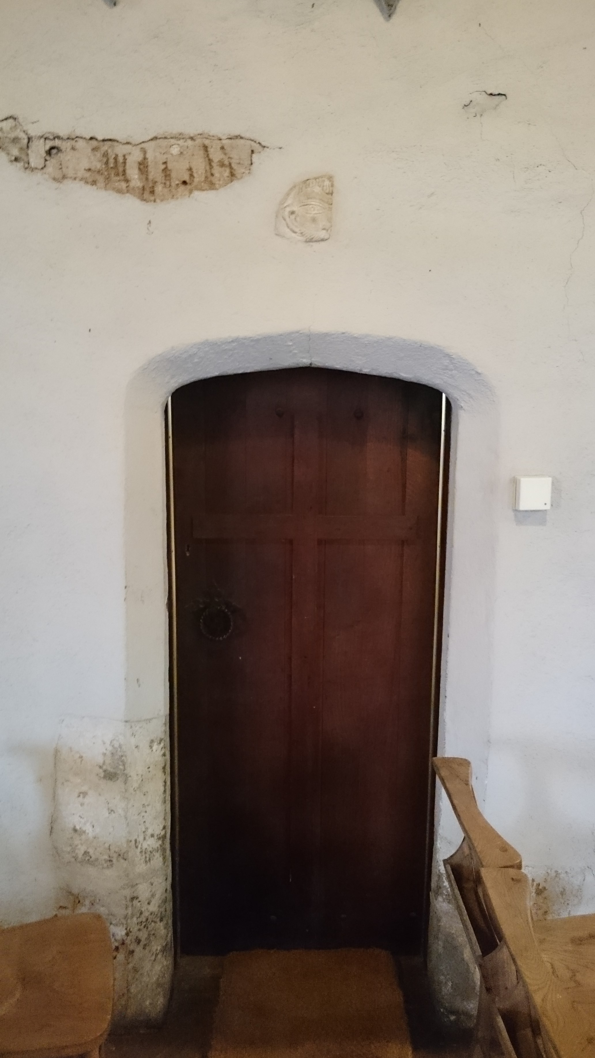
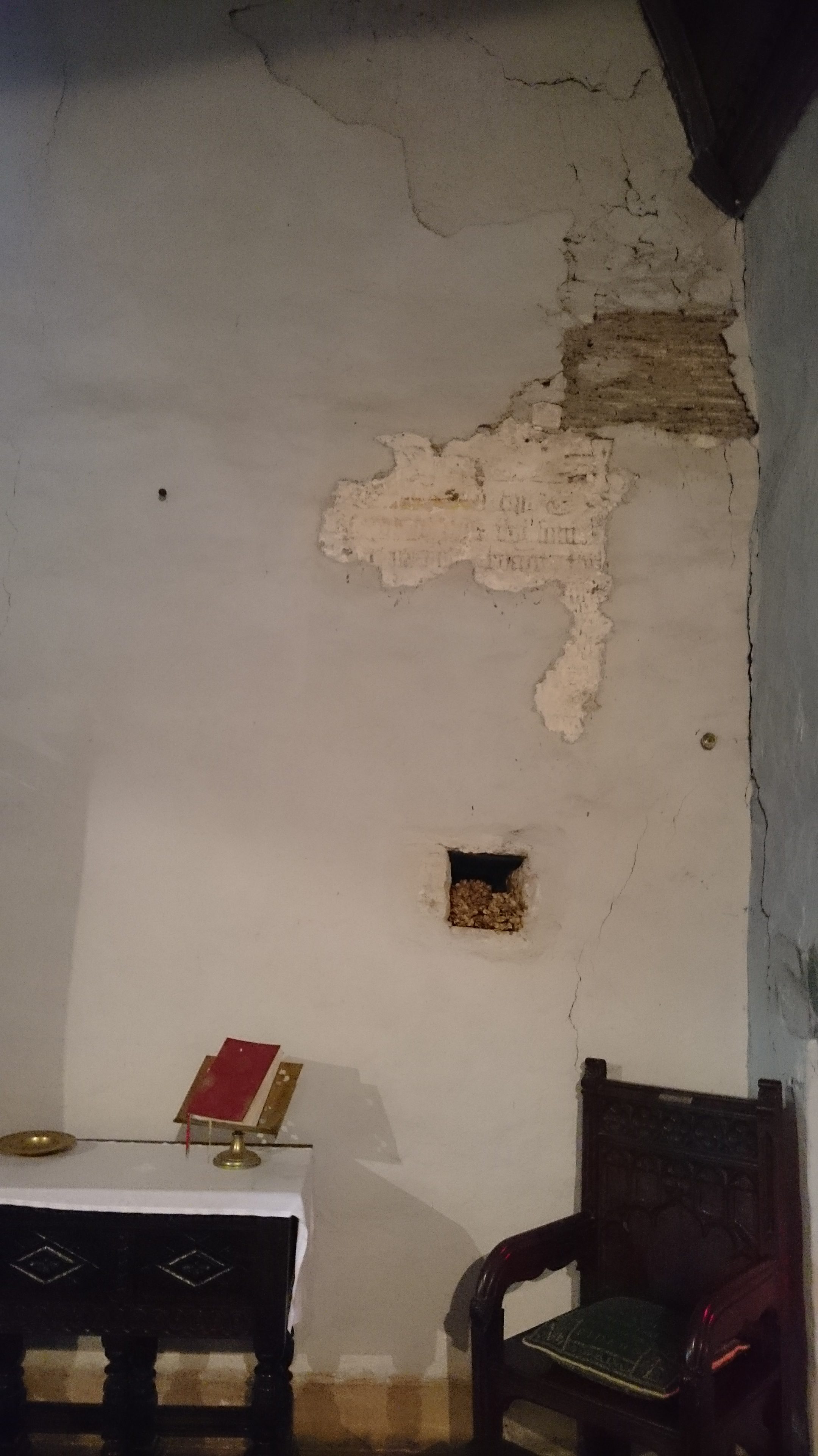
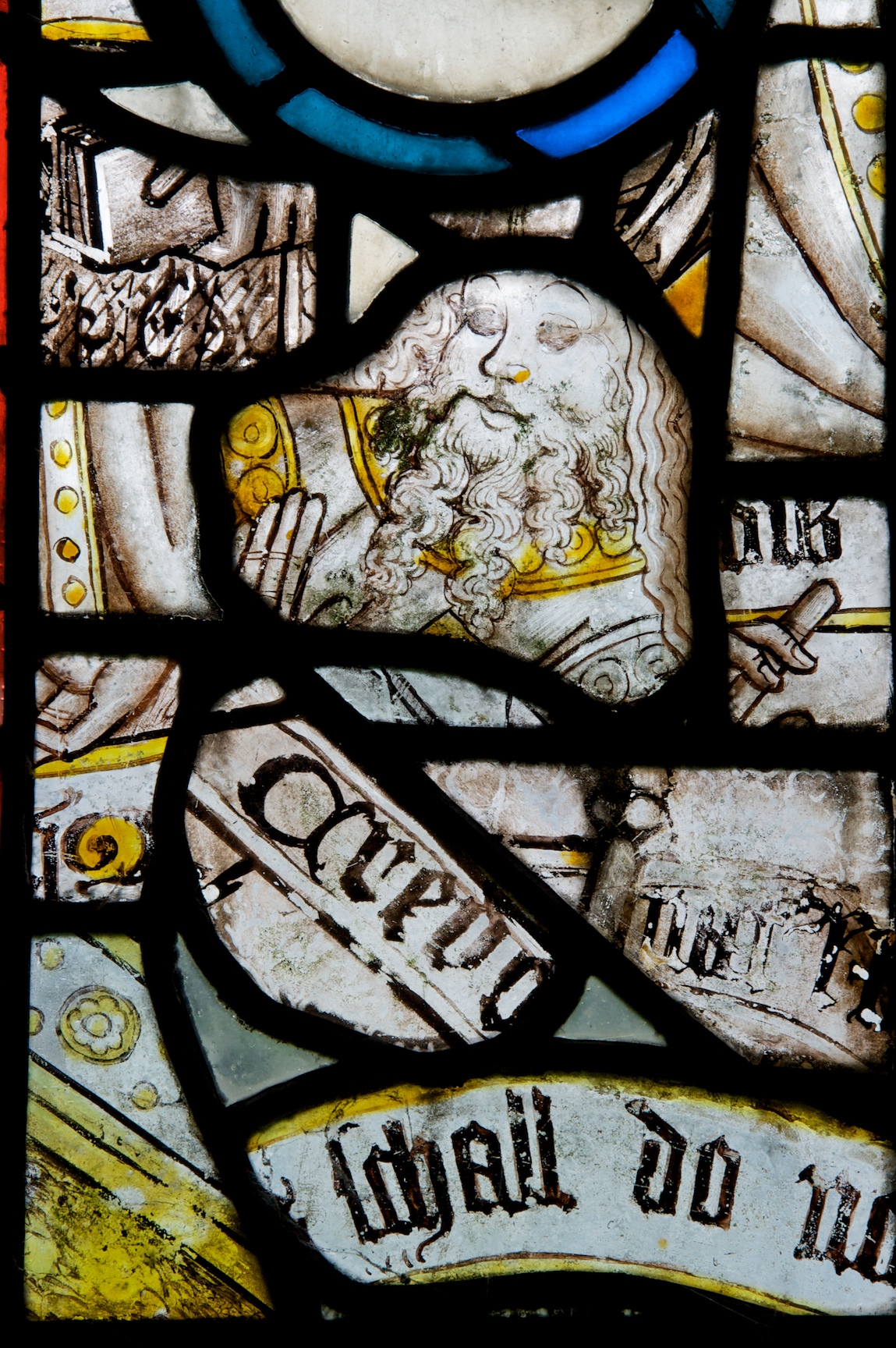
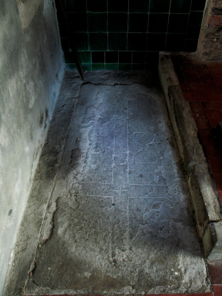
I’ve been meaning to look at this route for some time. Then I went to Llandyfodwg with Tristan Gray Hulse to look at the famous medieval effigy slab there.

llandyfodwg_compressed

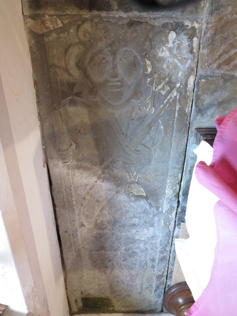
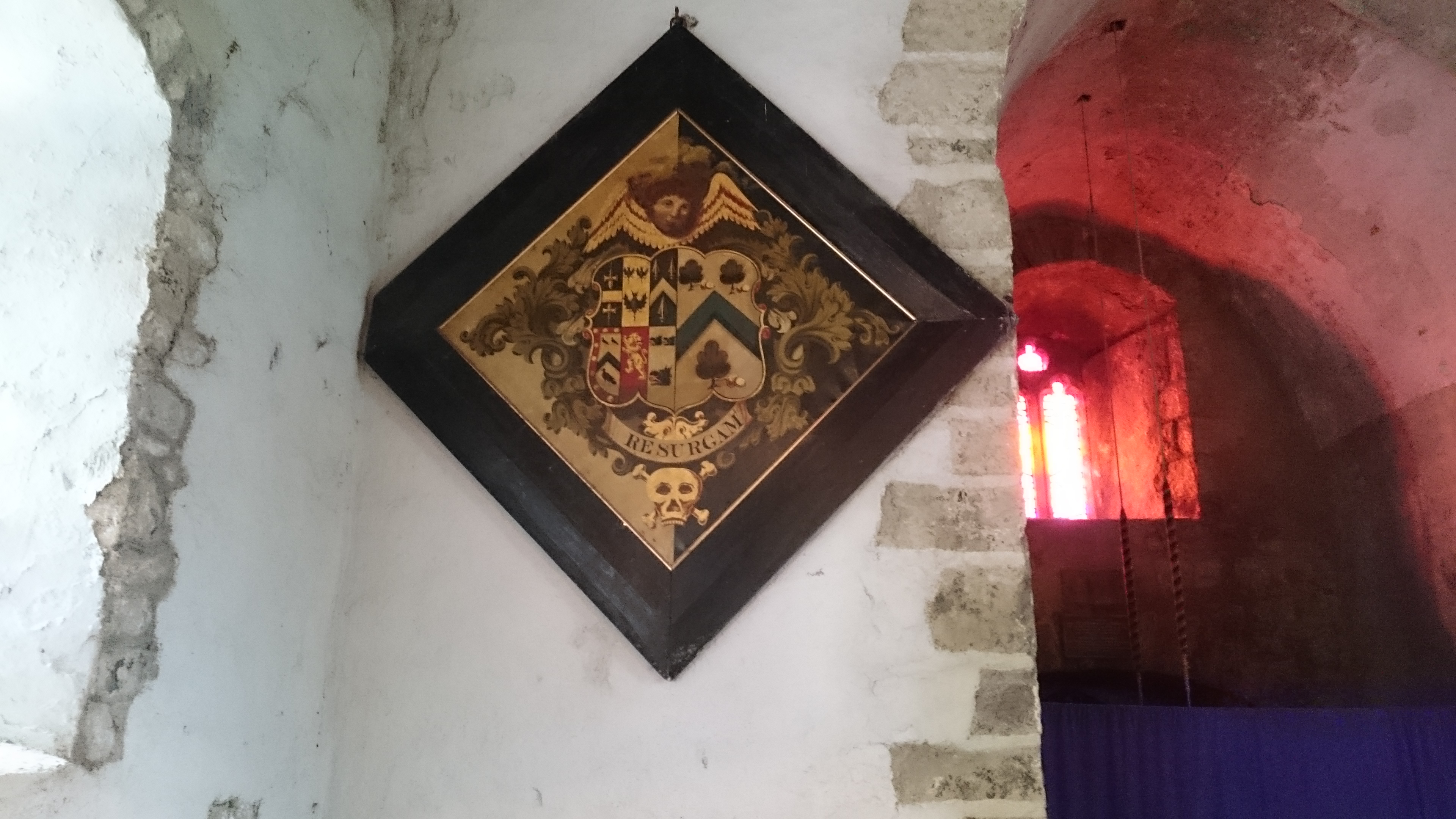
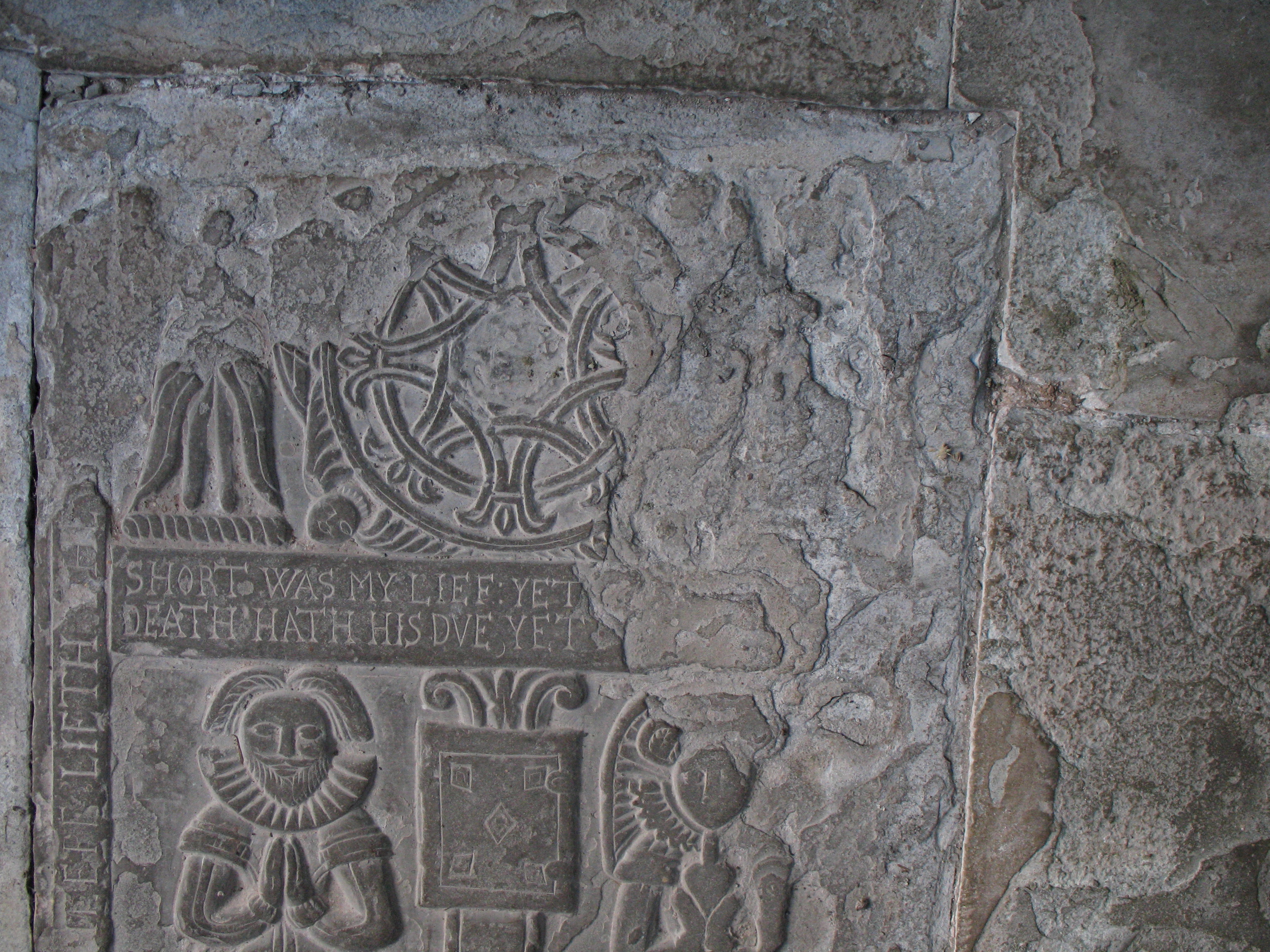
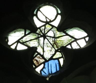
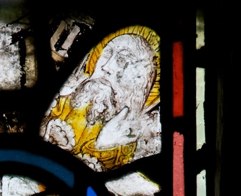
It depicts a pilgrim with staff, satchel and badges including a scallop shell, the crossed keys of St Peter and – crucially – another badge showing keys on a ring. Tristan thinks this may actually show the saint himself. According to legend, Tyfodwg locked himself in chains as a penitential act and threw away the key. He then went on a pilgrimage to Rome, where he found the key in a fish he was given to eat.

There is another Welsh parish named after Tyfodwg: the old name of Ystrad Rhondda, between Treherbert and Tonypandy, was Ystradyfodwg. Before the Industrial Revolution, this was a huge and sparsely-populated curacy, covering the whole of the Rhondda and dependent on the rectory of Llantrisant. (This all looks like the remains of a minster church set-up providing for the spiritual needs of a small Welsh kingdom.) The old church in Ystradyfodwg was where Ton Pentre church is now (the Cistercian Way goes past it). As far as we can see from surviving records, though, this church was never actually dedicated to Tyfodwg: the earliest sources record it as dedicated to St John the Baptist. Was this an early second millennium rededication? Possibly – or (the theory on the Llandyfodwg church web site) was Tyfodwg an early Welsh ruler of the whole area who brought Christianity there and was eventually regarded locally as a saint? So the whole Rhondda area was Ystrad Dyfodwg, Tyfodwg’s valley, and Llan Dyfodwg was possibly the church where he died and was buried.

Mike Ash of the Glamorgan Ramblers has looked at old maps of the area around Ton Pentre. A trackway ran north of where the church is now. There seems to have been a bridge just north of the modern bridge, and there are also rocky outcrops which could have provided the supports for a medieval timber bridge.  Writing in about 1540, the antiquarian and general surveyor John Leland said there were timber bridges across the two Rhonddas just west and east of Penrhys.

The parish of Llandyfodwg has raised money to conserve the effigy and reposition it off the floor and in a more accessible position. Might there be scope for a parish pilgrimage, from Llandyfodwg to Ystradyfodwg? Time to put the boots on …

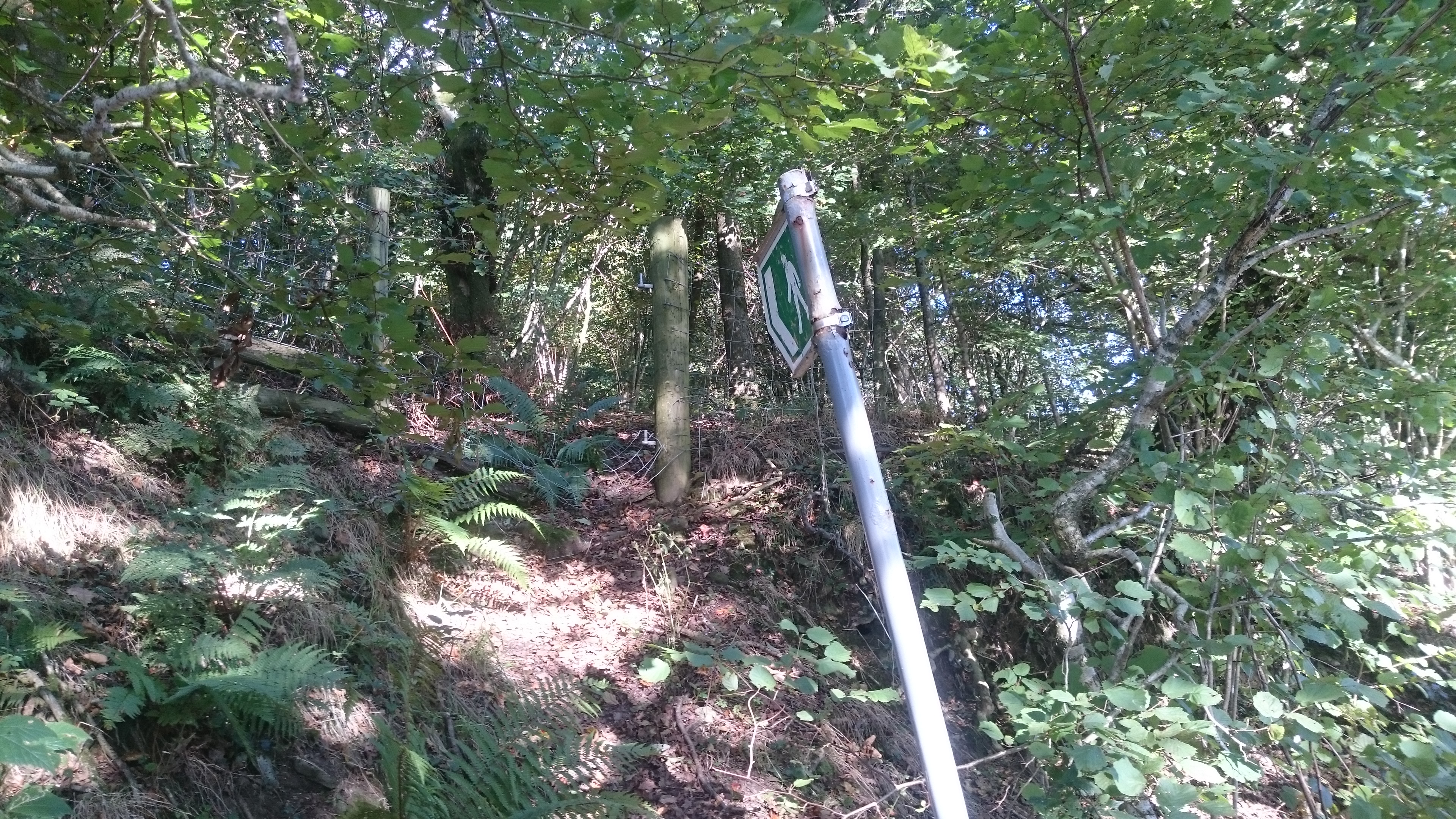
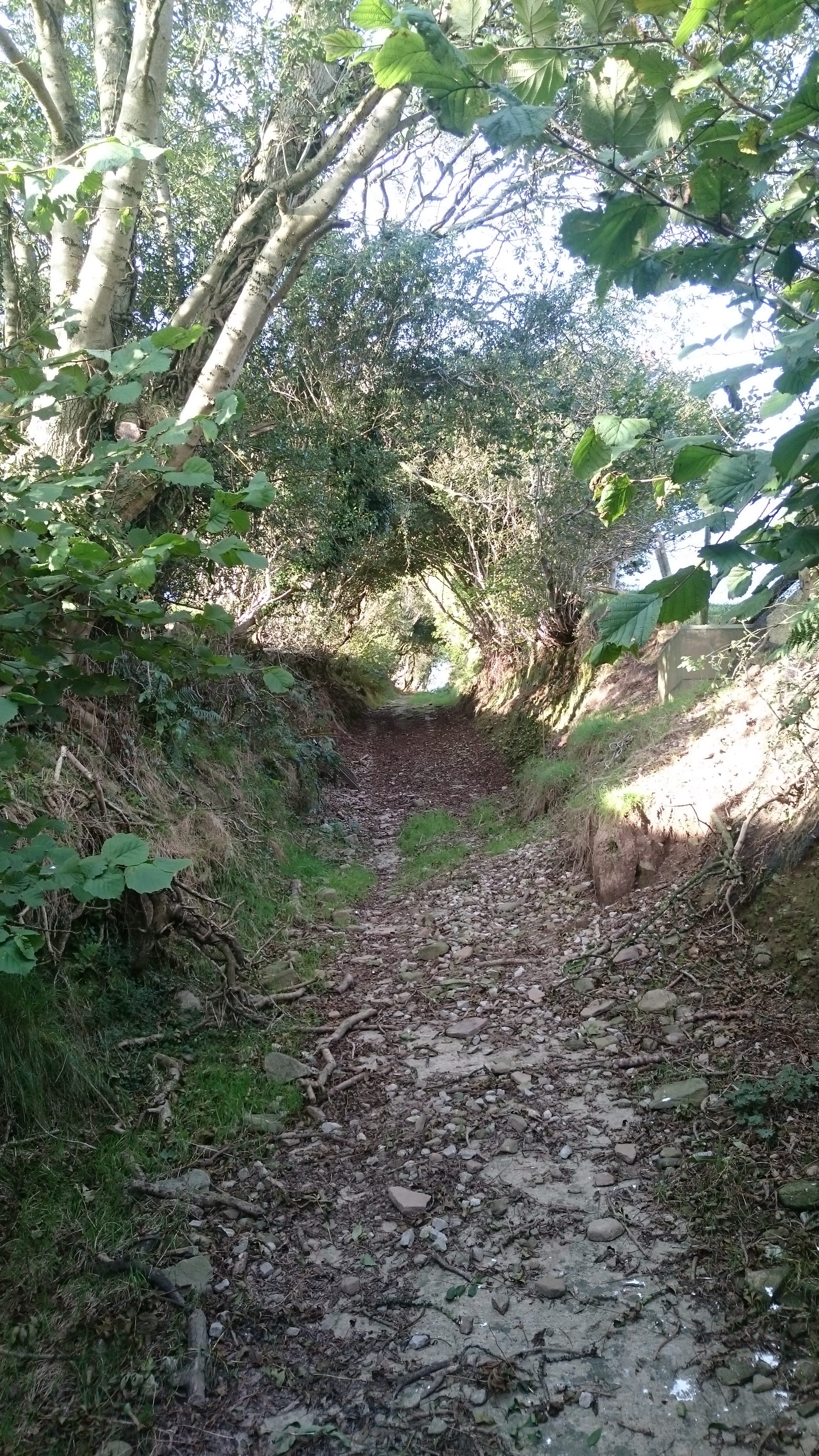
The Royal Commission’s route up the ridge from Llandyfodwg isn’t the obvious one along the bridleway from SS 95766 87306. Instead, it goes up the west side of Cwm Dimbath, and along the footpath which leaves Dimbath Lane at SS 94802 87782. The beginning is very overgrown

dsc_1638

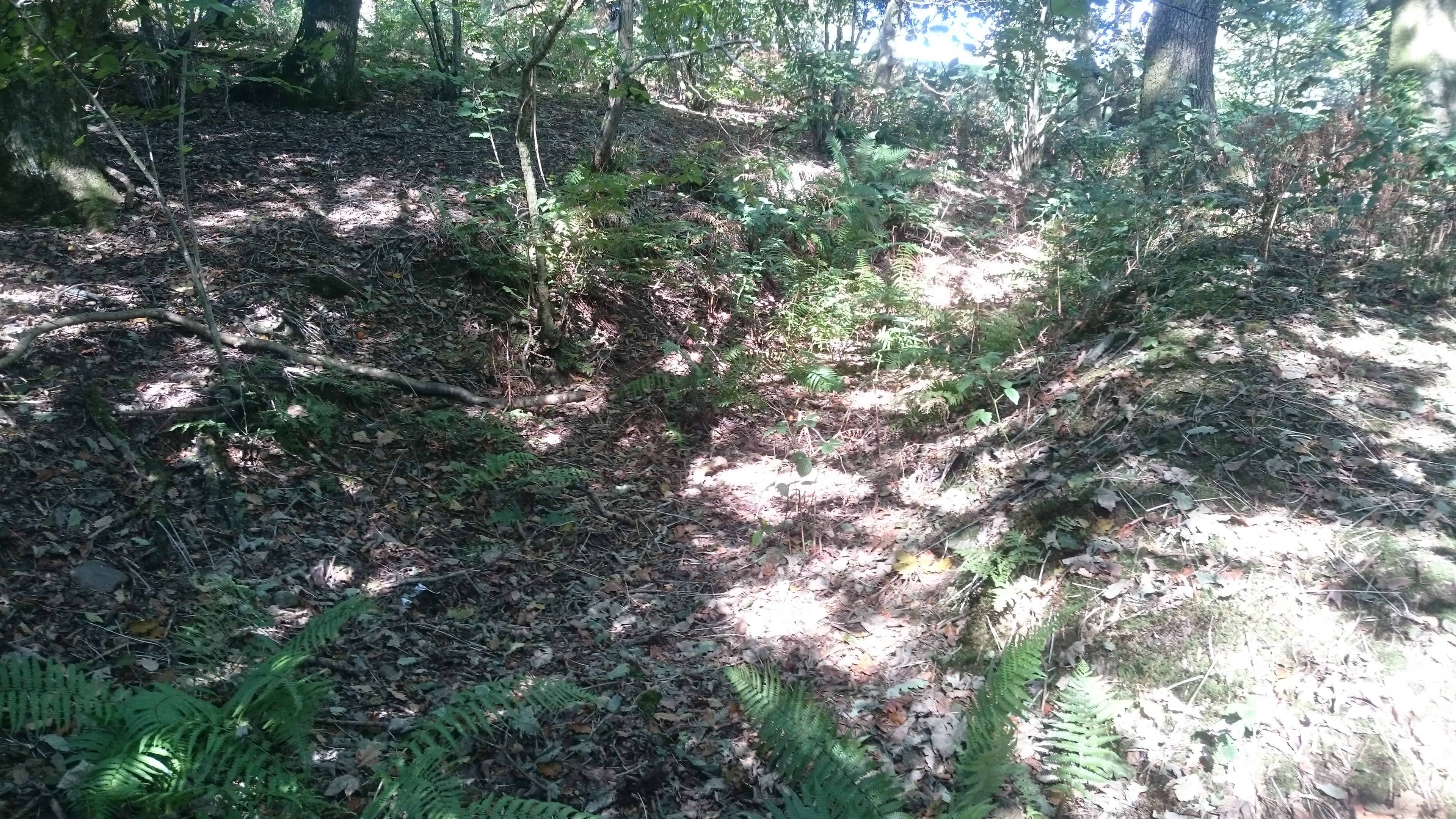
but there is a hollow lane visible from about SS 94769 87831 (still very overgrown)

dsc_1640

dsc_1642

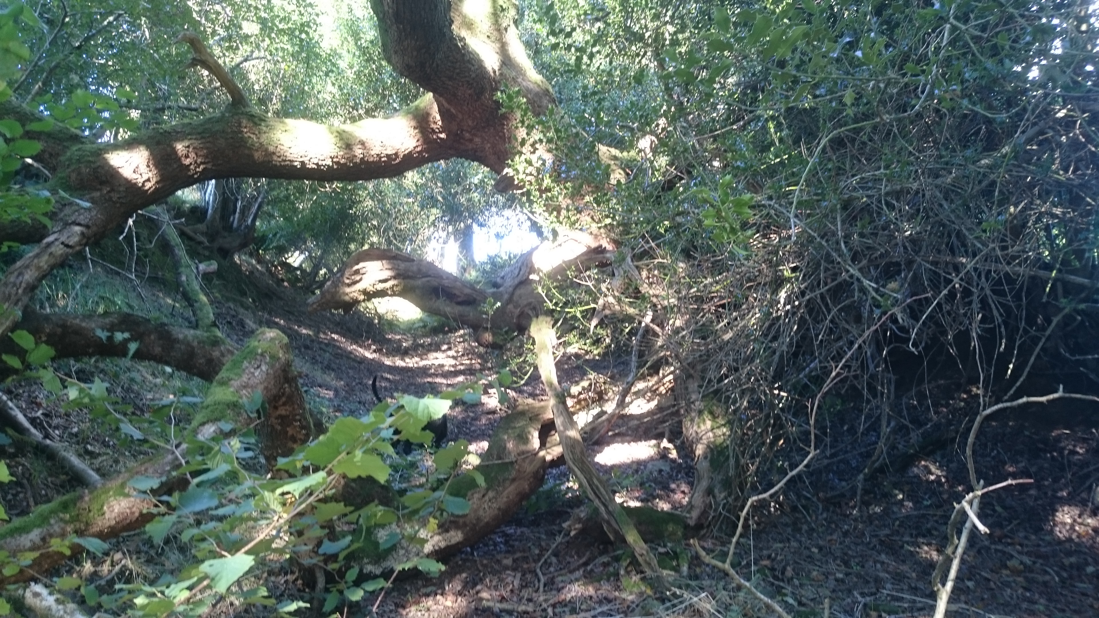
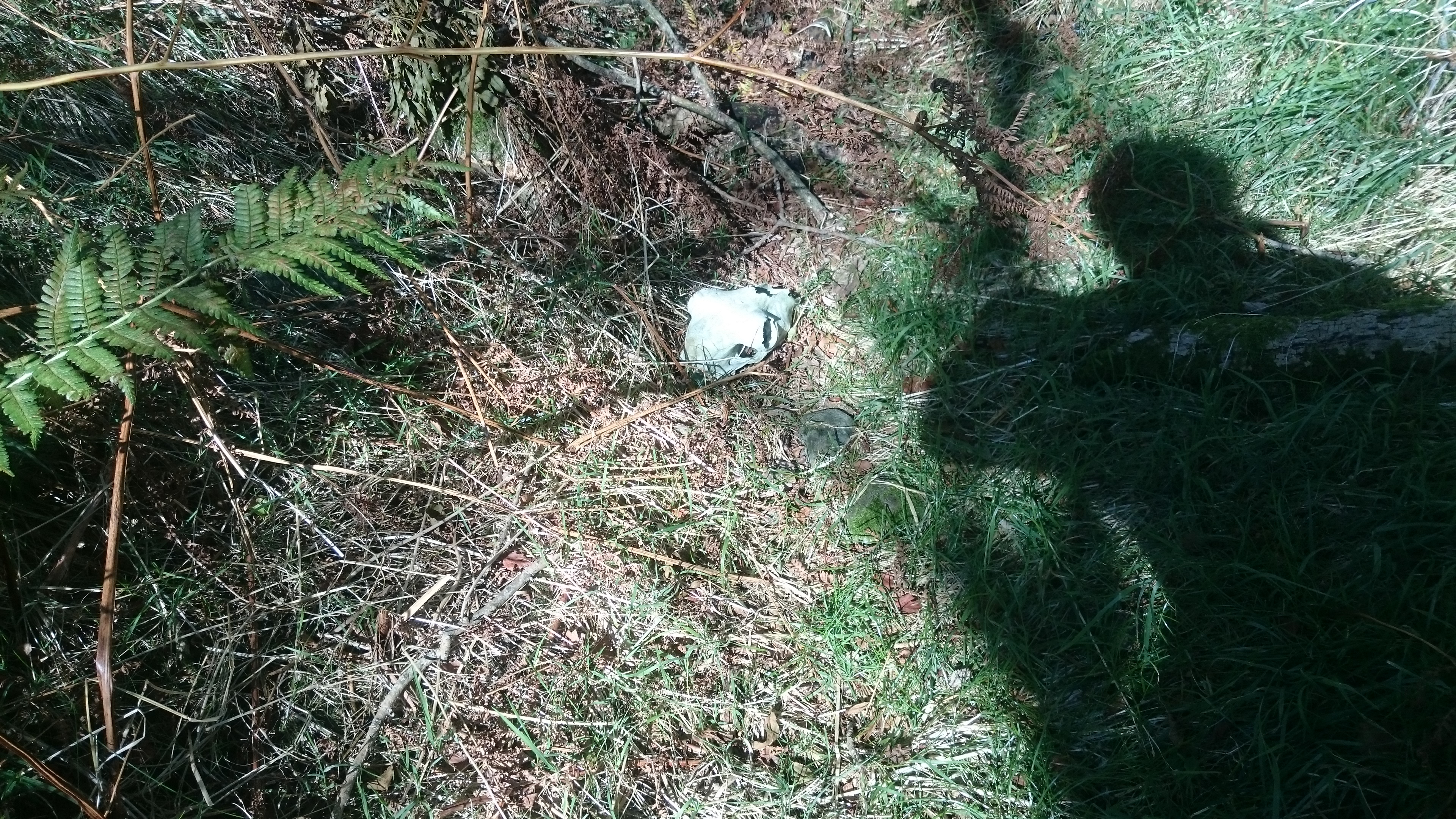
and some travellers clearly didn’t make it … .

dsc_1643

This hollow lane continues up the edge of the fields to SS 94439 88211, skirts the coal tip (suggesting it was an old boundary) and goes into the forest at SS 94171 88861. From here it follows the forest road to SS 94999 90679 then cuts across the angle of the forest road to the edge of the forest at SS 95271 91052. This section has had a lot of off-roading damage.

dsc_1645

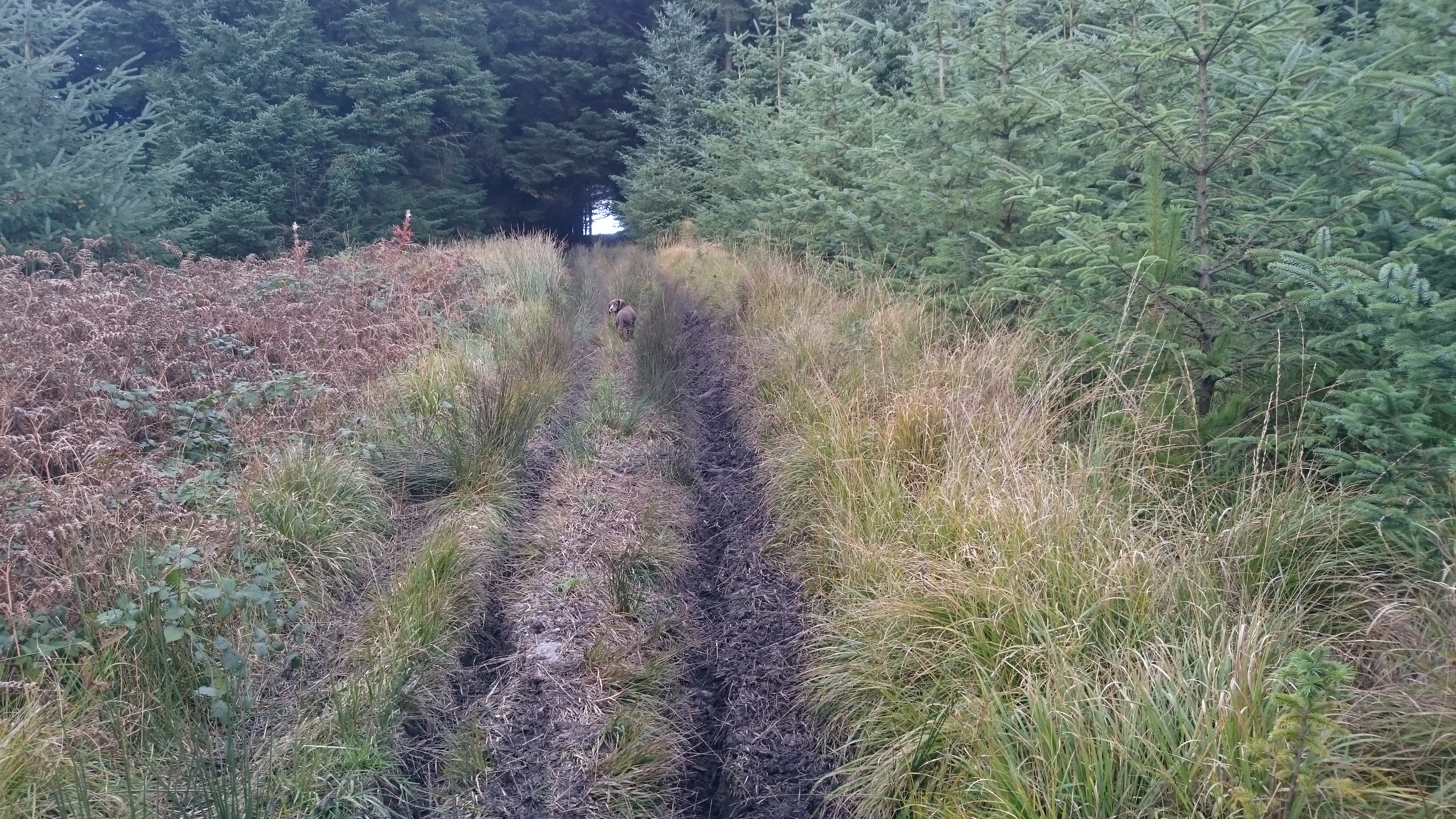
Nell likes off-roading damage because it makes puddles. Cara doesn’t like it because she gets stuck in the ruts.

The track continues round the head of Cwm y Fuwch. From there it has been interrupted by the building of yet another wind farm but it should be possible to pick it up again as it climbs to re-enter the forest on Mynydd William Meyrick at SS 95636 92082. From there it slants down along forest roads and presumably follows the line of the public footpath down the steep side of Cwm Cesig and into Ton Pentre.

We thought we ought to turn back when we got to the wind farm. My recently-purchased 1:25,000 OS map didn’t have the wind farm on it, but the online version does. I wanted to cut across to look at the bridleway to the east of Cwm Dimbath. Unfortunately the paths across the moor are confused by the access tracks for the wind farm – we could see the stile but between us and it was knee deep bog. We ended up on a lengthy diversion through the forest but we eventually got back on track. The bridleway is another well-marked hollow trail

dsc_1648

and seems to be waymarked from Llandyfodwg at least as far as SS 96269 90405, where it descends into the valley of the Ogwr Fach. This might be a better route for any walk between the two churches.  From this point, where the bridleway crosses the windfarm access road,  your best bet would be to follow the access road to SS 95711 91940, bear left with the road to SS 95601 91865 and pick up the line of the footpath into the forest.