Laleston to Parc Slip

posted in: Heritage Paths | 0

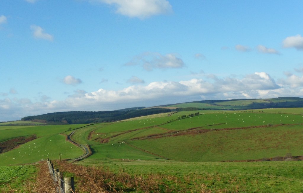
Well, we always knew this would be the tricky bit of the route. We actually started doing it backwards from Parc Slip so Steve could park there and walk round the reserve while Cara and I went on. It started well – footpath waymarked from the Bankers Hill road, and we saw 3 deer, 2 does and a young stag, in the woods (but they crashed into the undergrowth before I could get the camera out).

Then it got tricky. The route is theoretically mostly clear but VERY muddy and difficult to follow. This is roughly how it would work if you were going north:

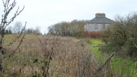
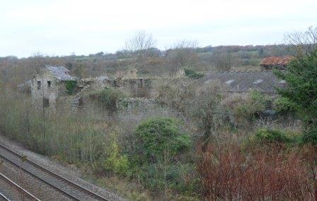
Probably best to follow the Merthyr Mawr – Laleston route in reverse so you go through Laleston village and across the field to the Ffordd y Gyfraith. Then when the Ffordd y Gyfraith gets to Cae’r Heneglwys, turn left and walk along the lane to the Cefn Cribwr road then take the footpath to the right through the woods. This brings you out on the road at the old pound. Go straight on here, with the site of Margam’s Llangewydd Grange under the brambles to your left and two atmospheric ruined farmhouses on either side of the railway line

.Image

Image

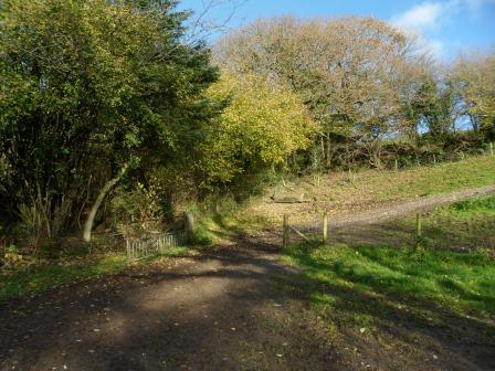
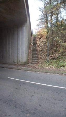
Eventually you go under the M4. Turn left immediately up some overgrown steps
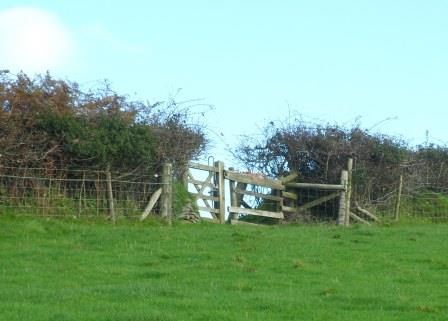
Image

over a stile

Image

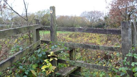
and across the field walking along the embankment above the motorway to another stile

Image

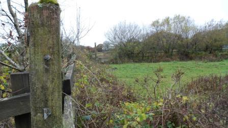
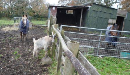
(this was where we met the goat!)

Image

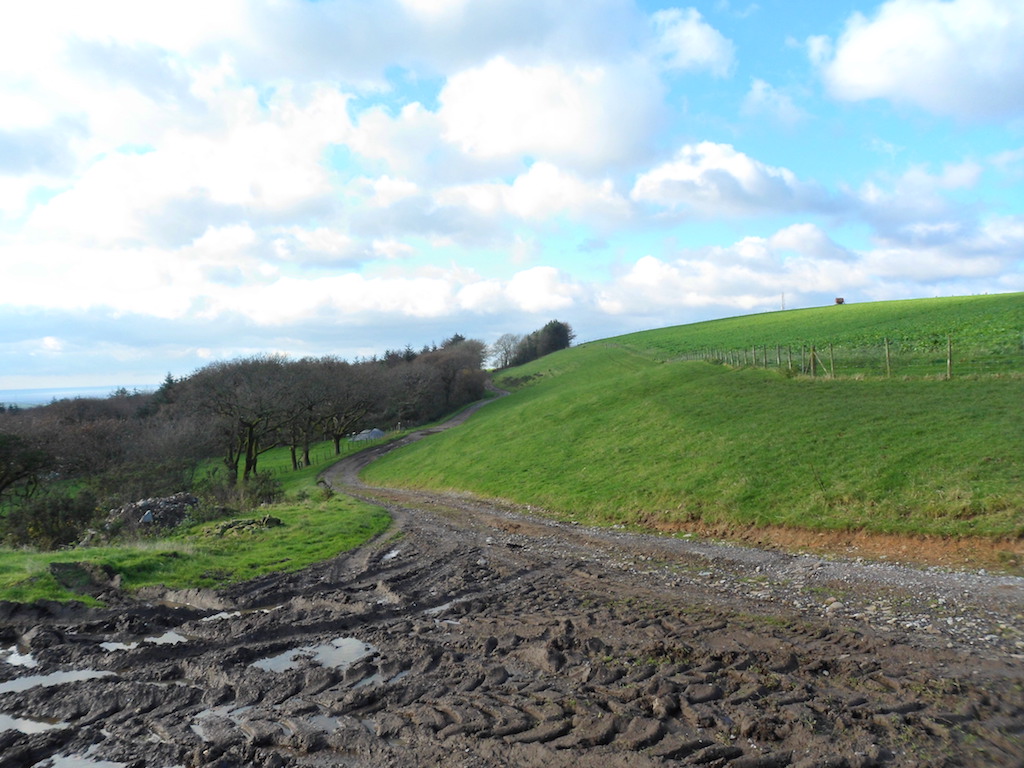
Then it gets tricky – you need to bear right across the fields but they are deep in mud and there are no waymarks. Eventually you reach a roughly cleared track

Image


a not-very-useful stile

Image

and out on the Cefn Cribwr road.

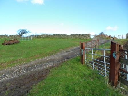
You should go left here and there should be a path almost immediately going north but we couldn’t find it in the other direction. Instead we walked along the track down towards the old quarry. When you get to the skeleton of an old railway carriage

Image

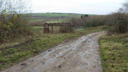
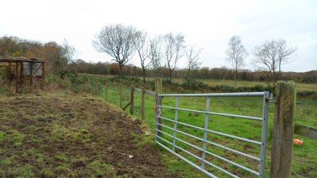
you are back on track. Go through the gate, turn left and through another gate.

Image

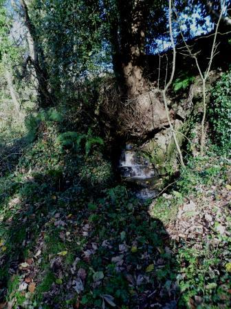
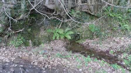
I think the line of the footpath then goes down the fence to your right and across a little stream

Image

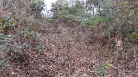
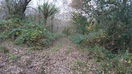
(virtually impassable, this bit) – then turn left and walk north of the line of trees as best you can. Eventually you get into the trees where there seems to be the line of an old embankment

Image

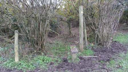
which becomes a lane (this was where we saw the deer)

Image

and comes out on the Bankers Hill road. From here it’s a short walk across the old railway line to the entrance to Parc Slip nature reserve.

So what do we say to Bridgend CBC – well, the route they want to Llangynwyd is doable but needs quite a bit of work before you can promote it. Up to them.


Heritage trails (again)

posted in: Heritage Paths | 0

The road goes ever on …

The trial round Laleston and Merthyr Mawr seems pretty much sorted. Bridgend CBC are keen to have a trail going north to Llangynwyd. Since the route round Laleston is themed around the pilgrimage route to Llangynwyd this seemed a no-brainer. And yesterday was a sunny day so Cara the pilgrim dog and I set off with our sandwiches.

Following the actual Ffordd y Gyfraith won’t work  beyond Llangewydd because most of it is a busy B road. It’s difficult to find footpaths shadowing it and crossing the M4, but the very minor road north from the Laleston pound goes under the M4 and there are footpaths across the fields, then a wiggle gets you into the Parc Slip nature reserve at Cwm Ffos.

More about Parc Slip at http://www.welshwildlife.org/visitor-centres/parc-slip-visitor-centre/ and something about walking trails in and around the park at http://www.glamorganwalks.com/parc_slip.htm . The long walk around the park looked promising so we parked there and set off north. The road past the reserve crosses the main Cefn Cribwr road and becomes a pretty lane to Cwmrisca farm.

Image


When you get to the farm, go through the gate to the right

Image

Some of the gates need a bit of attention but in general the path is well waymarked.

Image

You leave the fields, climb a steep slope and emerge on the ridge. Don’t take the obvious trackway to the left

Image

but bear right to join the old Ogwr Ridgeway (now renamed the Glamorgan Ridgeway)

Image

and turn left over this rather battered stile

Image

Follow the ridgeway past the mast on Mynydd Baeden and down to a minor road. You are now back on the medieval Ffordd y Gyfraith. The hollow trails running parallel to the metalled road suggest how much traffic it took.

Image

(here’s a detail with some sheep for scale)

Image


The little dimple on the far ridge of Mynydd Ty-talwyn is a house platform, all that remains of a deserted settlement. Many of these upland settlements vanished during the early fourteenth century, when the weather got dramatically worse, there were famines and mountain land could no longer be farmed. Harsh times.

Our world now has the opposite problem, the diseases of affluence – once you get back on the road, rubbish and fly-tipping is a problem.

Image

but the views are spectacular

Image


You can take a diversion along the track to Cefn Ydfa, home of the famous maid of Cefn Ydfa, the beautiful Ann Thomas.

Image

The story is that she was the daughter of a wealthy local farmer. She was in love with a young poet, Wil Hopcyn. But Wil was only a labourer and her family made her marry the son of another local landowner. She died of a broken heart. Wil wrote the famous Welsh song ‘Bugeilio’r Gwenith Gwyn’ in which he says he has watched the white wheat ripening but another man has the harvest. You can see memorials to both of them at Llangynwyd church.

I didn’t have time to explore the footpaths down into Llangynwyd – that will have to wait for another day. We walked on along the Ridgeway then down through the forest. The monks of Margam had a summer grange here called Hafod Deca. Walking here some years ago I thought I found the ruins of an old farmhouse but it is now nowhere to be seen. Did I really see it, or did I read about it and think I had seen it? Memory is a funny thing.

Below where the ruins might have been you rejoin the Glamorgan Walks route, cross a minor road and walk through the farmyard of Ffynnon Iago with its well under the trees.

Image

But after that the route gets bogged down and totally overgrown. We had to push our way through woods and I sank up to my knees in some very wet fields. Not an alternative route, then, and no scope for a circuit. But once you reach Llangynwyd there are routes off in all directions – east to the railway station, east and west along the Glamorgan Ridgeway, following the pilgrimage route down to Margam, or north to join Andrew Dugmore’s Cultural Olympiad route.

We got back to Parc Slip in the twilight –

Image

more fine tuning next week.