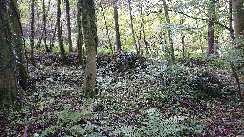
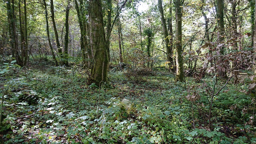
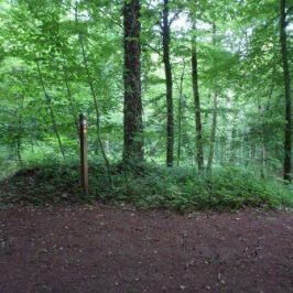
This is another little farmstead that I must have walked past at least a dozen times without realising it was there. It’s at the north-east side of the Wern-ddu Claypits, just above the site of the old brickworks, at about ST 16684 85984.
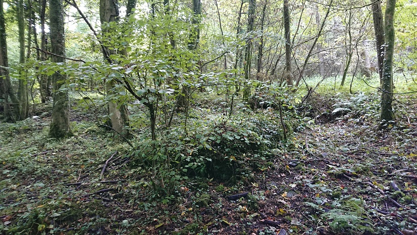
To be fair to myself, what you can see from the lane
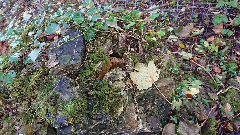
isn’t the farm house but a little outbuilding – henhouse? pigsty?
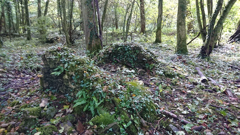
(nice bit of creamy mortar)
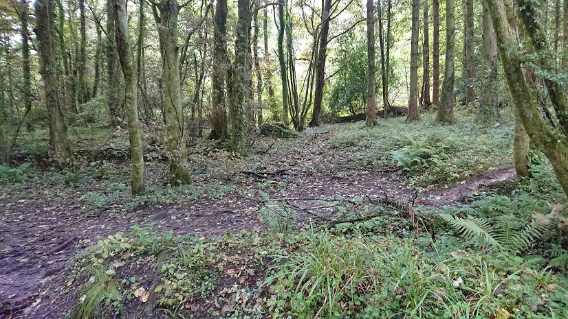
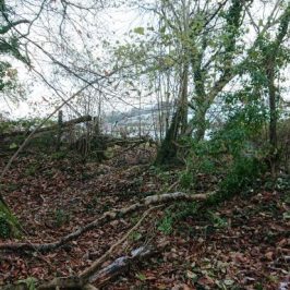
Once you know it’s there, you can just make out the farmhouse from the lane
and this fenced-off bit
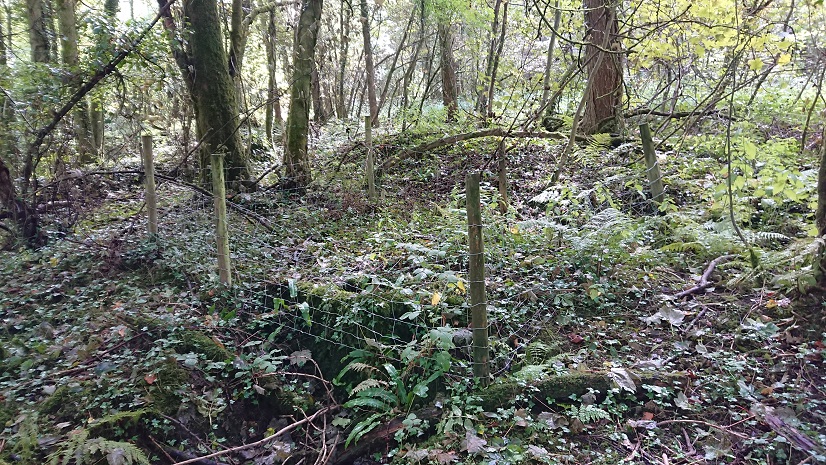
must be the well
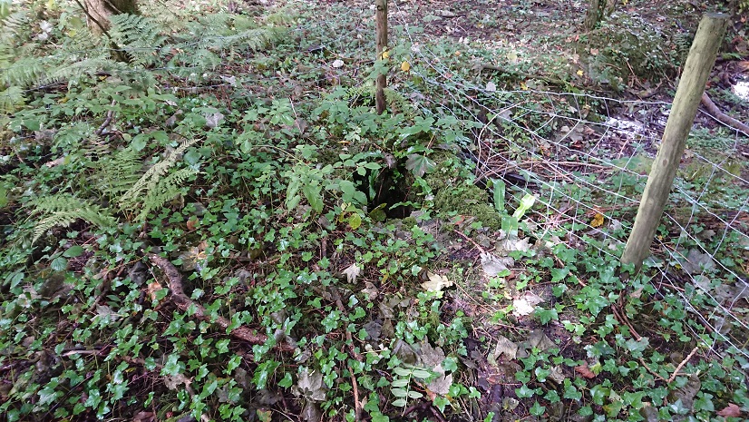
(still marked on the modern OS map).
On the old OS maps it’s Tre-boeth, the warm township, but on the tithe plan it’s Treboth. The name might suggest early industrial activity. There’s plenty of evidence for early coal mining, and before that there would have been charcoal burning for the early iron industry. The farmhouse looks small, and there is only the one outbuilding, but on the tithe apportionment it’s a substantial farm of 133 acres, part of the Clive estate and tenanted by a Thomas Evans. Most of the land is to the north and west: to the south was wooded in 1841. By the first 6”OS map (1875) the whole of the former farm was wooded. Plantation for pit props? The farm is still marked but must by that date have been a smallholding for a worker in the clay pits or the brickworks, or possibly in the woods. It’s still there on the 1915 revision but by the 1938-47 revision it has disappeared.
Part of the size of the farm on the tithe apportionment seems to be that it has swallowed up another farm. On the tithe apportionment it’s described as ‘Treboth and Warren’. ‘Warren’ is actually another farmstead to the west, in what is now the depths of Wern-ddu woods, marked on the tithe plan but not on any of the OS maps. There may be nothing now on the ground but I feel I should have a look.
Watch this space. (It may just be a space.)


John Owen
William Rees in his 1937 book on Caerphilly Castle, mentions that in 1428 oaks were taken from the woods of Glynrhymney and Treboeth for repair of a bridge at the castle, so the name dates back to at least the 15th century. Based on the Dictionary of Place Names of Wales, regarding Morganstown\Pentre Poeth, Tre Boeth probably means an area cleared by burning. In this case, Tre would mean Place, or Farm, as opposed to town. Warren House was probably the House occupied by the Warrener, in charge of the warren associated with the Van. Probably, once they had moved to StFagans, the Lewis Family disembarked the deer park at Parc y Fan. The Warren House may have become a farm, there are traded of what look like field banks in the wood on the east of Mountain Road in Caerphilly. The industrial activity in the area is from mid 19th century, though timber may have been cut from the time the Caerphilly Furnace was a charcoal one, but the 15th century date quoted by William Rees would suggest we can dismiss industrial activity.
Madeleine Gray
Excellent. Definitely agree about the warrener’s house – and is there anything visible at the site of Parc-y-Fan, between the Van and the woods? I was assuming that was some sort of park-keeper’s residence at one time. I want to see if there’s anything still on the ground of the remains of the Warren, then I can have a look somewhere else. The Warren is definitely a farm on the tithe plan, but seems to have been absorbed into Treboeth and was I should think being occupied by a farm worker.
John Owen
Don’t know about Parc y Fan now, haven’t been there for years. There used to be substantial remains some years ago. There’s also Ty yn y Parc, I remember it being occupied, and then used y the Caerphilly Mountain organisation. Years ago I looked at the Plymouth Estate maps for the area, late 18th century, and virtually all the field names were different from those on the Tithe Maps.
Change of topic. There’s what appears to be a small cross Ridgefield on Rudry Common. Not very big, but noticeable,but it’s in an odd location.
Madeleine Gray
Is Ty’n-y-parc the one at ST 17830 85903 – I think you said you remembered a forester living there in the 1950s. A couple of photos of the surviving buildings at http://www.heritagetortoise.co.uk/2020/05/more-deserted-farmsteads/.
To be honest I’ve been looking at the old farmsteads as a way of getting myself out for exercise – as you will have realised, I don’t have enough of the background on things like the estate records.
So you are minor nobility – congratulations!
John Owen
I haven’t done much in Caerphilly for a while. About two years ago I was contacted by an unknown first cousin in America, though DNA tests. She was looking for her father, who’d been a Sergeant Major on the Welsh Guards, my father had been one, and I thought we might have been siblings, but they were brothers. To circuit a long story short, it turns out there were family connections with Somerset, and potential links through yeoman farmers, to gentry and then Wiltshire minor nobility. So I’ve been checking the paper trail and it’s a possibility. I’m not that concerned, but its opened up a way of looking at marriage patterns among the Marcher Lords, you don’t get reading the conventional history books. Obviously, all of this is not first hand material, so I don’t trust it, but it makes a change from Pembrokeshire peasantry and Haverfordwest artisans.
John Owen
Just a few comments.
Your original translation of Tre Boeth as Warm Town isn’t strictly correct, though Tree came to mean town, originally it meant a place.
You mentioned Ty yn y Parc. After a few walks in the area between the Van and Rudry Common, the extent of the Van Deer Park came to mind. I’ve seen the extent in the Plymouth Estate Maps, 20 years ago, but forgotten them. In his ‘History of Caerphilly’, 1900 , Henry Lloyd says it stretched from Rudry Common across past Ty yn y Parc to the house on the Warren slope, and then is bounded by the Van Brook. The trouble with that is that it’s cut in two by the Rudry Road. The 1841 Tithe Map describes fields, which are now Coed P arc y Fan as part of Van Park. By contrast, the fields belonging to the small farm Parc y Fan are just called fields. But the fields tend to have different names in the 18th century Plymouth Estate Map from the names in the 19th century Tithe Map.
Madeleine Gray
Thanks for this. I really must get back to the record office and have a look at the Plymouth estate maps.
But would it still have been used as a park in the C18 when the family had gone to St Fagans?