I’m still finding ruined farmsteads north of Cardiff. The number surprises me. We’re used to finding little lost farms in the upland forests – they were no longer viable in the changing economy of the later 20th century and many were swallowed up by the Forestry Commission in the great drive to plant conifers after World War 2. On the fringes of Cardiff, though, you would have thought they could have kept going with market gardening, chickens and dairying – but it was a hard life, and jobs in light industry must have been attractive.
This one
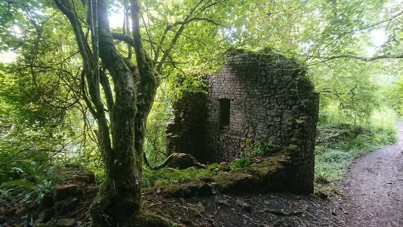
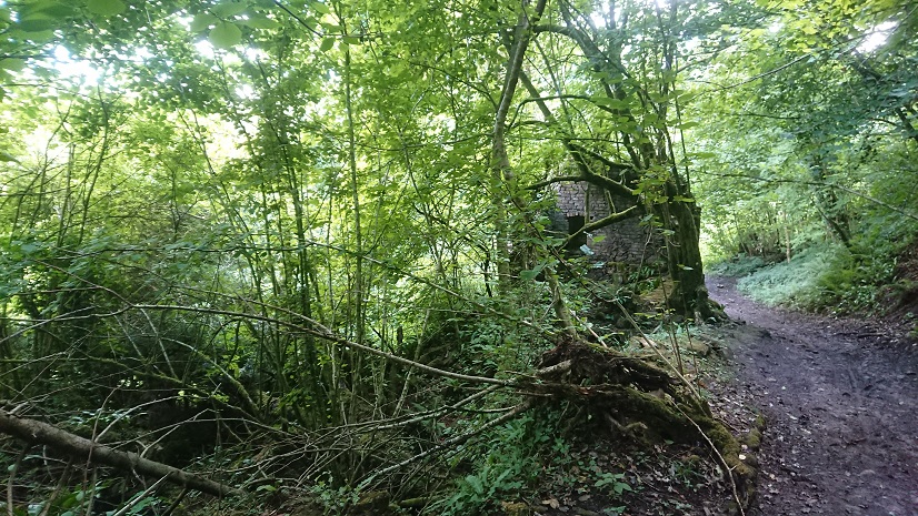
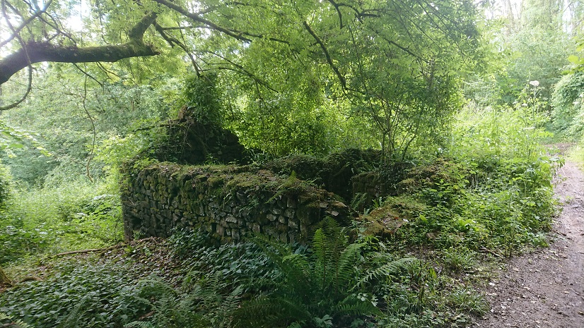
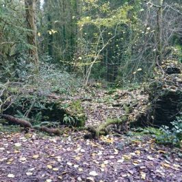
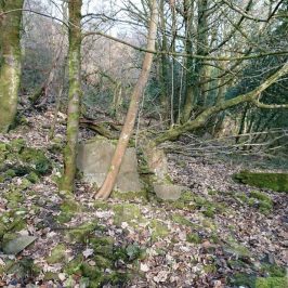
was first spotted by @mikekohnstamm. It’s on the slopes above Lisvane but in the parish of Rudry, where Coed Cefn-onn meets Coed Coesau-whips. On the Tithe Map it’s Coedcae Garw, a smallholding of 11 acres, part of the Tredegar estate and occupied in 1840 by Edward Rowlands. Most of its land is to the south-west, and Edward Rowlands was also farming land down the lane part of the Clive estate. It’s still marked on the 1953 6” map but it may have been deserted by then.
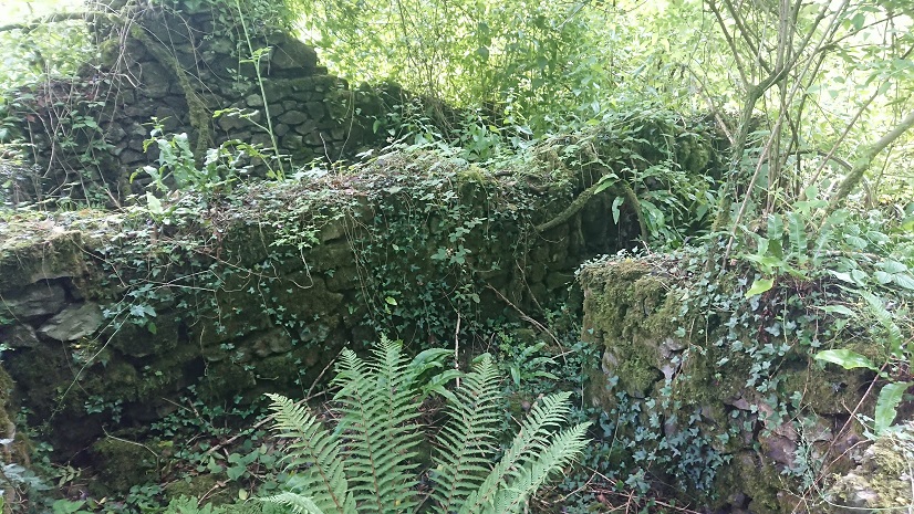
Part of the farm house seems to have been rebuilt in brick, probably in the late 19th or early 20th centuries,
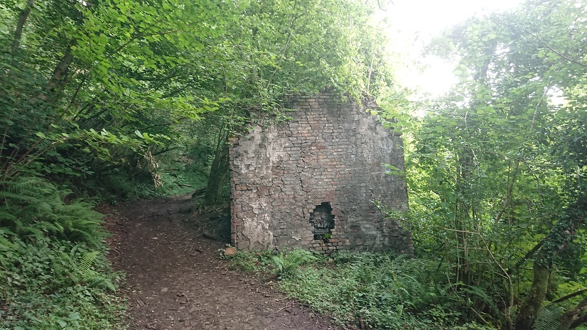
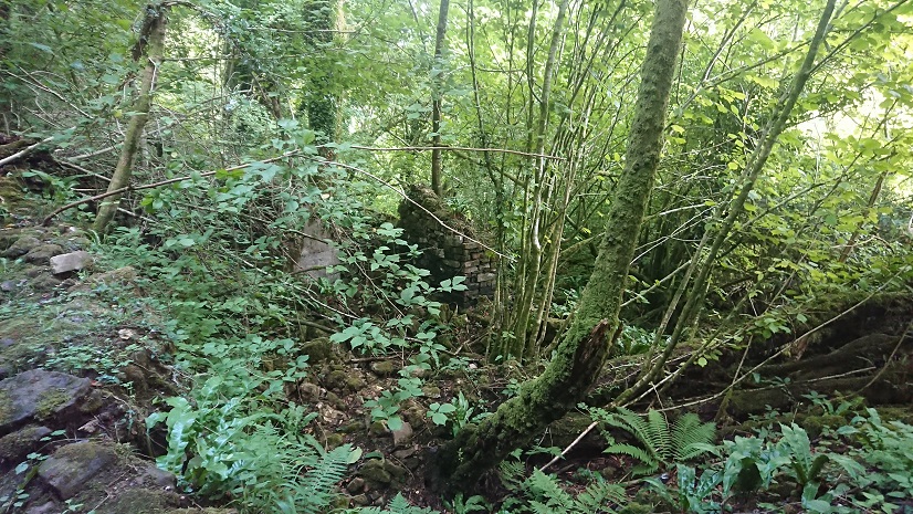
but the old pigsties are still stone.
My grandparents kept pigs on their farm at Cefn Llwyd, a couple of miles to the east. They always took the sows to the boar at the Maen-llwyd, and there was one sow who could find her own way there when she felt like it. I wonder whether the sows at Coedcae Garw went to the same boar.
The name Coed Coesau-whips is interesting. John Owen of Caerphilly suggests it could indicate that the older woods were coppiced to provide charcoal for the iron industry. There was a lead shaft just above Coedcae Garw (still visible on the Rhymney Valley Ridgeway) and the Rudry iron mine is a little further down the Nant y Cwm.
There are also a couple more farms that don’t seem to be on the modern map – Cwm and Ty’rywen. Next week, perhaps.

John Owen
There was a lot of lead mining on that ridge, from the Romans at Draethen to small scale 19th century lead mining from Draeten, up to and beyond the Maenllwyd pub. I think the lead mine you are referring to was worked by John Edmunds of Caerphilly, in the 1850s. He had a lease from the Plymouth Estate to explore for, and mine, various minerals. His biggest venture was the Van colliery ( and associated unsuccessful blast furnace), at Wernddu.
Duncan
Many thanks for that update. All very interesting. Last week I happened to meet the present owner of my Grand fathers old farm. Apparently she bought a lot of the land 13 years ago at an auction where they were selling very parcels of land around the Wenallt area. She owns all along the lane down to the Rhiwbina Hill road. She bought the land for a horse riding business. She is going to clear a lot of the overgrowth around the farm but not in it and do more fencing to tidy her land up. She seems to have her base in the private car park area just beyond the farm. Kind regards, Duncan
Dan Moody
Hi, I have been farming the land and caring for late owner of Coed Cae Garw who sadly passed away. I am his neighbour a few hundred yards to the west of the main farmhouse known as Tyn y Graig. My late neighbour had owned the land since the early 50’s and I am taking this piece of history on into the future. I have historical information from my late neighbour should anyone be interested.
Benjamin Coupland
Hi Dan, stumbled upon this website and your post. I’d be keen to see if we can uncover lost history by scanning the land, as a keen detectorist, I’m hoping we can meet and see what we can find.
Feel free to message me on 07454177113.
Best wishes
Ben
Roger Evans
My father, born and raised in South Wales was telling me he worked as a boy hand on the Coedcae Farm – when he was 12 ish. – that would be around 1939 (Yes he is 97 [2024]). Mentioned that, as it was usual in those days, the farmers were self-supportive and he was lucky to be there to help. (Best cheese maker around in those days :))
He had somehow got to hear that the farmer he was helping eventually gave up the farm and went down into the nearby village to open a butchers shop. I know the comment from Dan is 2 years back, but wonder if Dan has further info of the owners of that period – and possibly family akin? — or any info that could perhaps pinpoint that this farm was the farm he was on?