More on portable/movable fonts

posted in: Uncategorized | 0

A couple of additions to the post on small fonts at https://www.heritagetortoise.co.uk/2022/06/portable-fonts/. The Penrhys font is about 9 kg in weight – I would describe it as movable but not really portable.

We had a very fruitful discussion on the medieval-religion Jiscmail discussion group. Several people posted links to photos of similar patterns on late medieval fonts so we are back to the possibility that the Penrhys find was late medieval. This honestly makes more sense, both of its very battered condition and of the place where it was found. But the jury, as they say, is still out. You can access the discussion even if you aren’t a list member – go to https://www.jiscmail.ac.uk/cgi-bin/webadmin?A0=MEDIEVAL-RELIGION and put portable fonts as your search term.

Another example has cropped up on Twitter – https://twitter.com/Joseamey/status/1535323907745538051 is a cream terracotta miniature font from the South Western Potteries catalogue ‘This font is intended to be placed on the table of Churches Chapels or elsewhere when required for use. It is really about 9 inches in height’ .

Several more examples (without sizes or much in the way of background, but some lovely photos) at https://www.pinterest.co.uk/andrews7322/miniature-church-fonts/ .

Picturesque tourism and industry: some links

posted in: Uncategorized | 0

These are links to the online texts that I’m using in my lecture to the Oxford House Industrial Archaeological Society

Richard Warner, A Walk Through Wales  https://books.google.co.uk/books?id=AdcQh0l41XoC&printsec=frontcover#v=onepage&q&f=false (p. 232)

The anonymous ‘Northern Tour, or, Poetical epistles’ is at https://books.google.co.uk/books?id=s_Q7AQAAMAAJ&printsec=frontcover#v=onepage&q&f=false (p. 446)

Wigstead, Remarks on a Tour to North and South Wales https://books.google.co.uk/books/about/Remarks_on_a_Tour_to_North_and_South_Wal.html?id=E6RbAAAAQAAJ&redir_esc=y (p. 57)

Edward Donovan, Descriptive Excursions through South Wales … https://books.google.co.uk/books?id=nUU9AAAAYAAJ&printsec=frontcover#v=onepage&q&f=false (starts at p. 49)

  1. W. Manby, An Historic and Picturesque Guide from Clifton … https://books.google.co.uk/books?id=x-AuAAAAMAAJ&printsec=frontcover#v=onepage&q&f=false (starts at p. 183)

The Rev. S. Shaw, A Tour to the West of England, in 1788 … is in John Pinkerton’s A General Collection of the Best and Most Interesting Voyages and Travels …  https://books.google.co.uk/books?id=JkwnAAAAMAAJ&printsec=frontcover#v=onepage&q&f=false (quote on p. 224)

Even more deserted farmsteads …

posted in: Uncategorized | 0

We had quite an energetic Twitter conversation about those deserted farms north of Cardiff.

@mikekohnstamm  drew my attention to Deri-Duon, which is amazingly in the middle of Lisvane, in the fields between Lisvane church and the reservoir.

It’s marked as a ‘cottage and garden’ on the tithe plan, part of the Morgan estate and occupied by a David Thomas. You can just about see the garden boundary under the bushes.

The Royal Commission on Ancient and Historical Monuments in Wales did an amazingly detailed survey of farmhouses and cottages in Glamorgan, published back in 1988. That describes Deri-duon as a ‘direct entry, end-chimney’ house: in other words, the main door was in the long side wall and went straight into the main room. The chimney was at one end of the house and the stairs to the upper floor was to the side of the fireplace. It was at one time thatched.

The house is still there on the early OS (must try to check the date on that) but now just the chimney end of the house remains standing plus walls under the ivy and brambles.

But how long will it be there? Apparently the whole area has been approved for building. This seems a serious mistake. Open spaces like the fields between Lisvane and the reservoirs are a vital resource – if there’s anything we’ve learned during the current epidemic, it’s the importance of open space for physical and mental well-being.

The Royal Commission inventory also includes two of the three Cefn-Carnau farms. Cefncarnau-fawr, the one now a complete ruin on the lane from Bwlch-y-cwm to the golf course, is described as a ‘hearth-passage house’, with the original entry into a lobby formed by one side of the great fireplace and the staircase in the angle at the other side of the fireplace. Cefncarnau-fawr started out in the late 17th century with a main downstairs room and a second unheated room to the west. Later on, a kitchen and cowhouse were added to the east, and later again an extension to the north, towards the lane. Cefncarnau-uchaf must have been completely rebuilt, but it was originally like Deri-duon, with the main door in the long side wall and the staircase in the angle of the fireplace. Oddly enough, the inventory doesn’t mention Cefncarnau-Fach, nor any of the other deserted farmsteads I’ve been looking at. (I did check the grid reference for Cefncarnau-uchaf in the RCAHMW inventory and it’s the one at the top of Cefncarnau Lane, the one marked as Cefncarnau-uchaf on the OS map.)

But looking at the tithe plan for Deri-duon, I spotted a couple more, probably just cottages, on the lanes north of Cefn-Onn country park. Time for another look … and what are these, on the lane down from the ridge past Transh yr Hebog towards Lisvane: a building

and an adit?

And is this another lime kiln, a bit further along the lane from Bwlch-y-gelli to Blaen-nofydd?

and back at Deri-duon, some nice creamy-white mortar for @AncientTorfaen!

Deserted farmsteads (again)

posted in: Uncategorized | 2

So is that farm just off the Heol Hir Ty Drav (as on the tithe map) or Ty Draw (which seems more likely)? And is it actually below the track leading to Wern Ddu woods?

The lower track doesn’t seem to be on the tithe plan but it’s difficult to be sure because we are on the edge of 3 parishes (Ty Draw is in the Van hamlet of Bedwas, but immediately to the south is Llanishen, and to the west is Eglwysilan) and the plans don’t exactly line up. Copyright restrictions mean I’m reluctant to post a screenshot of the tithe map, but here’s a sketch plan based on it.

Field boundaries in green, buildings in brown. The red line marks the southern extent of the farm and looks suspiciously like the rather odd little angle of a field boundary just south of the lower track on the early OS map (it’s still just visible on the modern 1:25,000). Also, intriguingly, that  zigzag line is marked as the parish boundary on the early OS map.

So is the farm below this lane, leading down from the gate?

All that can be seen now is some tumbled stone under the brambles at about grid ref ST 17221 85357.

But the real give-away may be this

a patch of currant and raspberry bushes still holding their own against the undergrowth.

The lines of the fields from the tithe plan are also just about discernible under the trees along the lane.

Ty-Draw is marked as a ruin on the c 1840 tithe plan. The fields around it belong to the Clive estate and are occupied by a Thomas Roberts. But where did he live if the farmhouse was a ruin? He doesn’t appear anywhere else on the apportionments for Bedwas, Llanishen or Eglwysilan. Possibly he was sub-letting the fields around Ty-Draw to another of the local farmers: that might not have shown up on the tithe record.

Also, if the southern boundary of the farm is the parish boundary, what might that suggest about the age of the farm? The area to the north of the fields is marked on the tithe plan as a plantation – had the farm been nibbled away by the planting of trees for pit props, and was that why the farmhouse  had fallen into ruin?

It’s hard to see what some farms and cottages have survived and others have been lost. On the ridge above Tongwynlais, both Blaengwynlais and Bwlch-y-cwm are still there, Bwlch-y-cwm with enough garden to look like a smallholding. If Cwm-nofydd is anything like the Difrinn Anovid of that early C11 charter in the Book of Llan Daf, it lasted for the best part of a millennium but is now an overgrown ruin.  John Owen has identified Cefn Carnau in a survey of the de Clare estate in 1295.  Cefn-carnau Fawr, the biggest of the farms, is a ruin. though there are new stable buildings along the lane and the owner is working on some of the Cefn-carnau outbuildings. The farm called Cefn-carnau Ucha on the tithe plan but Cefn-carnau Fach on the OS, is a solid little farmhouse with another dwelling in the converted outbuildings.

And the Cefn Carnau of the tithe plan (Cefn Carnau Uchaf on the OS) is now a private rehabilitation hospital.

At the end of the lane from Cefn-carnau Fach, Pant-y-gollen is not on the tithe plan and is an un-named cottage on the early OS but is now a substantial house. The farmer at Cefn-carnau Fach told me Pant-y-gollen was once a shop.

Blaen-nofydd is also a substantial farm with converted outbuildings,

while the farms along the lane are long gone.

That’s about as far as I can get without delving into the census returns. In the comments on an earlier post, John Owen said he hadn’t found Bwlch-y-Gelli on the 1851 or later censuses but tht Bwlch-y-Llechfaen was on the 1861 and 1871 ones. But they are both on the OS map – I need a date for that before I start drawing any more conclusions.

I’ve updated my earlier posts with grid references, inserted a photo pf the limekiln near Bwlchygelli, and corrected my earlier reference to Bwlchyllechfaen as Bwlchygelli.

Graduation day

posted in: Uncategorized | 0

Something a bit more cheerful – some lovely photos of our last graduation day. Here’s the sports hall as the graduands process in.

beforeceremony

With Kerry, Justin and Dominic in the Board Room after.

kerrymaddyjustindominic

Team photo with Nathan practising for next year.

GroupwithNathan

Justin got the dissertation prize for a stunning dissertation on population movement and crime in nineteenth-century Monmouthshire. Here he is with his wife (one of our graduates from a couple of years ago) and the head of History, Dr Lock-Lewis

justincerianne

and here in a team photo

Justinandgroup

and here’s me with Kerry, probably the student who is closest to my own research interests

kerryandmaddy

cheers!

Weep, weep, o Walsingham

posted in: Uncategorized | 0

In the wracks of Walsingham
Whom should I choose
But the Queen of Walsingham
to be my guide and muse.

Then, thou Prince of Walsingham,
Grant me to frame
Bitter plaints to rue thy wrong,
Bitter woe for thy name.

Bitter was it so to see
The seely sheep
Murdered by the ravenous wolves
While the shepherds did sleep.

Bitter was it, O to view
The sacred vine,
Whilst the gardeners played all close,
Rooted up by the swine.

Bitter, bitter, O to behold
The grass to grow
Where the walls of Walsingham
So stately did show.

Such were the worth of Walsingham
While she did stand,
Such are the wracks as now do show
Of that Holy Land.

Level, level, with the ground
The towers do lie,
Which, with their golden glittering tops,
Pierced once to the sky.

Where were gates are no gates now,
The ways unknown
Where the press of peers did pass
While her fame was blown.

Owls do scrike where the sweetest hymns
Lately were sung,
Toads and serpents hold their dens
Where the palmers did throng.

Weep, weep, O Walsingham,
Whose days are nights,
Blessings turned to blasphemies,
Holy deeds to despites.

Sin is where Our Lady sat,
Heaven is turned to hell,
Satan sits where Our Lord did sway —
Walsingham, O farewell!


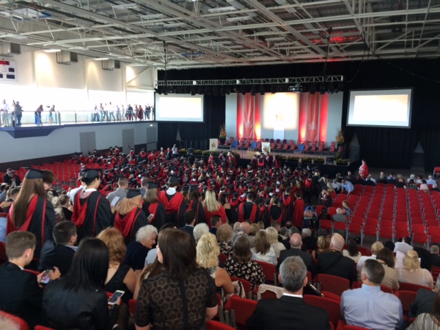
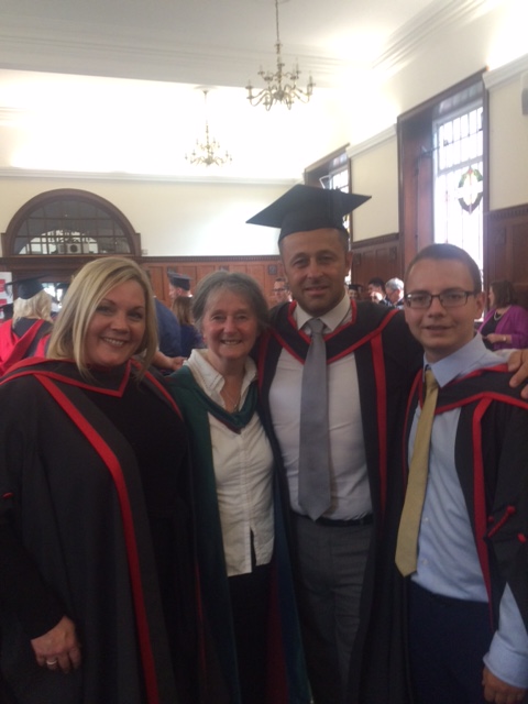
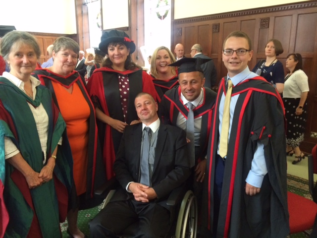
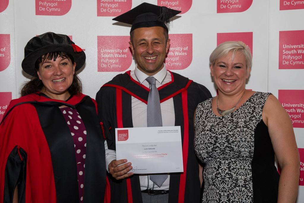
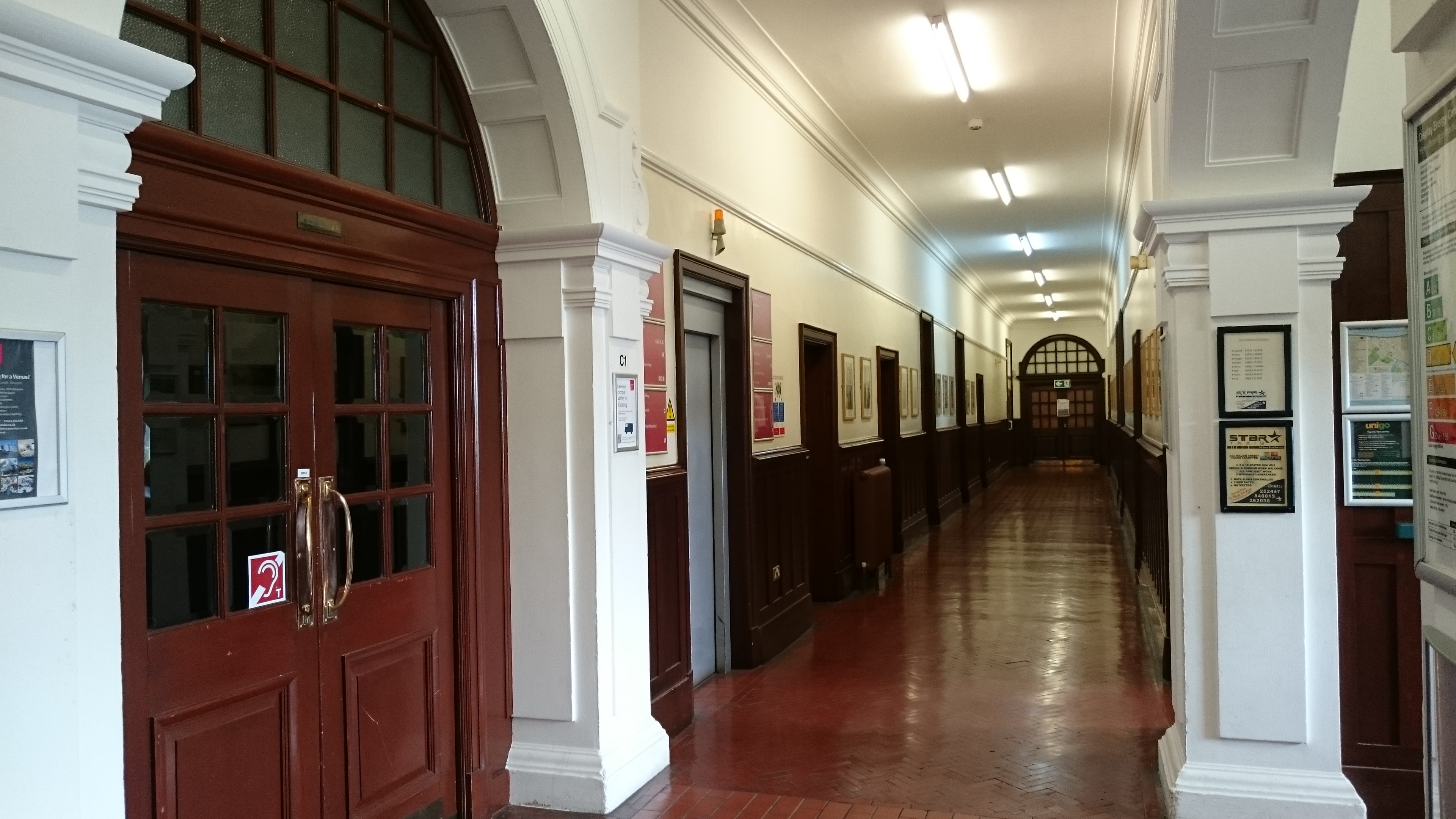
Last graduation day on campus. Office empty, library almost empty. Tearful students. The ceremony featured what I can only call the B team – pro-Chancellor, pro-Vice Chancellor, reading speeches clearly written for them by Marketing and Communications. That would be the same Marketing and Communications team that told us all we weren’t to comment on the plans for disposal of the campus – apparently we were supposed to say “Sorry, I’m not really involved in the campus changes programme. Let me find and / introduce you to my colleague who knows more about it all.” [then introduce to a member of the Corporate Communications team]

Some of us felt we had to try to explain to them as gently as possible the many ways that could have gone wrong. I mean, suppose we had forgotten our words? Or written them down, then couldn’t find our reading glasses?  What would they do to us?

Of course, there was no reference to the campus closure in the speeches. They were generic, not geared to the actual subjects that were graduating, they edged up to the problem with a few words about the necessity for change and development then bottled it.

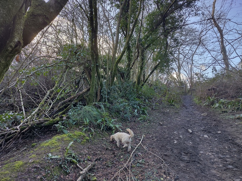
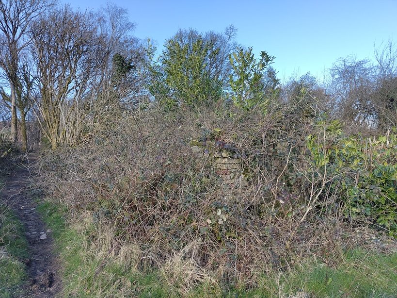
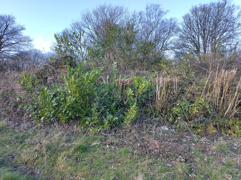
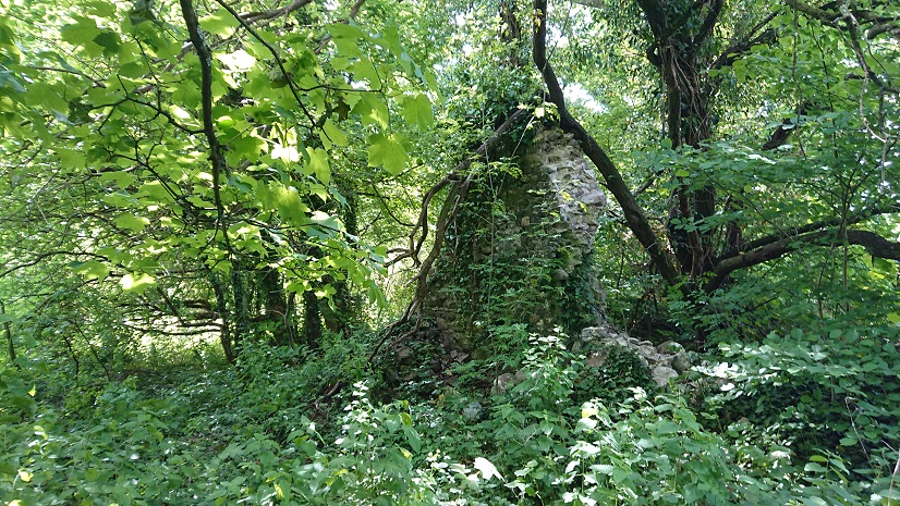
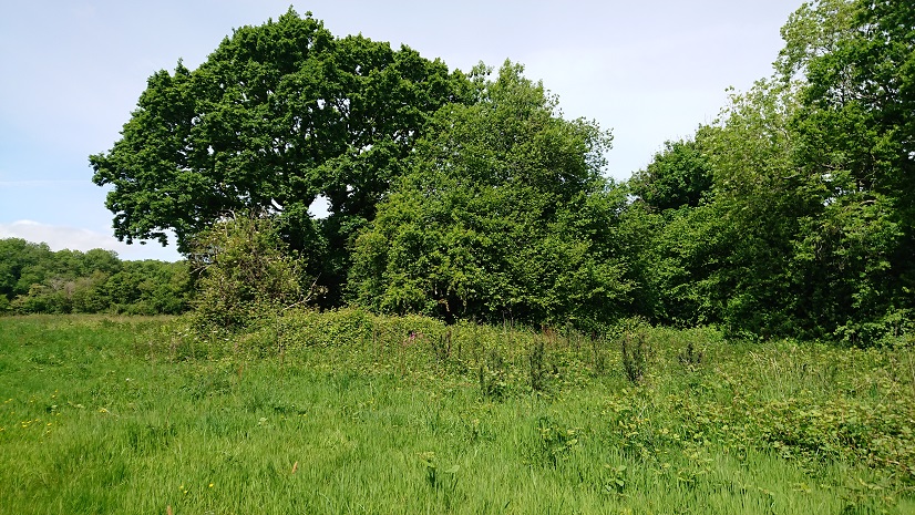
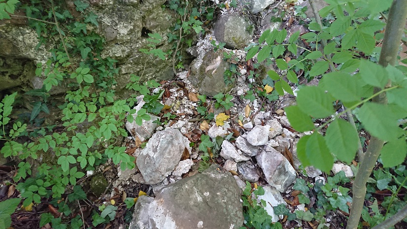
To get myself through it I started thinking about the parallels with the events in the past that I study. Some of my learned colleagues have been speculating about the parallels between Brexit and Henry VIII’s declaration of independence from the Pope in the 1530s. Part of the fallout from that was the Dissolution of the Monasteries and the destruction of shrines like Walsingham and our own Penrhys. So how did people deal with that? We know about the few brave rebels who died for their beliefs, but what about everyone else? Should we assume (as traditional histories of the Reformation did) that non-resistance meant approval, that the late medieval church was so corrupt and unpopular that it only took one push to overthrow it? Was the low recruitment in the last years of the monasteries, and the drying-up of bequests to some of the shrines, an indication that people had lost interest in them?

I don’t think anyone will be chaining themselves to the gates of my university campus, or lying down in front of the bulldozers. That doesn’t mean that people like what has happened. Ironically, there has been more of a campaign to save the building than there was to save the institution. That in itself is telling. When we were told we were being closed down, we soon realised there was very little we could do to fight it. After all, if the University management said they were reprieving us for a trial period, who would have wanted to sign up for courses on a campus that was at imminent risk of closure? The more our supporters tried to keep us open (and they did try), the more publicity the closure got. So of course we recruited badly the next year.

Might the same have been true of religious houses and shrines in the 1530s? After the closure of the smaller houses – and probably after the great survey of church property in 1535 – it must have been obvious what was going to happen. There were a few very brave men like John Houghton and his fellow Carthusian monks who resisted on a point of principle and died slowly and horribly for it. Then there were men like the abbots of Glastonbury, Reading and Colchester, who thought they could play who blinks first with Thomas Cromwell. We had a vice-chancellor like that. It ended badly. It generally does.

But for most of us it has been a case of salvaging what we can and getting on with things. When monastic lands were sold off, some devout Catholics were prepared to buy them, saying ‘Might I not as well as others have some profit of the spoil of the abbey? For I did see all would away; and therefore I did as others did.’ Some, indeed, bought the ornaments of monastic churches to look after them in case the monasteries were ever restored, but for most it was an investment, salvaging some small profit from the mess. In the same way I took boxes of books from the University library, including a near-complete set of Archaeologia Cambrensis which now sits on my study shelves.

In 1536, monks and nuns were expected to  move from the smaller religious houses to larger and theoretically better-run ones. Only the heads of houses were pensioned off. Then as the larger houses were picked off one by one, all their inmates were pensioned. It was the other way round for us. There was an initial offer of voluntary severance but now people are just being made redundant.

There’s a bit of irony in some of the pop-up posters on campus for the day:

DSC_1433_compressed

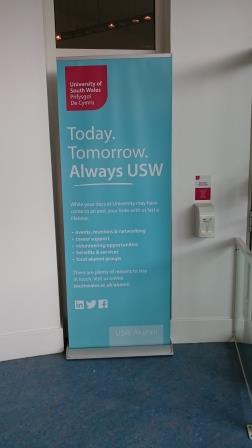
Now the corridors are empty again and at the end of the month the site will finally be locked down.

Weep, weep, o Walsingham.

Penrhys – the meadow on the nose of the forest

posted in: Uncategorized | 0

First post on the new (renamed) site – there wasn’t enough room for all the blog posts and photos on the web site. So the wonderful Sarah Chong is going to reorganise my blogs, keep this one for the Cistercian Way, create another one for tomb carvings and related matters, and keep everything else on the web site. Two project blogs and three web sites – will I ever keep track of it all?

So instead I went walking. Last summer with the Rhondda Cynon Taf tourism and footpaths team I spent some time looking at routes from Penrhys up the ridge and down into Ton Pentre (it’s all on the blog but I can’t put links in just yet). The plan was to get the footpath down the slope from the wind farm to the lane above Ton Pentre waymarked in order to reinstate the footpath which had been damaged by a landslip. Unfortunately we then learned that the area of the landslip hadn’t quite settled yet – so walking through it might not be recommended.

This leaves us with two possible alternatives. Up the ridge, down the bridleway from the top of the windfarm, down Cwm Bodringallt and along the track above the houses of Ystrad Rhondda; or on up the ridge and down the old Maerdy road through the forest. Both start at the statue, take the road round the west of the estate, and turn left on a roughly metalled road at the top, between the sub-station and what remains of the sports centre, at grid reference ST 00027 95074. Walk up the metalled road and bear left along the forest edge. The road becomes a  rough track along the ridge. Follow it bearing slightly west of north with the fence and the wind farm to your left. This is an exhilarating walk along the ridge between the two Rhondda rivers with larks singing and buzzards wheeling overhead. (Gwilym Tew, the poet who wrote about the shrine at Penrhys in the late fifteenth century, had a very odd image in which he described the infant Jesus in his mother’s arms, first as like a hawk then like a lark –

A’i Mab ar ei dwrn, medd swrn a sydd
Ymyl ei hadain mal ehedydd

it’s often hard to work out just what Gwilym Tew was getting at  – to be honest, he wasn’t a very good poet and the complexity of the Welsh rules of cynghanedd often seem to have defeated him – but it’s nice to see him drawing his imagery from the actual landscape round the shrine.)

At about SS 99221 96229 you cross the road to the wind farm. At SS 98589 96828 a gate in the fence to your left leads to the bridleway down Cwm Bodringallt.

For the ridge route, keep on to the right of the forest. At SS 97472 97377 the track goes through a gap in the fence ahead of you and into the forest.

2016-04-19 11.57.02.jpg

At SS 97322 97446 a muddy track crosses the ridge route.

2016-04-19 11.59.17.jpg

(There is a dilapidated and unmarked waymarking post to the right.) Turn left and walk through the trees along a track which has been worn into deep ruts by off-road riding. At SS 97379 97209 cross a forest road and continue on the same line, bearing a little to the left and steeply down hill.

2016-04-19 12.08.11.jpg

This is the old road from Pentre to Maerdy – it could never have taken wheeled traffic but packhorses and colliers walking to work would have used it. It goes steeply down to cross a little stream, follows the stream for a bit

2016-04-19 12.47.48.jpg

the bears away to the right. The woods above Pentre church are full of laurel and rhododendron – was there a big house here? The path bends back to the left then turns left at the churchyard wall. Pentre church is the ‘Cathedral of the Rhondda’, its tower dominating the valley. Walk down past the church, turn right on the main road then left on Elizabeth Street. Walk down to the river, cross the footbridge and turn left on a metalled path which takes you under the railway line and up to the main road.

2016-04-19 13.10.30.jpg

Turn left and follow the main road for about .4 km then turn right at the police station and walk up The Parade. This becomes a roughly metalled road, then the track over Mynydd Maendy.

The route up the ridge is certainly the fun choice. The track is peaty, badly eroded and gets a lot of scrambler and 4×4 use. Nell liked the puddles.

2016-04-19 10.53.52

Probably as well she’s peat coloured anyway.

It’s quite hard going underfoot but the views from the top are spectacular – Pen y Fan, Corn Ddu and Cribyn

2016-04-19 11.44.51

round to the Black Mountains

2016-04-19 11.44.58

down the Rhondda Fawr

2016-04-19 11.45.02

the Maerdy valley

2016-04-19 11.45.07
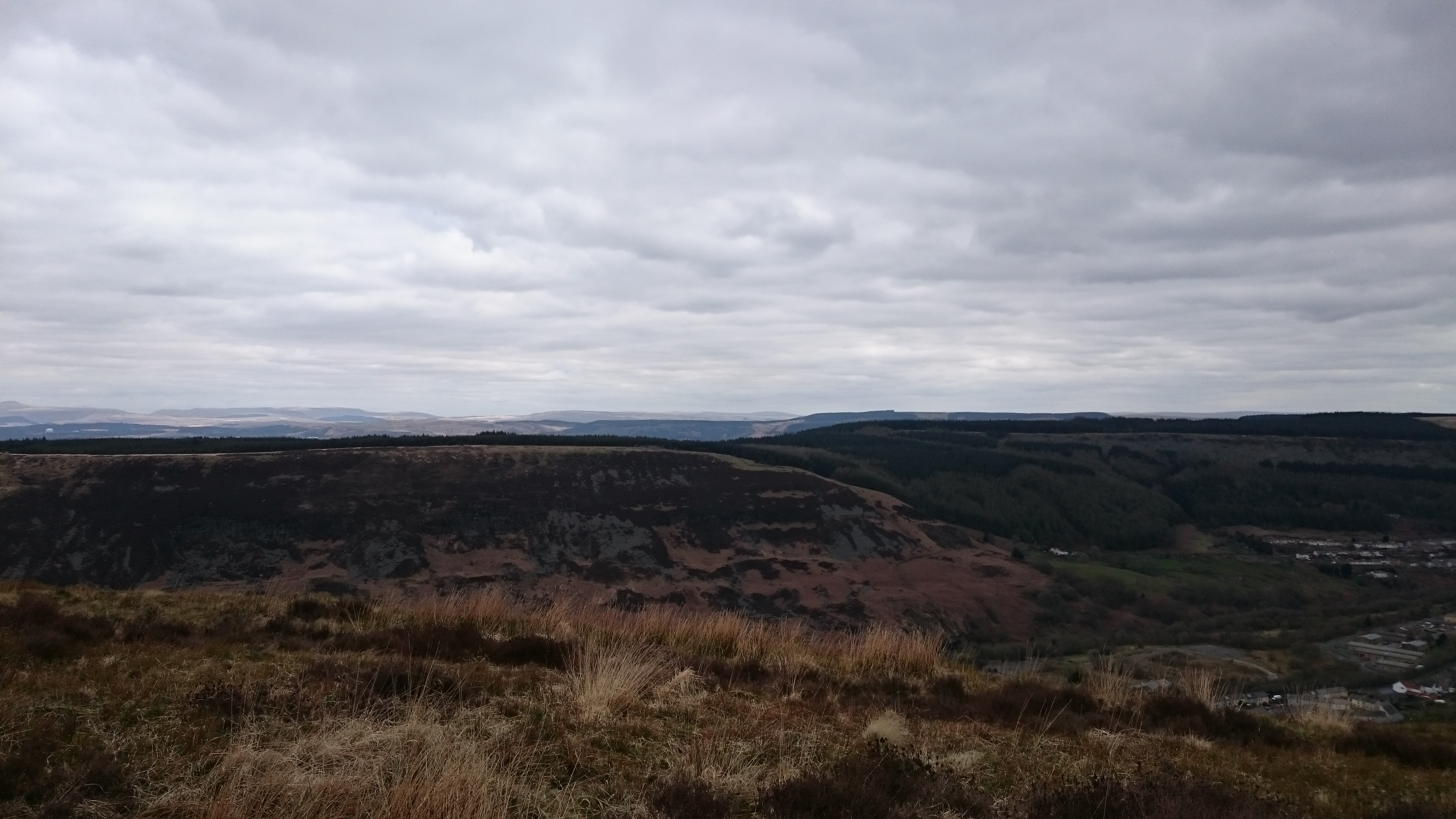
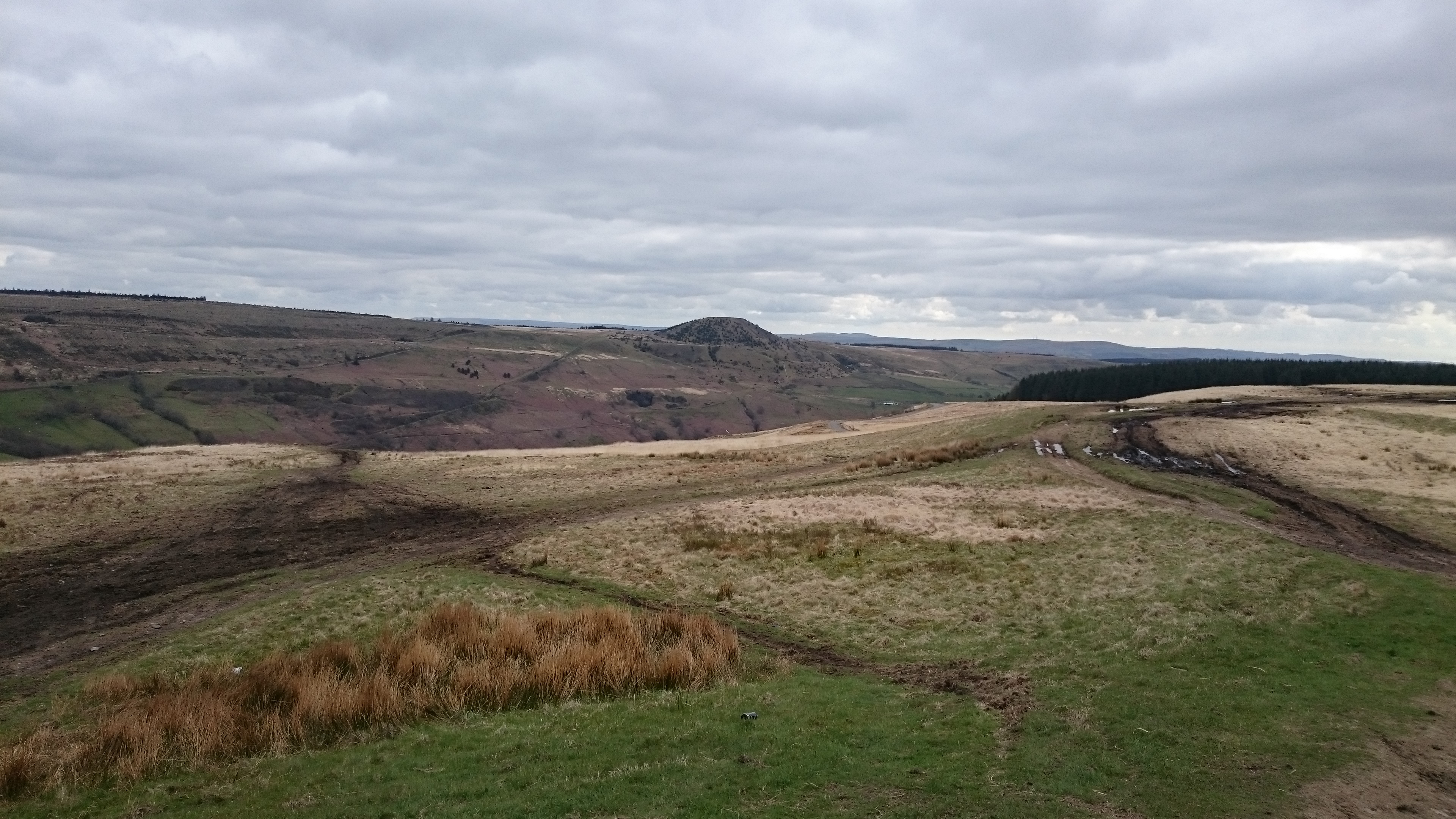
and the squat majesty of Tylorstown Tip.

2016-04-19 10.58.26

Also old stone walls striding across the hills

2016-04-19 11.22.18

and some totally unphotographable Bronze Age burial mounds.

The track down to Pentre is pretty but very rough under foot and very very steep – it’s a long pull up the ridge only to lose your height very rapidly in the woods. And it’s about 2 km longer than the route down Cwm Bodringallt. We’ll try that one again next and see how it goes.


Penrhys – Ton Pentre (again)

posted in: Uncategorized | 0

I’ve now had another look at the ridge above Penrhys with Ceri and Ron from Rhondda Cynon Taf.

Main aim was to look at the blocked section of path around SS 972 955, just above Pleasant View. We walked up to the ridge and back along the top footpath. The blocked section (probably about 200 yards) is now completely impassable, heavily overgrown with brambles. Clearing it would be a huge job – and keeping it clear would need local effort. The stiles are there

and there’s even a waymark at the bottom but that hasn’t helped. The problem is probably that where it joins Pleasant View it runs between a house and its garage. Walking through people’s gardens is always difficult. An informal alternative (marked as a track on the online Ordnance Survey but not on the latest printed version) runs east from the blockage and down to the entrance to the quarry. From there you follow a very well-marked track down to the other end of Pleasant View. This runs through open access land but there are difficulties in waymarking routes through open access that aren’t rights of way. There is an alternative. On the way up, Ron’s pathfinding skills took us along most of the line of the lower footpath. I have tried and failed to find this in the past. It contours over some very uneven ground (the result of at least one landslip) and eventually joins the upper footpath near the top of Cwm Bodringallt. We lost the path at the end and walked up the bridleway from Cwm Bodringallt but Ron felt it would be possible to follow it down from the top using GPS then to waymark it. That looks like the best option. You would start up the ridge on the route described in https://heritagetortoise.wordpress.com/2014/09/04/on-from-penrhys/ . When you cross the stream at SS 982 959 bear slightly to the left to pick up the lower path. There are several places where the track seems to go on but you need to bear left down the slope – these will need waymarking. Eventually you join the well-walked track below the quarry and follow it down to the south-east end of Pleasant View at SS 973 954. Job done (almost). Route now clear Llantarnam – Margam (Caerphilly might be persuaded to do a bit of maintenance to the Raven Walk over Mynydd Machen. Ceredigion pretty much done. Volunteers forging ahead in Denbighshire and Flintshire. Web site nearly finished. What do we move on to next?

Caerleon Campus History Lectures 2014

posted in: Uncategorized | 0

University of South Wales (Caerleon Campus)

History Public Seminar Programme Spring 2014

Wednesdays, 6pm 

A chance to share in some of the recent research from the History team at Caerleon: the lectures will be followed by informal discussion 

Wednesday,29 January 2014, 6 pm, Caerleon Campus: Boardroom 

Erica Canela

‘In the Name of God Amen: Tudor Wills in Breconshire, 1528 – 1571’


Wednesday, 5 February 2014, 6 pm, Caerleon Campus: Conference Suite, Main Building A45

Chris Gardiner

Admiring the pugilistic art? Newspaper reports on boxing in nineteenth century south Wales


Wednesday, 12 February 2014, 6pm , Caerleon Campus: Boardroom

Maddy Gray

Cross Slabs and Closet Catholics: some thoughts on seventeenth-century tombstones


Wednesday, 19 February 2014, 6 pm , Caerleon Campus: Boardroom

Paul Thomas

An Investigation of Pre-Roman Communications in South Eastern Wales: with Special Reference to Possible Surviving Iron Age Road Networks in Gwent


Wednesday, 5 March 2014, 6pm, Caerleon Campus: Conference Suite, Main Building A45

Jessica Powell

‘Breaking the Bonds’: The Rise (and Fall) of Monmouth’s Independent Burgesses


Wednesday, 12 March 2014, 6 pm, Caerleon Campus: Boardroom

David Howell and Ray Howell

Digging up the Past: Excavating Llanfihangel Tor-y-Mynydd


For further information, email ray.howell@southwales.ac.uk , richard.allen@southwales.ac.uk or madeleine.gray@southwales.ac.uk

For last-minute updates and changes (and for further information on our activities) follow us on Twitter – http://twitter.com/HeritageUSW

#smokingisnottheonlyrubbish

posted in: Uncategorized | 0

Why are we so mucky in south Wales?

As Steve and I work our way round Wales looking at tomb carvings and interesting bits of building stone, we are tasked by our daughter to photograph smoking-related litter. She works for AshWales’s Filter project and they are building up a map of smoking rubbish in Wales https://maps.google.com/maps/ms?msid=204821950365946795220.0004e0999aa42298c0d23&msa=0&ie=UTF8&t=h&ll=51.460639,-3.375893&spn=0.164281,0.468636&source=embed

You will see that most of the little flags are in the Cardiff area and up the valleys. The Filter team thought that was because they are based in Cardiff, and they have been trying to record smoking litter elsewhere in Wales. But it took me a lot of hard work to find the few photos I took around St Davids in August. Visits to Brecon and the Marches produced no photos at all. Likewise a trip to the Vale of Clwyd. Not just no smoking-related litter, very little litter at all. Meanwhile, the lanes and woods around Cardiff are full of it. I do a bit of freelance litter-picking in the woods above my house but I’ve given up on the roads – you can clear a section and a week later it’s as if you hadn’t bothered.

Why? It can’t be poverty and despair because Cardiff is one of the more prosperous areas of Wales. What is really sad is that we seem to have lost our pride. We used to have a saying about not messing on your own doorstep (well, we put it a bit stronger than that but you know what I mean). So much has got better in south Wales – the harshness of the chapel culture has been liberalised, there’s less male chauvinism – but along with the bathwater of patriarchy we seem to have chucked out the baby of our self-respect.

Most of the rubbish comes from what I would call junk food. Longwood Drive, off the Coryton roundabout where the M4 meets the A470, has several outlets (better not name names) and the volunteers from the Forest Farm conservation centre pick up at least a bin bag of rubbish A DAY there.

Shouldn’t the people whose logos are emblazoned over this unsightly mess be just the least bit concerned? After all, one burger is much like another, one cheap lager is much like another. So what they are selling is an image – ‘buy our product and be like these beautiful people strolling hand in hand into the golden sunset’ … but instead what they are saying is ‘Buy our product and be like these sad little souls whose idea of sensual  gratification is a six-pack of lager and a big packet of crisps, and whose idea of really wild iconoclastic behaviour is to chuck their rubbish in the nearest hedgerow’.

We need a way of getting the polluter to pay.

But we also need a way to get our self-respect back.